 |
|
| Rankin Airport |
| IATA: none – ICAO: none – FAA LID: 49F |
| Summary |
| Airport type |
Public |
| Owner |
Upton County |
| Serves |
Rankin, Texas |
| Elevation AMSL |
2,543 ft / 775 m |
| Coordinates |
31°13′39″N 101°57′11″W / 31.2275°N 101.95306°W / 31.2275; -101.95306 |
| Runways |
| Direction |
Length |
Surface |
| ft |
m |
| 17/35 |
3,000 |
914 |
Gravel |
| Statistics (2007) |
| Aircraft operations |
700 |
| Source: Federal Aviation Administration |
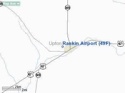
Rankin Airport (FAA LID: 49F) is a county-owned, public-use airport located one mile (2 km) west of the central business district of Rankin, a city in Upton County, Texas, United States.
Facilities and aircraft
Rankin Airport covers an area of 7 acres (3 ha) and has one runway designated 17/35 with a 3,000 x 35 ft (914 x 11 m) gravel surface. For the 12-month period ending April 21, 2007, the airport had 700 general aviation aircraft operations, an average of 58 per month.
The above content comes from Wikipedia and is published under free licenses – click here to read more.
Location & QuickFacts
| FAA Information Effective: | 2008-09-25 |
| Airport Identifier: | 49F |
| Airport Status: | Operational |
| Longitude/Latitude: | 101-57-11.4730W/31-13-38.5300N
-101.953187/31.227369 (Estimated) |
| Elevation: | 2543 ft / 775.11 m (Surveyed) |
| Land: | 7 acres |
| From nearest city: | 1 nautical miles W of Rankin, TX |
| Location: | Upton County, TX |
| Magnetic Variation: | 09E (1985) |
Owner & Manager
| Ownership: | Publicly owned |
| Owner: | Upton County |
| Address: | Upton Co Courthouse
Rankin, TX 79778 |
| Phone number: | 432-693-2321 |
| Manager: | Brent Wrinkle
COUNTY COMMISSIONER. |
| Address: | Po Box 494
Rankin, TX 79778 |
| Phone number: | 432-693-6313 |
Airport Operations and Facilities
| Airport Use: | Open to public |
| Wind indicator: | Yes |
| Segmented Circle: | No |
| Control Tower: | No |
| Landing fee charge: | No |
| Sectional chart: | San Antonio |
| Region: | ASW - Southwest |
| Boundary ARTCC: | ZHU - Houston |
| Tie-in FSS: | SJT - San Angelo |
| FSS on Airport: | No |
| FSS Toll Free: | 1-800-WX-BRIEF |
| NOTAMs Facility: | SJT (NOTAM-d service avaliable) |
Airport Communications
Airport Services
| Airframe Repair: | NONE |
| Power Plant Repair: | NONE |
Runway Information
Runway 17/35
| Dimension: | 3000 x 35 ft / 914.4 x 10.7 m |
| Surface: | GRVL, Good Condition |
| |
Runway 17 |
Runway 35 |
| Traffic Pattern: | Left | Left |
| Obstruction: | 60 ft hill, 1500.0 ft from runway, 25:1 slope to clear | 25 ft tree, 523.0 ft from runway, 62 ft left of centerline, 20:1 slope to clear |
|
Radio Navigation Aids
| ID |
Type |
Name |
Ch |
Freq |
Var |
Dist |
| MA | NDB | Farly | | 326.00 | 09E | 49.5 nm |
| MAF | VORTAC | Midland | 095X | 114.80 | 11E | 48.5 nm |
| MAF | VOT | Midland International | | 108.20 | | 44.6 nm |
Images and information placed above are from
http://www.airport-data.com/airport/49F/
We thank them for the data!
| General Info
|
| Country |
United States
|
| State |
TEXAS
|
| FAA ID |
49F
|
| Latitude |
31-13-38.530N
|
| Longitude |
101-57-11.473W
|
| Elevation |
2543 feet
|
| Near City |
RANKIN
|
We don't guarantee the information is fresh and accurate. The data may
be wrong or outdated.
For more up-to-date information please refer to other sources.
|
|


