 |
|
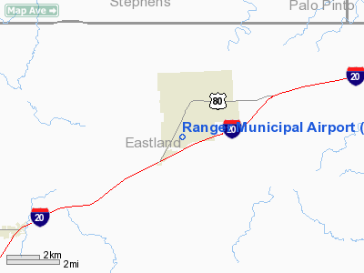
Location & QuickFacts
| FAA Information Effective: | 2008-09-25 |
| Airport Identifier: | F23 |
| Airport Status: | Operational |
| Longitude/Latitude: | 098-40-58.2110W/32-27-09.4690N
-98.682836/32.452630 (Estimated) |
| Elevation: | 1470 ft / 448.06 m (Estimated) |
| Land: | 77 acres |
| From nearest city: | 2 nautical miles S of Ranger, TX |
| Location: | Eastland County, TX |
| Magnetic Variation: | 07E (1985) |
Owner & Manager
| Ownership: | Publicly owned |
| Owner: | City Of Ranger |
| Address: | 400 W. Main
Ranger, TX 76470 |
| Phone number: | 254-647-3522 |
| Manager: | Charles Calvert
CITY ADMINISTRATOR. |
| Address: | 715 Cypress Street
Ranger, TX 76470 |
| Phone number: | 254-647-1855 |
Airport Operations and Facilities
| Airport Use: | Open to public |
| Wind indicator: | Yes |
| Segmented Circle: | No |
| Control Tower: | No |
| Landing fee charge: | No |
| Sectional chart: | Dallas-ft Worth |
| Region: | ASW - Southwest |
| Boundary ARTCC: | ZFW - Fort Worth |
| Tie-in FSS: | FTW - Fort Worth |
| FSS on Airport: | No |
| FSS Phone: | 817-541-3474 |
| FSS Toll Free: | 1-800-WX-BRIEF |
| NOTAMs Facility: | FTW (NOTAM-d service avaliable) |
Airport Communications
Airport Services
Runway Information
Runway 01/19
| Dimension: | 2730 x 75 ft / 832.1 x 22.9 m |
| Surface: | TURF, Good Condition |
| |
Runway 01 |
Runway 19 |
| Traffic Pattern: | Left | Left |
| Obstruction: | 30 ft tree, 770.0 ft from runway, 4 ft right of centerline, 25:1 slope to clear | 5 ft fence, 0.0 ft from runway, 115 ft left of centerline |
|
Runway 18/36
| Dimension: | 1850 x 80 ft / 563.9 x 24.4 m |
| Surface: | TURF, Good Condition |
| |
Runway 18 |
Runway 36 |
| Traffic Pattern: | Left | Left |
| Obstruction: | 10 ft fence, 202.0 ft from runway, 20:1 slope to clear | 20 ft tree, 303.0 ft from runway, 70 ft right of centerline, 15:1 slope to clear |
|
Radio Navigation Aids
| ID |
Type |
Name |
Ch |
Freq |
Var |
Dist |
| OIP | NDB | Old Rip | | 410.00 | 07E | 7.2 nm |
| BKD | NDB | Breckenridge | | 245.00 | 07E | 20.6 nm |
| GZV | NDB | Brazos River | | 280.00 | 07E | 32.9 nm |
| MWL | NDB | Mineral Wells | | 266.00 | 06E | 37.4 nm |
| GHX | NDB | Graham | | 371.00 | 07E | 43.9 nm |
| BWD | VOR/DME | Brownwood | 023X | 108.60 | 08E | 36.4 nm |
| MQP | VORTAC | Millsap | 124X | 117.70 | 09E | 38.4 nm |
| JEN | VORTAC | Glen Rose | 097X | 115.00 | 06E | 44.5 nm |
Remarks
- PEDESTRIAN TRAFFIC ON FLD AT TIMES.
- PRE-DATES THE ACT.
Images and information placed above are from
http://www.airport-data.com/airport/F23/
We thank them for the data!
| General Info
|
| Country |
United States
|
| State |
TEXAS
|
| FAA ID |
F23
|
| Latitude |
32-27-09.469N
|
| Longitude |
098-40-58.211W
|
| Elevation |
1470 feet
|
| Near City |
RANGER
|
We don't guarantee the information is fresh and accurate. The data may
be wrong or outdated.
For more up-to-date information please refer to other sources.
|
|


