|
 |
|
||||
|
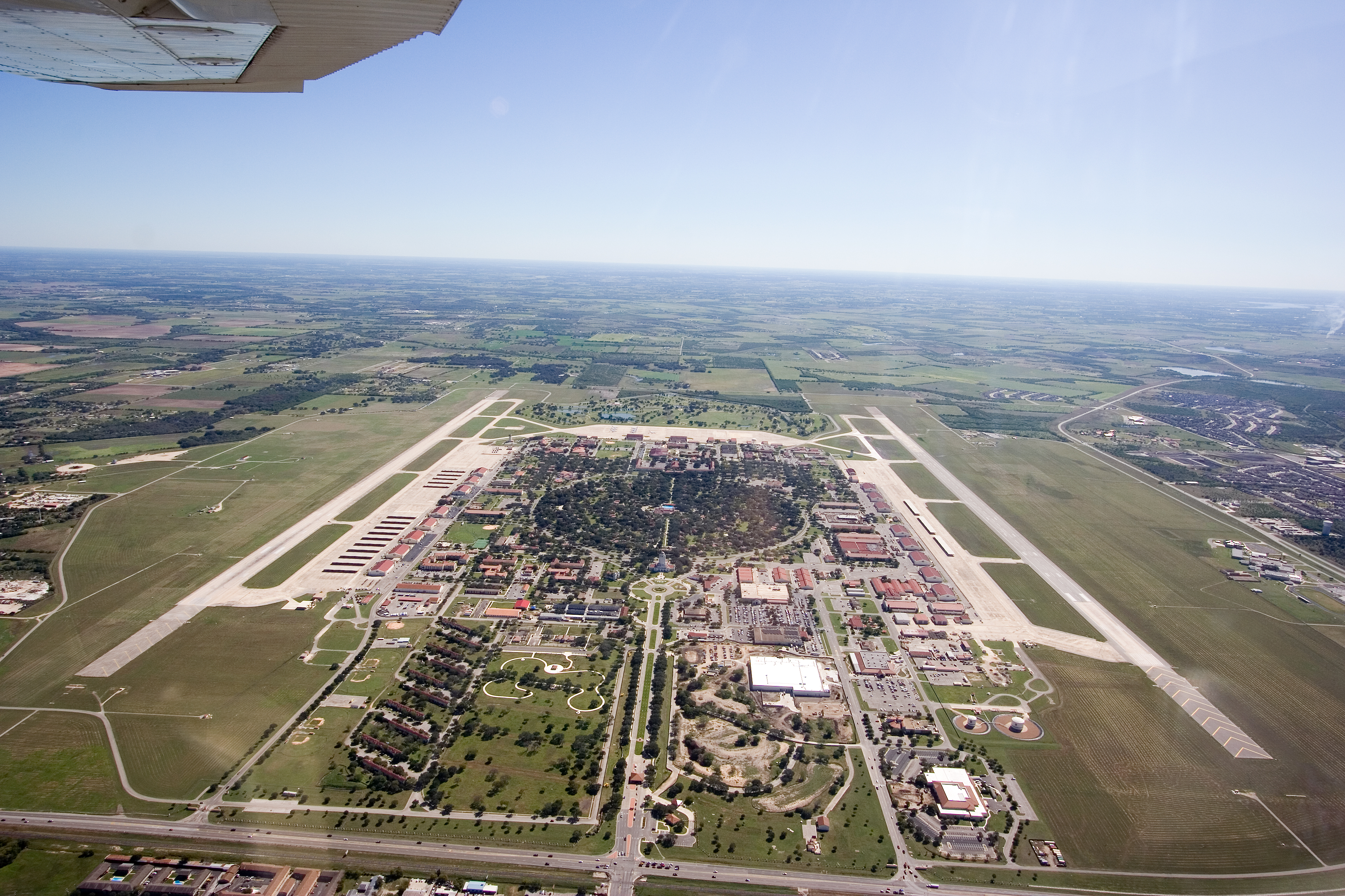
Randolph Air Force Base building 100, nicknamed the Taj Mahal.
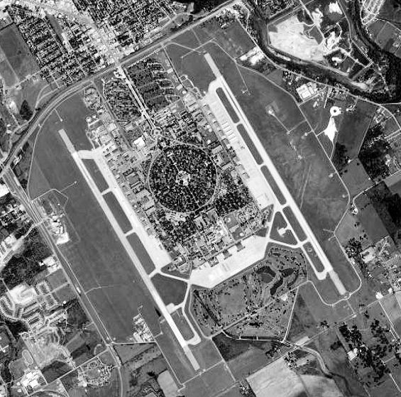
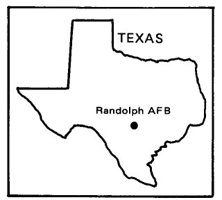
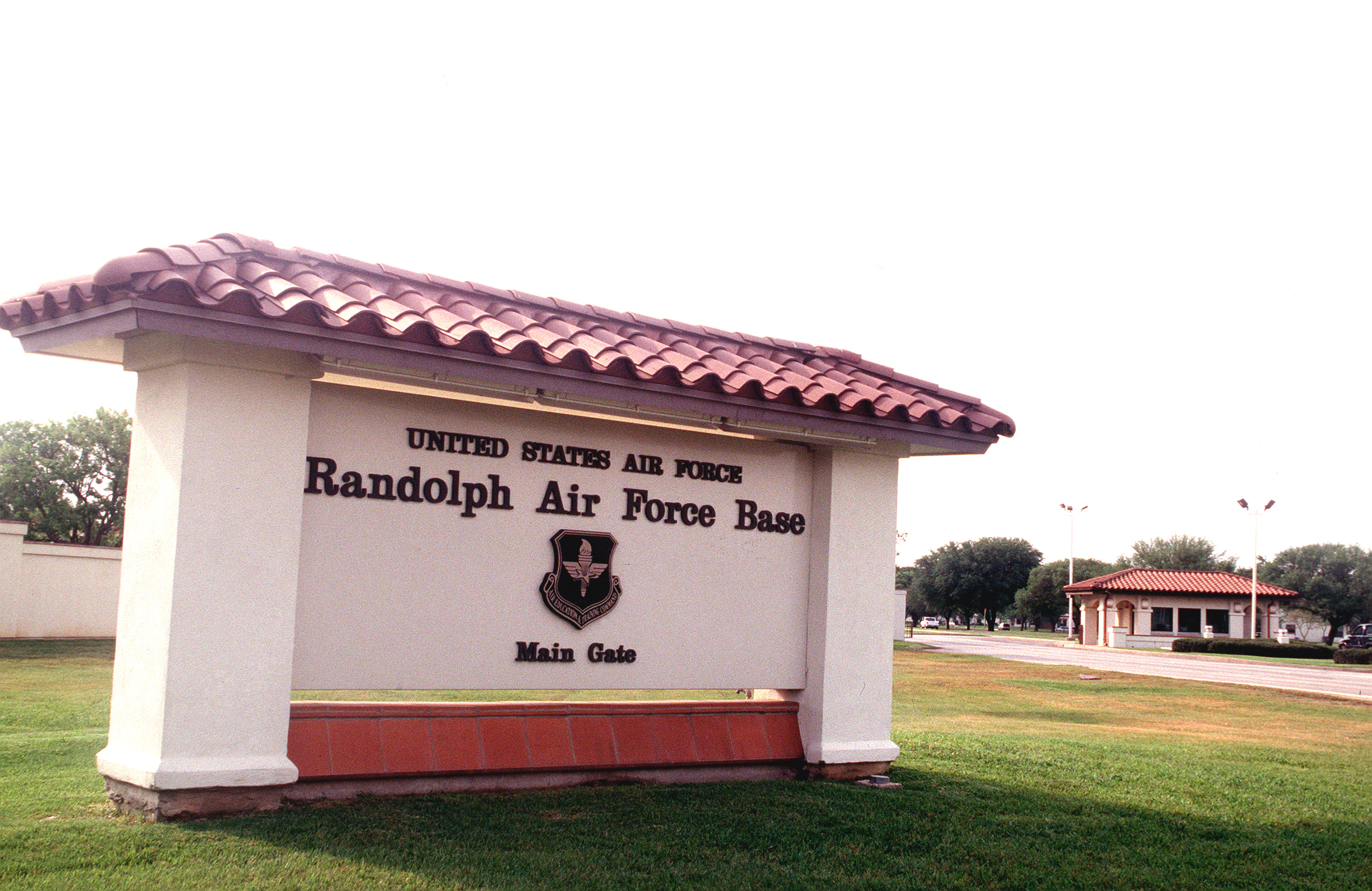
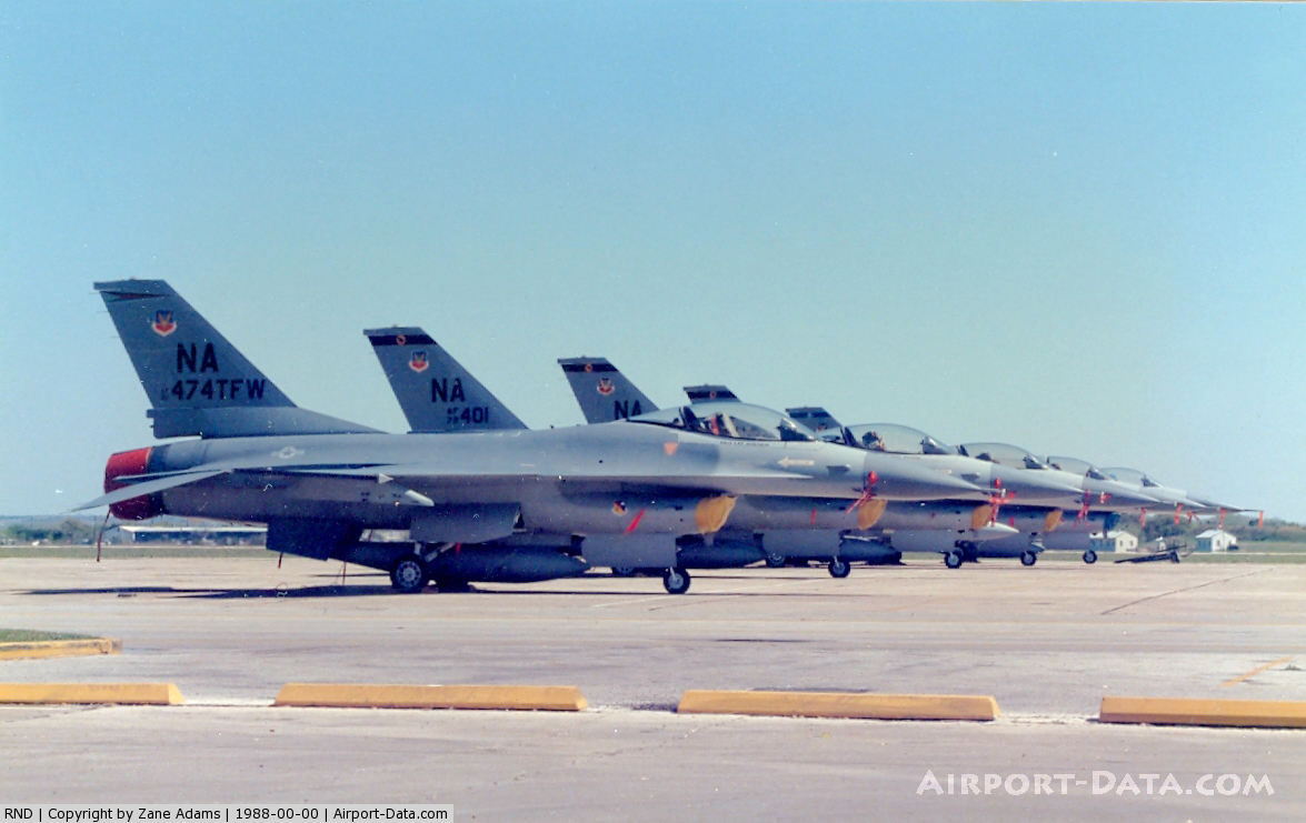
Randolph Air Force Base (Randolph AFB) is a base of the United States Air Force located in Universal City, Texas, near San Antonio. Dedicated June 20, 1930, as a flying training base, it continues with that mission today. The base is named after Captain William Millican Randolph, a native of Austin, who was on the base naming committee at the time of his death in a crash. It serves as headquarters of the Air Education and Training Command (AETC) as well as the Air Force Personnel Center (AFPC) and is known as "the Showplace of the Air Force" because of the Spanish Colonial Revival Style architecture in which all structures including hangars were constructed. The symbol of the base is a large water tower atop Building 100, housing the headquarters for Randolph's major flying unit, the 12th Flying Training Wing (12 FTW). With its distinctive architecture, the wing's headquarters has come to be known throughout the Air Force as "the Taj Mahal," or simply "The Taj". Another AETC unit, the 502d Air Base Wing (502 ABW) is the host wing for Randolph. A recently established organization, the 502 ABW assumed host wing duties from the 12 FTW, allowing the latter to concentrate on flight operations and training. Randolph AFB operates parallel runways on either side of its main installation facilities and conducts 24-hour-a-day flight training operations. Tenant units of Randolph AFB also include the Air Force Personnel Center (AFPC), Air Force Manpower Agency, Air Force Office of Special Investigations Field Investigations Region 4 and the Air Force Recruiting Service. HistoryEarly historyThe idea for Randolph began soon after passage in the United States Congress of the Air Corps Act of 1926, which changed the name of the Army Air Service to the Army Air Corps, created two new brigadier general positions and provided a five-year expansion program for the under-strength Air Corps. One of the new general officer positions was given to Frank P. Lahm, who was placed in charge of all flying training. General Lahm established the Air Corps Training Center and set up its headquarters at Duncan Field, next to Kelly Field, Texas. He soon learned that the facilities at Kelly and Brooks Fields were not sufficient for proper training. The buildings, erected during World War I with a life expectancy of five years, had no suitable areas for ground training, and the living quarters were inadequate. San Antonio's rapid growth was also beginning to interfere with flying training operations. The Air Corps soon decided that an additional training field was needed, and a site north of San Antonio was chosen for the new field. In 1926 and 1927, 1st Lt Harold Clark designed Randolph while assigned as dispatch officer in the Kelly Field motor pool, although the War Department received the land in 1928. Having trained as an architect prior to entering the military, Lieutenant Clark sketched his ideas of a perfect "Air City" on the back of old dispatch sheets. After learning a new field was to be built, Lieutenant Clark took his drawings to General Lahm, who was so impressed with the designs he appointed him to be the architect in charge of the Randolph Field project. It was, at the time, the largest construction project undertaken by the U.S. Army Corps of Engineers since the Panama Canal. Once the site for the field was selected, a committee decided to name the base after Captain William Millican Randolph, a native of Austin and graduate of Texas A&M, who was killed on February 17, 1928, in the crash of an AT-4 on takeoff from Gorman Field, Texas. Ironically, Captain Randolph was serving on the committee to select a name for the new field at the time of his death. Captain Randolph is buried at Fort Sam Houston National Cemetery. Randolph Field was dedicated June 20, 1930, with an estimated 15,000 people in attendance and a fly-by of 233 planes, possibly the largest assembly of military aircraft in the world. Early in 1931, the School of Aviation Medicine from Brooks Field and the first cadets from the Air Corps Flying School at Duncan Field, then a part of Kelly AFB, began relocating to Randolph. By the autumn of 1931, Randolph was ready for business. On October 1, the Air Corps Training Center moved its headquarters from Duncan Field to Randolph. The flying school at Brooks Field transferred to Randolph on October 20, while the school at March Field transferred on October 25. The School of Aviation Medicine also transferred from Brooks Field during 1931. The Air Corps Act of 1926 mandated that rated pilots comprise 90% of all commissioned officers of the Air Corps. Because of this requirement, nearly all officers of the Air Corps underwent Randolph's rigorous pilot training program and, in combination with the architectural beauty of the base, resulted in the unofficial nickname "West Point of the Air" applied to Randolph Field. A 1935 Hollywood film, West Point of the Air, was filmed on location at Randolph. 1940s to 1970sIn June 1941, the Army Air Corps became the Army Air Forces. Basic flying training at Randolph continued until March 1943, when the central instructors school took over. For the next two years, training instructors for the Air Corps's ground training and primary, basic and advanced flying training was the main mission. Randolph produced 15,396 instructor graduates from this course before it moved to Waco Field in 1945. When the central instructors school moved to Waco Field it was replaced by the Army Air Forces pilot school, which specialized in transition training for B-29 bomber pilots, copilots and engineers. Primary pilot training returned to Randolph from Goodfellow Field in December 1945. Like many military installations during World War II, Randolph fielded an intercollegiate football team, nicknamed the Ramblers. In 1943, under Coach Frank Tritico, the team achieved a 9-1-0 record, and was invited to play in the January 1, 1944 Cotton Bowl Classic, where they battled the University of Texas at Austin to a 7-7 tie. In the 1944 season, with such players as former All-American and National Football League Rookie of the Year Bill Dudley, as well as eight other former NFL players, the team went undefeated and untied in 11 games, and was voted #3 in the nation by the Associated Press poll. The Army Air Forces also planned to return basic pilot training to Randolph on February 1, 1946. Even though basic training transferred from Goodfellow Field in February 1946, the Army Air Forces suspended all pilot training when it found itself desperately short of maintenance personnel. The U.S. Air Force became a separate service on September 18, 1947, and Randolph Field was officially renamed Randolph Air Force Base on January 13, 1948. When the suspension was lifted in March 1948 and Randolph resumed its pilot training mission, the Air Force reshaped pilot training into two separate four-month phases. Primary pilot training moved on in December 1950. Basic pilot training changed over to nine new contract schools in July 1951. Randolph became the Air Force's Instructor Pilot (IP) training base and had that as its primary mission until requirements for new pilots during the Vietnam War revived its basic training function. From 1967-1971 1,269 pilots earned their wings at Randolph. Also, Randolph produced pilots in two unique classes. During World War II, Class 42-X gave 235 pilots their wings in an experimental course. Class 62-FZ produced 25 pilots who completed their training in the new T-38A, then undergoing test and evaluation. Before the current 502d Air Base Wing, the 12th Flying Training Wing, and the 3510th Flying Training Wing were the host units at Randolph. The 3510 FTW started out as the 3510th Basic Pilot Training Wing on August 28, 1948. This unit became the 3510th Combat Crew Training Wing on January 1, 1952 and then the 3510 FTW on June 11, 1952. The 12th Flying Training Wing (12 FTW) replaced the 3510 FTW on May 1, 1972. Recent historyToday, the 12 FTW provides instructor pilot training and refresher/recurrency training in the T-6A Texan II, T-38C Talon and T-1A Jayhawk. The wing also operates the T-1A and the T-43A in support of Specialized Undergraduate Navigator Training (SUNT), a mission it assumed following the Base Realignment and Closure (BRAC) closure of Mather AFB, California and inactivation of the 323d Flying Training Wing. SUNT trains prospective USAF Navigators/Combat Systems Officers destined for the B-52 Stratofortress, E-3 Sentry, E-8 Joint STARS, RC-135, non-PACER CRAG KC-135 Stratotanker, and various models of the C-130 Hercules (i.e., C-130, AC-130, EC-130, HC-130, MC-130, etc.), as well as prospective Naval Flight Officers en route to fly land-based U.S. Navy P-3C Orion, EP-3 Aries and E-6 Mercury aircraft. The 12 FTW also provides training to numerous NATO/Allied officer students via SUNT, as well as supporting Marine Corps and Coast Guard enlisted navigator training via the Marine Aerial Navigation School (MANS). The Marine Aerial Navigation School remained at Randolph until the school was decommissioned with the graduation of Class 04-01 on 31 July 2004. Advanced Electronic Warfare Officer (EWO) training is also conducted by the 12 FTW for those navigators/CSOs destined for eventual assignment as USAF EWOs. Two T-1s in the 99th Flying Training Squadron, which provides training for Combat Systems Officers.The 12 FTW also operates an additional airfield for practice approaches and touch-and-go landings approximately 12 miles east-northeast of Randolph in Seguin, Texas. Known as Randolph AFB Auxiliary Field/Seguin Field, this airfield was originally constructed with three runways in 1941. Normally unattended, the airfield has a single active 8350-ft runway and is supported by a manned runway supervisor unit (RSU) and aircraft rescue and fire fighting (ARFF) vehicles when conducting flight operations. Randolph has also completed major renovations to the Base Commissary as well as completely re-paving Harmon Drive, the main entrance to the base leading to "The Taj". Additional plans include construction of a new Base Exchange, which is managed by the Army and Air Force Exchange Service (AAFES). Historic DistrictRandolph Field Historic District, located at the center of Randolph Air Force Base, is a National Historic Landmark. The district consists of 350 contributing buildings, 47 non-contributing buildings, and other features, most of which were built between 1929 and 1932, in an area of about 405 acres (1.6 km²). The historical society makes it very difficult for the base to plan improvements, constructions, and renovations. The old Hospital Building, a part of the Historic District is supposedly haunted among many other locations in the district. The above content comes from Wikipedia and is published under free licenses – click here to read more.
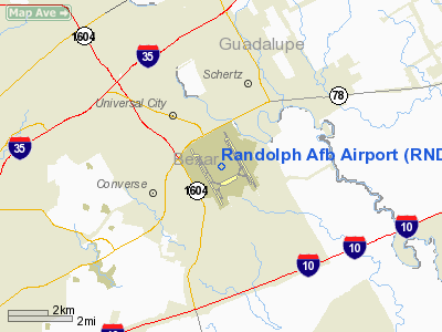
Location & QuickFacts
Owner & Manager
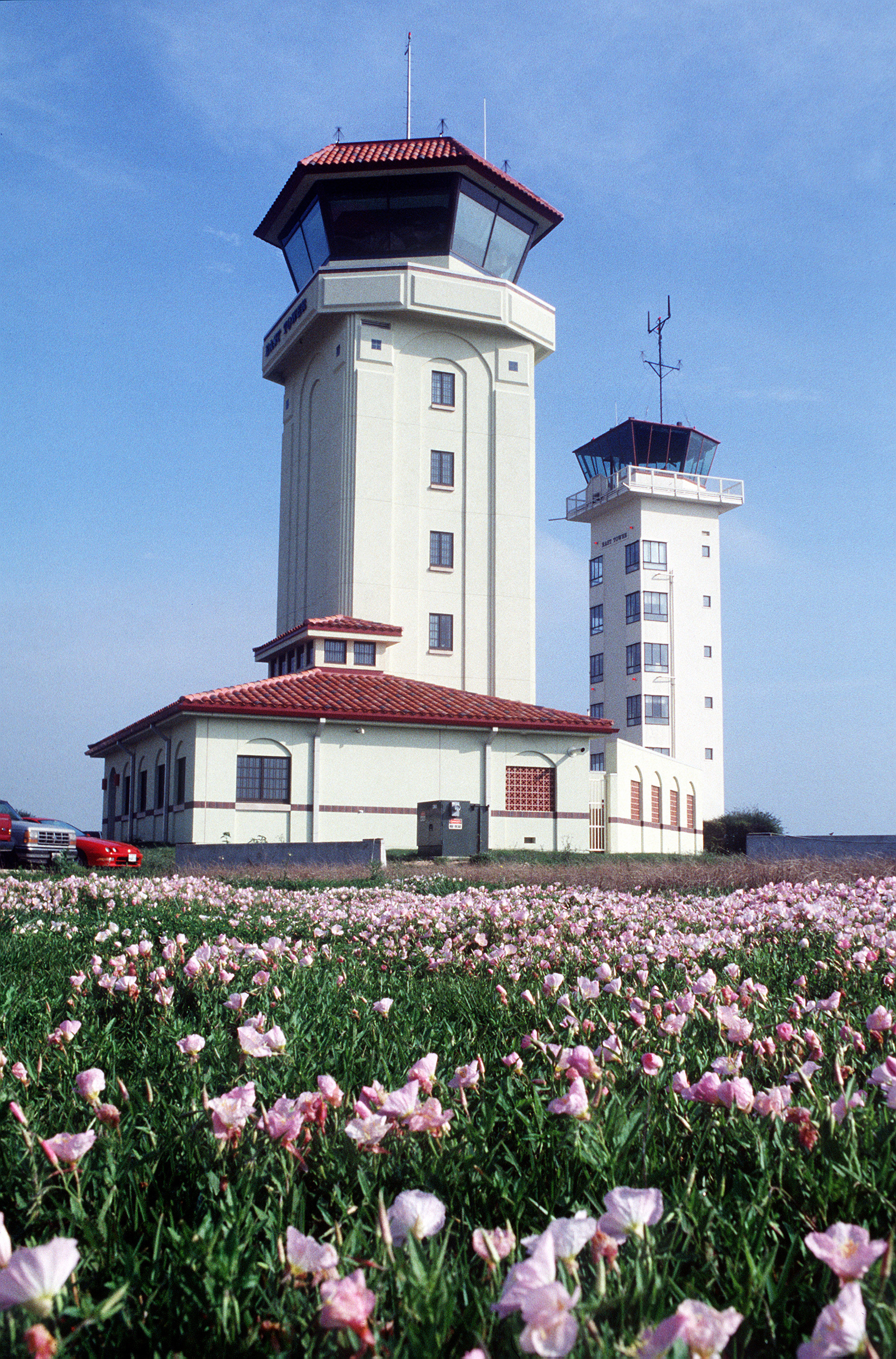
Airport Operations and Facilities
Airport Services
Runway InformationRunway 14L/32R
Runway 14R/32L
Radio Navigation Aids
Remarks
Images and information placed above are from We thank them for the data!
We don't guarantee the information is fresh and accurate. The data may
be wrong or outdated.
|
|||||||||||||||||||||||||||||||||||||||||||||||||||||||||||||||||||||||||||||||||||||||||||||||||||||||||||||||||||||||||||||||||||||||||||||||||||||||||||||||||||||||||||||||||||||||||||||||||||||||||||||||||||||||||||||||||||||||||||||||||||||||||||||||||||||||||||||||||||||||||||||||||||||||||||||||||||||||||||||||||||||||||

 |
|
Copyright 2004-2026 © by Airports-Worldwide.com, Vyshenskoho st. 36, Lviv 79010, Ukraine Legal Disclaimer |