 |
|
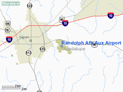
Location & QuickFacts
| FAA Information Effective: | 2008-09-25 |
| Airport Identifier: | SEQ |
| Airport Status: | Operational |
| Longitude/Latitude: | 097-54-30.0120W/29-33-56.8290N
-97.908337/29.565786 (Estimated) |
| Elevation: | 525 ft / 160.02 m (Estimated) |
| Land: | 0 acres |
| From nearest city: | 3 nautical miles E of Seguin, TX |
| Location: | Guadalupe County, TX |
| Magnetic Variation: | 07E (1985) |
Owner & Manager
| Ownership: | Air Force owned |
| Owner: | U.s. Air Force |
| Address: | Randolph Afb
University City, TX 78148 |
| Manager: | Commanding Officer |
| Address: | Randolph Afb
University City, TX 78148 |
Airport Operations and Facilities
| Airport Use: | Private |
| Segmented Circle: | No |
| Control Tower: | No |
| Sectional chart: | San Antonio |
| Region: | ASW - Southwest |
| Boundary ARTCC: | ZHU - Houston |
| Tie-in FSS: | SJT - San Angelo |
| FSS on Airport: | No |
| FSS Toll Free: | 1-800-WX-BRIEF |
Airport Services
| Airframe Repair: | NONE |
| Power Plant Repair: | NONE |
| Bottled Oxygen: | NONE |
| Bulk Oxygen: | NONE |
Runway Information
Runway 13/31
| Dimension: | 8350 x 150 ft / 2545.1 x 45.7 m |
| Surface: | ASPH, |
| |
Runway 13 |
Runway 31 |
| Traffic Pattern: | Left | Left |
| Runway End Identifier: | No | No |
| Centerline Lights: | No | No |
| Touchdown Lights: | No | No |
|
Radio Navigation Aids
| ID |
Type |
Name |
Ch |
Freq |
Var |
Dist |
| OKT | NDB | Yoakum | | 350.00 | 06E | 43.1 nm |
| PEZ | NDB | Pleasanton | | 275.00 | 07E | 48.7 nm |
| DHK | TACAN | Randolph | 036X | | 09E | 18.9 nm |
| KSY | TACAN | Kelly | 057X | | 07E | 36.7 nm |
| SSF | VOR | Stinson | | 108.40 | 09E | 33.6 nm |
| RND | VORTAC | Randolph | 70X | 112.30 | 09E | 19.9 nm |
| SAT | VORTAC | San Antonio | 115X | 116.80 | 08E | 29.3 nm |
| SAT | VOT | San Antonio Intl | | 110.40 | | 29.4 nm |
Remarks
- MISC: LTD EXCLUSIVELY TO RANDOLPH AFB TRNG ACFT.
- MISC: RWY SUPERVISORY UNIT CALL CHARLIE BROWN, 271.2 CTL RANDOLPH TRNG ACFT MON-FRI DAYLT HR.
- MISC: INTS TOUCH AND GO LDG DUR DAYLT VFR MON-FRI.
- MISC: CTC CHARLIE BROWN FOR BIRD WATCH COND.
Images and information placed above are from
http://www.airport-data.com/airport/SEQ/
We thank them for the data!
| General Info
|
| Country |
United States
|
| State |
TEXAS
|
| FAA ID |
SEQ
|
| Latitude |
29-33-56.829N
|
| Longitude |
097-54-30.012W
|
| Elevation |
525 feet
|
| Near City |
SEGUIN
|
We don't guarantee the information is fresh and accurate. The data may
be wrong or outdated.
For more up-to-date information please refer to other sources.
|
|


