 |
|
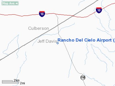
Location & QuickFacts
| FAA Information Effective: | 2008-09-25 |
| Airport Identifier: | XS44 |
| Airport Status: | Operational |
| Longitude/Latitude: | 104-12-44.6990W/31-00-55.0000N
-104.212416/31.015278 (Estimated) |
| Elevation: | 4408 ft / 1343.56 m (Estimated) |
| Land: | 0 acres |
| From nearest city: | 2 nautical miles N of Kent, TX |
| Location: | Jeff Davis County, TX |
| Magnetic Variation: | 10E (1990) |
Owner & Manager
| Ownership: | Privately owned |
| Owner: | Jdc Ranch Partners |
| Address: | Po Box 3076
Kent, TX 79855 |
| Phone number: | 915-828-3520 |
| Manager: | Ralph Donaho |
| Address: | Po Box 3076
Kent, TX 79855 |
| Phone number: | 915-828-3520 |
Airport Operations and Facilities
| Airport Use: | Private |
| Segmented Circle: | No |
| Control Tower: | No |
| Sectional chart: | El Paso |
| Region: | ASW - Southwest |
| Boundary ARTCC: | ZAB - Albuquerque |
| Tie-in FSS: | SJT - San Angelo |
| FSS on Airport: | No |
| FSS Toll Free: | 1-800-WX-BRIEF |
Runway Information
Runway 08/26
| Dimension: | 6300 x 60 ft / 1920.2 x 18.3 m |
| Surface: | ASPH, |
| |
Runway 08 |
Runway 26 |
| Traffic Pattern: | Left | Left |
|
Radio Navigation Aids
| ID |
Type |
Name |
Ch |
Freq |
Var |
Dist |
| VHN | NDB | Van Horn | | 233.00 | 10E | 29.7 nm |
| BWR | NDB | Brewster County | | 412.00 | 09E | 44.4 nm |
| PEQ | VOR/DME | Pecos | 055X | 111.80 | 11E | 42.6 nm |
| MRF | VOR/DME | Marfa | 106X | 115.90 | 11E | 45.1 nm |
Remarks
- OWNER DESIRES ARPT NOT BE CHARTED.
Images and information placed above are from
http://www.airport-data.com/airport/XS44/
We thank them for the data!
| General Info
|
| Country |
United States
|
| State |
TEXAS
|
| FAA ID |
XS44
|
| Latitude |
31-00-55.000N
|
| Longitude |
104-12-44.699W
|
| Elevation |
4408 feet
|
| Near City |
KENT
|
We don't guarantee the information is fresh and accurate. The data may
be wrong or outdated.
For more up-to-date information please refer to other sources.
|
|


