 |
|
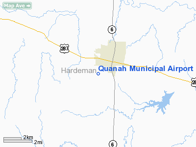
Location & QuickFacts
| FAA Information Effective: | 2008-09-25 |
| Airport Identifier: | F01 |
| Airport Status: | Operational |
| Longitude/Latitude: | 099-45-33.3670W/34-16-37.4990N
-99.759269/34.277083 (Estimated) |
| Elevation: | 1602 ft / 488.29 m (Surveyed) |
| Land: | 320 acres |
| From nearest city: | 2 nautical miles SW of Quanah, TX |
| Location: | Hardeman County, TX |
| Magnetic Variation: | 08E (1985) |
Owner & Manager
| Ownership: | Publicly owned |
| Owner: | City Of Quanah |
| Address: | 5429 Fm 2568
Quanah, TX 79252 |
| Phone number: | 940-663-5336 |
| Manager: | Len Miller, Fbo |
| Address: | Po Box 486
Quanah, TX 79252 |
| Phone number: | 940-663-2311 |
Airport Operations and Facilities
| Airport Use: | Open to public |
| Wind indicator: | Yes |
| Segmented Circle: | Yes |
| Control Tower: | No |
| Lighting Schedule: | DUSK-DAWN
MIRL RY 17/35 PRESET LOW INTST; TO INCR INTST ACTVT - CTAF. |
| Beacon Color: | Clear-Green (lighted land airport) |
| Landing fee charge: | No |
| Sectional chart: | Dallas-ft Worth |
| Region: | ASW - Southwest |
| Boundary ARTCC: | ZFW - Fort Worth |
| Tie-in FSS: | FTW - Fort Worth |
| FSS on Airport: | No |
| FSS Phone: | 817-541-3474 |
| FSS Toll Free: | 1-800-WX-BRIEF |
| NOTAMs Facility: | FTW (NOTAM-d service avaliable) |
| Federal Agreements: | NGPY |
Airport Communications
| CTAF: | 122.700 |
| Unicom: | 122.700 |
Airport Services
| Fuel available: | 100LL |
| Airframe Repair: | MAJOR |
| Power Plant Repair: | MAJOR |
| Bottled Oxygen: | NONE |
| Bulk Oxygen: | NONE |
Runway Information
Runway 06/24
| Dimension: | 2268 x 70 ft / 691.3 x 21.3 m |
| Surface: | TURF, Good Condition |
| |
Runway 06 |
Runway 24 |
| Longitude: | 099-45-47.8410W | 099-45-23.4710W |
| Latitude: | 34-16-35.7780N | 34-16-45.5260N |
| Elevation: | 1602.00 ft | 1594.00 ft |
| Alignment: | 64 | 127 |
| Traffic Pattern: | Left | Left |
| Displaced threshold: | 0.00 ft | 360.00 ft
DSPLCD THLD UNMARKED. |
| Obstruction: | , 50:1 slope to clear | 24 ft pole, 150.0 ft from runway, 150 ft left of centerline, 6:1 slope to clear
APCH RATIO 34:1 TO +15 FT ROAD AT 510 FT ACROSS APCH AT DSPLCD THLD. |
|
Runway 11/29
| Dimension: | 2340 x 70 ft / 713.2 x 21.3 m |
| Surface: | TURF, Good Condition |
| |
Runway 11 |
Runway 29 |
| Longitude: | 099-45-47.8410W | 099-45-24.2220W |
| Latitude: | 34-16-34.2790N | 34-16-23.3330N |
| Elevation: | 1602.00 ft | 1599.00 ft |
| Alignment: | 119 | 127 |
| Traffic Pattern: | Left | Left |
| Displaced threshold: | 0.00 ft | 360.00 ft
DSPLCD THLD UNMARKED. |
| Obstruction: | , 50:1 slope to clear | 15 ft road, 135.0 ft from runway, 9:1 slope to clear
APCH RATIO 33:1 TO +15 FT ROAD AT 495 FT ACROSS APCH AT DSPLCD THLD. |
|
Runway 17/35
| Dimension: | 4445 x 60 ft / 1354.8 x 18.3 m |
| Surface: | ASPH, Good Condition |
| Weight Limit: | Single wheel: 12500 lbs. |
| Edge Lights: | Medium |
| |
Runway 17 |
Runway 35 |
| Traffic Pattern: | Left | Left |
| Markings: | Non-precision instrument, Good Condition | Non-precision instrument, Good Condition |
| VASI: | 2-light PAPI on left side | 2-light PAPI on left side |
| Visual Glide Angle: | 3.50° | 3.50° |
| Obstruction: | 15 ft road, 550.0 ft from runway, 23:1 slope to clear | 4 ft fence, 350.0 ft from runway, 37:1 slope to clear |
|
Radio Navigation Aids
| ID |
Type |
Name |
Ch |
Freq |
Var |
Dist |
| VRT | NDB | Wilbarger | | 230.00 | 08E | 24.0 nm |
| CDS | VORTAC | Childress | 123X | 117.60 | 10E | 26.9 nm |
| LTS | VORTAC | Altus | 035X | 109.80 | 08E | 33.5 nm |
| GTH | VORTAC | Guthrie | 092X | 114.50 | 10E | 41.5 nm |
| HBR | VORTAC | Hobart | 055X | 111.80 | 10E | 49.4 nm |
Remarks
- WIDTH OF TUR RYS BASED ON THE AREA MOWED AND MAINTAINED; NSTD MARKINGS.
Images and information placed above are from
http://www.airport-data.com/airport/F01/
We thank them for the data!
| General Info
|
| Country |
United States
|
| State |
TEXAS
|
| FAA ID |
F01
|
| Latitude |
34-16-37.499N
|
| Longitude |
099-45-33.367W
|
| Elevation |
1602 feet
|
| Near City |
QUANAH
|
We don't guarantee the information is fresh and accurate. The data may
be wrong or outdated.
For more up-to-date information please refer to other sources.
|
|


