 |
|
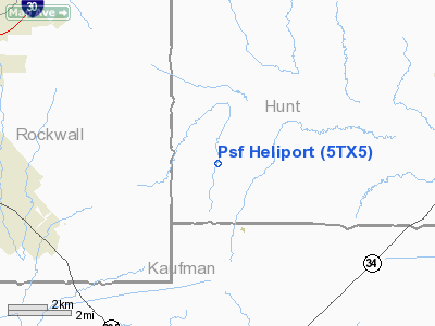
Location & QuickFacts
| FAA Information Effective: | 2008-09-25 |
| Airport Identifier: | 5TX5 |
| Airport Status: | Operational |
| Longitude/Latitude: | 096-16-17.9240W/32-52-08.4470N
-96.271646/32.869013 (Estimated) |
| Elevation: | 515 ft / 156.97 m (Estimated) |
| Land: | 6 acres |
| From nearest city: | 9 nautical miles N of Terrell, TX |
| Location: | Hunt County, TX |
| Magnetic Variation: | 06E (1985) |
Owner & Manager
| Ownership: | Privately owned |
| Owner: | Paul S. Foster |
| Address: | Route 4 Box 301
Terrell, TX 75160 |
| Phone number: | 214-222-8676 |
| Address: |
|
Airport Operations and Facilities
| Airport Use: | Private |
| Wind indicator: | Yes |
| Segmented Circle: | No |
| Control Tower: | No |
| Lighting Schedule: | PHONE REQ
FOR ROTG BCN & PERIMETER LGTS CALL 214-524-2121. |
| Beacon Color: | Clear-Green-Yellow (heliport) |
| Sectional chart: | Dallas-ft Worth |
| Region: | ASW - Southwest |
| Boundary ARTCC: | ZFW - Fort Worth |
| Tie-in FSS: | FTW - Fort Worth |
| FSS on Airport: | No |
| FSS Phone: | 817-541-3474 |
| FSS Toll Free: | 1-800-WX-BRIEF |
Runway Information
Helipad H1
| Dimension: | 525 x 260 ft / 160.0 x 79.2 m |
| Surface: | TURF, |
| |
Runway H1 |
Runway |
| Traffic Pattern: | Left | Left |
|
Radio Navigation Aids
| ID |
Type |
Name |
Ch |
Freq |
Var |
Dist |
| AVZ | NDB | Travis | | 260.00 | 06E | 6.6 nm |
| MII | NDB | Caddo Mills | | 316.00 | 06E | 10.4 nm |
| SYW | NDB | Cash | | 428.00 | 05E | 12.3 nm |
| PQF | NDB | Mesquite | | 248.00 | 06E | 13.5 nm |
| JUG | NDB | Jecca | | 388.00 | 06E | 17.9 nm |
| LNC | NDB | Lancaster | | 239.00 | 06E | 28.7 nm |
| RBD | NDB | Redbird | | 287.00 | 06E | 32.4 nm |
| XQH | NDB | Cedar Hill | | 353.00 | 08E | 39.4 nm |
| HJM | NDB | Rayburn | | 415.00 | 06E | 45.0 nm |
| AHX | NDB | Athens | | 269.00 | 06E | 48.2 nm |
| TY | NDB | Tyler | | 320.00 | 06E | 48.9 nm |
| CGQ | NDB | Powell | | 344.00 | 06E | 49.0 nm |
| MJF | TACAN | Arvilla | 033X | | 05E | 15.9 nm |
| CVE | VOR/DME | Cowboy | 109X | 116.20 | 06E | 31.9 nm |
| TTT | VOR/DME | Maverick | 078X | 113.10 | 06E | 38.8 nm |
| SLR | VOR/DME | Sulphur Springs | 027X | 109.00 | 08E | 41.7 nm |
| UIM | VOR/DME | Quitman | 087X | 114.00 | 08E | 45.7 nm |
| BYP | VORTAC | Bonham | 093X | 114.60 | 06E | 40.2 nm |
| CQY | VORTAC | Cedar Creek | 095X | 114.80 | 06E | 41.2 nm |
| FUZ | VORTAC | Ranger | 104X | 115.70 | 06E | 45.8 nm |
| DAL | VOT | Dallas Love Field | | 113.30 | | 29.3 nm |
Remarks
- PRVDD ALL OPERATIONS AT PSF HELIPORT AND BISHOP ARPT ARE CONDUCTED IN ACCORDANCE W/OPERATIONAL LTR OF AGREEMENT DTD 1/12/89 AND SIGNED BY OWNERS OF BOTH FACILITIES.
Images and information placed above are from
http://www.airport-data.com/airport/5TX5/
We thank them for the data!
| General Info
|
| Country |
United States
|
| State |
TEXAS
|
| FAA ID |
5TX5
|
| Latitude |
32-52-08.447N
|
| Longitude |
096-16-17.924W
|
| Elevation |
515 feet
|
| Near City |
TERRELL
|
We don't guarantee the information is fresh and accurate. The data may
be wrong or outdated.
For more up-to-date information please refer to other sources.
|
|


