|
|
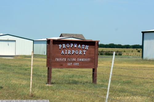 |
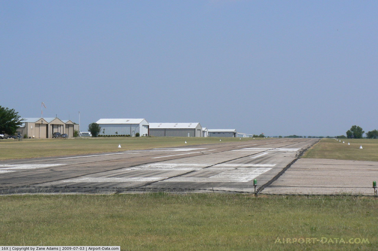
(Click on the photo to enlarge) |
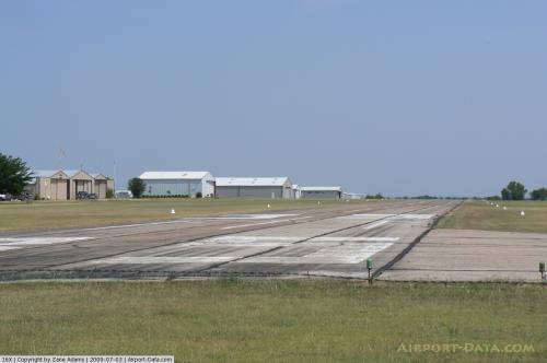 |
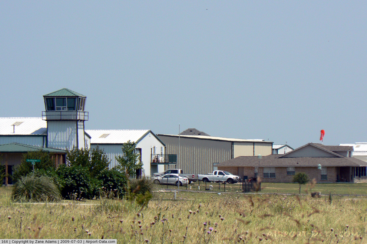
(Click on the photo to enlarge) |
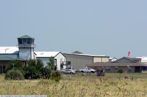 |
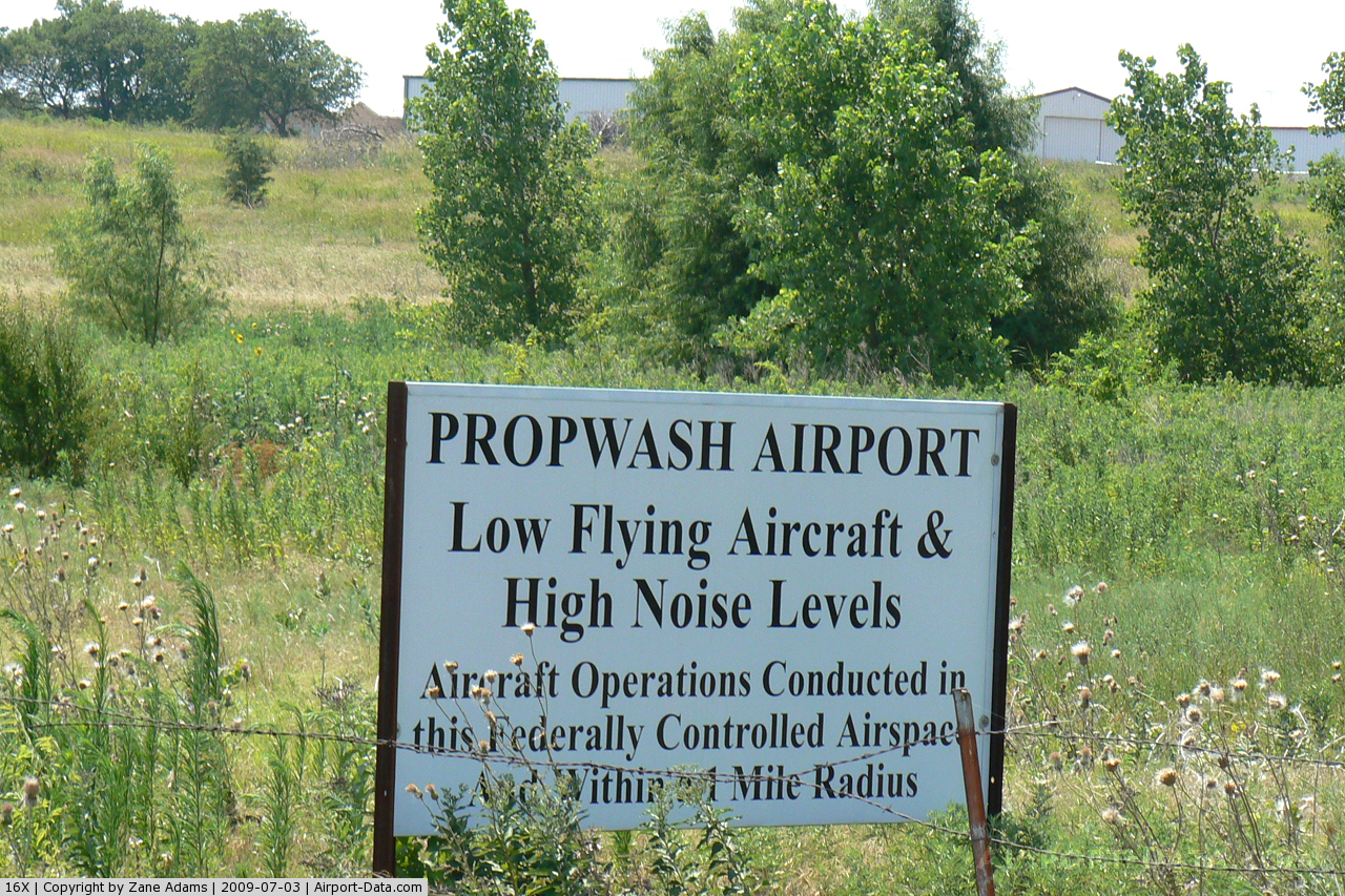
(Click on the photo to enlarge) |
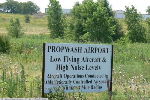 |
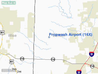
(Click on the photo to enlarge) |
 |
(Click on the photo to enlarge) |
Location & QuickFacts
| FAA Information Effective: | 2008-09-25 |
| Airport Identifier: | 16X |
| Airport Status: | Operational |
| Longitude/Latitude: | 097-21-32.0000W/33-04-50.4390N
-97.358889/33.080678 (Estimated) |
| Elevation: | 800 ft / 243.84 m (Estimated) |
| Land: | 79 acres |
| From nearest city: | 3 nautical miles W of Justin, TX |
| Location: | Denton County, TX |
| Magnetic Variation: | 07E (1985) |
Owner & Manager
| Ownership: | Privately owned |
| Owner: | Propwash Owners Association Inc |
| Address: | 15687 Cessna Rd
Justin, TX 76247 |
| Phone number: | 940-648-5620 |
| Manager: | Ron Grover
OWNERS ASSOCIATION VICE-CHAIRMAN. |
| Address: | 15807 Guy James Road
Justin, TX 76247 |
| Phone number: | 940-648-5620 |
Airport Operations and Facilities
| Airport Use: | Open to public |
| Wind indicator: | Yes |
| Segmented Circle: | No |
| Control Tower: | No |
| Lighting Schedule: | RDO-CTL
ACTVT ROTG BCN - CTAF. |
| Beacon Color: | Clear-Green (lighted land airport) |
| Landing fee charge: | Yes |
| Sectional chart: | Dallas-ft Worth |
| Region: | ASW - Southwest |
| Boundary ARTCC: | ZFW - Fort Worth |
| Tie-in FSS: | FTW - Fort Worth |
| FSS on Airport: | No |
| FSS Phone: | 817-541-3474 |
| FSS Toll Free: | 1-800-WX-BRIEF |
| NOTAMs Facility: | FTW (NOTAM-d service avaliable) |
Airport Communications
Runway Information
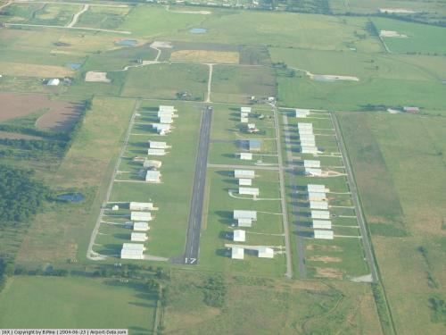
Runway 17/35
| Dimension: | 3000 x 60 ft / 914.4 x 18.3 m |
| Surface: | ASPH, |
| Edge Lights: | Low |
| |
Runway 17 |
Runway 35 |
| Traffic Pattern: | Right | Left |
| Markings: | Basic, Good Condition | Basic, Good Condition |
| Obstruction: | 30 ft pline, 210.0 ft from runway, 81 ft left of centerline
+4 FT FENCE 60 FT FM RY END ACROSS APCH. | 15 ft tree, 225.0 ft from runway, 125 ft right of centerline, 1:1 slope to clear
+5 FT FENCE 70 FT FM RY END ACROSS APCH; +15 FT ROAD 80 FT FM RY END ACROSS APCH. |
|
Radio Navigation Aids
| ID |
Type |
Name |
Ch |
Freq |
Var |
Dist |
| RBD | NDB | Redbird | | 287.00 | 06E | 34.6 nm |
| XQH | NDB | Cedar Hill | | 353.00 | 08E | 35.2 nm |
| GMZ | NDB | Grindstone Mountain | | 356.00 | 07E | 37.8 nm |
| GLE | NDB | Gainesville | | 330.00 | 06E | 39.2 nm |
| MWL | NDB | Mineral Wells | | 266.00 | 06E | 39.5 nm |
| LNC | NDB | Lancaster | | 239.00 | 06E | 44.2 nm |
| PQF | NDB | Mesquite | | 248.00 | 06E | 44.9 nm |
| JUG | NDB | Jecca | | 388.00 | 06E | 48.5 nm |
| NFW | TACAN | Nas Jrb Fort Worth | 024X | | 07E | 19.0 nm |
| TTT | VOR/DME | Maverick | 078X | 113.10 | 06E | 20.5 nm |
| CVE | VOR/DME | Cowboy | 109X | 116.20 | 06E | 25.6 nm |
| FUZ | VORTAC | Ranger | 104X | 115.70 | 06E | 14.6 nm |
| UKW | VORTAC | Bowie | 071X | 112.40 | 06E | 35.9 nm |
| MQP | VORTAC | Millsap | 124X | 117.70 | 09E | 38.6 nm |
| FTW | VOT | Fort Worth Meacham | | 108.20 | | 15.8 nm |
| DAL | VOT | Dallas Love Field | | 113.30 | | 29.2 nm |
Images and information placed above are from
http://www.airport-data.com/airport/16X/
We thank them for the data!
|
|