 |
|
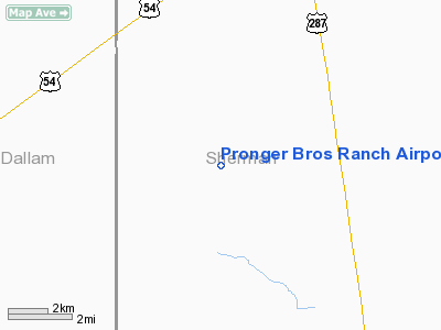
Pronger Bros Ranch Airport |
Location & QuickFacts
| FAA Information Effective: | 2008-09-25 |
| Airport Identifier: | 3E7 |
| Airport Status: | Operational |
| Longitude/Latitude: | 102-06-14.6390W/36-13-10.1120N
-102.104066/36.219476 (Estimated) |
| Elevation: | 3722 ft / 1134.47 m (Estimated) |
| Land: | 45 acres |
| From nearest city: | 8 nautical miles SW of Stratford, TX |
| Location: | Sherman County, TX |
| Magnetic Variation: | 09E (1985) |
Owner & Manager
| Ownership: | Privately owned |
| Owner: | A E Pronger Jr |
| Address: | 13400 Fm 2014
Stratford, TX 79084 |
| Phone number: | 806-769-4474 |
| Manager: | A E Pronger Jr |
| Address: | 13400 Fm 2014
Stratford, TX 79084 |
| Phone number: | 806-769-4474 |
Airport Operations and Facilities
| Airport Use: | Open to public |
| Wind indicator: | No |
| Segmented Circle: | No |
| Control Tower: | No |
| Landing fee charge: | No |
| Sectional chart: | Wichita |
| Region: | ASW - Southwest |
| Boundary ARTCC: | ZAB - Albuquerque |
| Tie-in FSS: | FTW - Fort Worth |
| FSS on Airport: | No |
| FSS Phone: | 817-541-3474 |
| FSS Toll Free: | 1-800-WX-BRIEF |
| NOTAMs Facility: | FTW (NOTAM-d service avaliable) |
Airport Communications
Airport Services
| Airframe Repair: | NONE |
| Power Plant Repair: | NONE |
Runway Information
Runway 06/24
| Dimension: | 3500 x 40 ft / 1066.8 x 12.2 m |
| Surface: | TURF, Poor Condition
SURFACE IS ROUGH AND CONTAINS PRAIRIE DOG HOLES.
SURFACE IS ROUGH AND CONTAIN PRAIRIE DOG HOLES. |
| |
Runway 06 |
Runway 24 |
| Traffic Pattern: | Left | Left |
| Obstruction: | , 50:1 slope to clear | 5 ft fence, 0.0 ft from runway |
|
Runway 17/35
| Dimension: | 4100 x 40 ft / 1249.7 x 12.2 m |
| Surface: | TURF, Poor Condition
SURFACE IS ROUGH AND CONTAINS PRAIRIE DOG HOLES.
SURFACE IS ROUGH AND CONTAIN PRAIRIE DOG HOLES. |
| |
Runway 17 |
Runway 35 |
| Traffic Pattern: | Left | Left |
| Obstruction: | , 50:1 slope to clear | 4 ft fence, 0.0 ft from runway |
|
Radio Navigation Aids
| ID |
Type |
Name |
Ch |
Freq |
Var |
Dist |
| DUX | NDB | Durrett | | 414.00 | 09E | 21.9 nm |
| BCY | NDB | Thorp | | 212.00 | 10E | 38.4 nm |
| GUY | NDB | Guymon | | 275.00 | 09E | 41.1 nm |
| EHA | NDB | Elkhart | | 377.00 | 10E | 48.2 nm |
| DHT | VORTAC | Dalhart | 057X | 112.00 | 12E | 22.7 nm |
| BGD | VORTAC | Borger | 023X | 108.60 | 11E | 43.0 nm |
Remarks
Images and information placed above are from
http://www.airport-data.com/airport/3E7/
We thank them for the data!
| General Info
|
| Country |
United States
|
| State |
TEXAS
|
| FAA ID |
3E7
|
| Latitude |
36-13-10.112N
|
| Longitude |
102-06-14.639W
|
| Elevation |
3722 feet
|
| Near City |
STRATFORD
|
We don't guarantee the information is fresh and accurate. The data may
be wrong or outdated.
For more up-to-date information please refer to other sources.
|
|


