 |
|
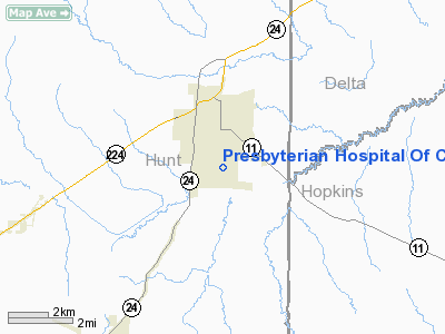
Presbyterian Hospital Of Commerce Heliport |
Location & QuickFacts
| FAA Information Effective: | 2008-09-25 |
| Airport Identifier: | 60TS |
| Airport Status: | Operational |
| Longitude/Latitude: | 095-53-48.8760W/33-13-31.4060N
-95.896910/33.225391 (Estimated) |
| Elevation: | 517 ft / 157.58 m (Estimated) |
| Land: | 0 acres |
| From nearest city: | 1 nautical miles S of Commerce, TX |
| Location: | Hunt County, TX |
| Magnetic Variation: | 06E (1985) |
Owner & Manager
| Ownership: | Publicly owned |
| Owner: | Hunt Memorial Hospital Dist. |
| Address: | 2900 Sterling Hart Drive
Commerce, TX 75428 |
| Phone number: | 903-886-3161 |
| Manager: | Joe Kana |
| Address: | 2900 Sterling Hart Drive
Commerce, TX 75428 |
| Phone number: | 903-886-3161 |
Airport Operations and Facilities
| Airport Use: | Private
MEDICAL. |
| Wind indicator: | Yes |
| Segmented Circle: | No |
| Control Tower: | No |
| Sectional chart: | Dallas-ft Worth |
| Region: | ASW - Southwest |
| Boundary ARTCC: | ZFW - Fort Worth |
| Tie-in FSS: | FTW - Fort Worth |
| FSS Phone: | 817-541-3474 |
| FSS Toll Free: | 1-800-WX-BRIEF |
Runway Information
Helipad H1
| Dimension: | 40 x 40 ft / 12.2 x 12.2 m |
| Surface: | CONC, |
| |
Runway H1 |
Runway |
| Traffic Pattern: | Left | Left |
|
Radio Navigation Aids
| ID |
Type |
Name |
Ch |
Freq |
Var |
Dist |
| SYW | NDB | Cash | | 428.00 | 05E | 17.0 nm |
| MII | NDB | Caddo Mills | | 316.00 | 06E | 20.9 nm |
| HJM | NDB | Rayburn | | 415.00 | 06E | 27.2 nm |
| AVZ | NDB | Travis | | 260.00 | 06E | 33.1 nm |
| PQF | NDB | Mesquite | | 248.00 | 06E | 40.5 nm |
| JUG | NDB | Jecca | | 388.00 | 06E | 46.4 nm |
| DUA | NDB | Durant | | 359.00 | 05E | 49.9 nm |
| MJF | TACAN | Arvilla | 033X | | 05E | 12.6 nm |
| SLR | VOR/DME | Sulphur Springs | 027X | 109.00 | 08E | 17.9 nm |
| PRX | VOR/DME | Paris | 083X | 113.60 | 07E | 29.5 nm |
| UIM | VOR/DME | Quitman | 087X | 114.00 | 08E | 33.8 nm |
| URH | VOR/DME | Texoma | 090X | 114.30 | 05E | 49.8 nm |
| BYP | VORTAC | Bonham | 093X | 114.60 | 06E | 25.3 nm |
Images and information placed above are from
http://www.airport-data.com/airport/60TS/
We thank them for the data!
| General Info
|
| Country |
United States
|
| State |
TEXAS
|
| FAA ID |
60TS
|
| Latitude |
33-13-31.406N
|
| Longitude |
095-53-48.876W
|
| Elevation |
517 feet
|
| Near City |
COMMERCE
|
We don't guarantee the information is fresh and accurate. The data may
be wrong or outdated.
For more up-to-date information please refer to other sources.
|
|


