 |
|
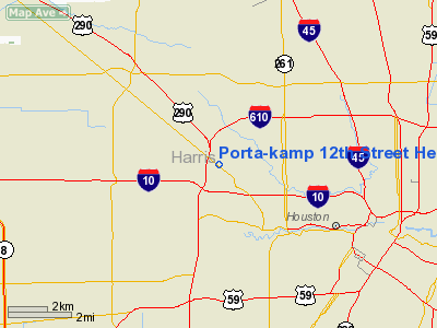
Porta-kamp 12th Street Heliport |
Location & QuickFacts
| FAA Information Effective: | 2008-09-25 |
| Airport Identifier: | 80TA |
| Airport Status: | Operational |
| Longitude/Latitude: | 095-26-41.7840W/29-47-28.8180N
-95.444940/29.791338 (Estimated) |
| Elevation: | 70 ft / 21.34 m (Estimated) |
| Land: | 1 acres |
| From nearest city: | 0 nautical miles N of Houston, TX |
| Location: | Harris County, TX |
| Magnetic Variation: | 06E (1985) |
Owner & Manager
| Ownership: | Privately owned |
| Owner: | Porta-kamp Manufacturing Co. |
| Address: | 3601 W. 12th St.
Houston, TX 77008 |
| Phone number: | 713-869-3293 |
| Manager: | William Strecker Jr |
| Address: | 555 Gellhorn Dr
Houston, TX 77029 |
| Phone number: | 713-674-3763 |
Airport Operations and Facilities
| Airport Use: | Private |
| Wind indicator: | Yes |
| Segmented Circle: | No |
| Control Tower: | No |
| Landing fee charge: | No |
| Sectional chart: | Houston |
| Region: | ASW - Southwest |
| Boundary ARTCC: | ZHU - Houston |
| Tie-in FSS: | CXO - Montgomery County |
| FSS on Airport: | No |
| FSS Toll Free: | 1-800-WX-BRIEF
FOR FP FILING CALL CXO FSS 1-800-833-5602. |
Runway Information
Helipad H1
| Dimension: | 50 x 50 ft / 15.2 x 15.2 m |
| Surface: | CONC, |
| |
Runway H1 |
Runway |
| Traffic Pattern: | Left | Left |
|
Radio Navigation Aids
| ID |
Type |
Name |
Ch |
Freq |
Var |
Dist |
| LYD | NDB | Lakeside | | 249.00 | 05E | 12.2 nm |
| EYQ | NDB | Weiser | | 286.00 | 06E | 13.3 nm |
| SGR | NDB | Hull | | 388.00 | 05E | 14.6 nm |
| BVP | NDB | Nixin | | 326.00 | 05E | 17.1 nm |
| SYG | NDB | Sandy Point | | 402.00 | 05E | 17.4 nm |
| JPA | NDB | Sanjac | | 347.00 | 05E | 20.9 nm |
| DWH | NDB | David Hooks | | 521.00 | 05E | 21.1 nm |
| CBC | NDB | Anahuac | | 413.00 | 05E | 40.8 nm |
| GLS | NDB | Galveston | | 206.00 | 08E | 45.3 nm |
| ARM | NDB | Wharton | | 245.00 | 06E | 49.1 nm |
| EFD | TACAN | Ellington | 031X | | 05E | 18.6 nm |
| HUB | VOR/DME | Hobby | 118X | 117.10 | 05E | 12.0 nm |
| MHF | VOR/DME | Trinity | 083X | 113.60 | 07E | 39.3 nm |
| ELA | VOR/DME | Eagle Lake | 111X | 116.40 | 08E | 46.2 nm |
| IAH | VORTAC | Humble | 113X | 116.60 | 05E | 11.2 nm |
| VUH | VORTAC | Scholes | 077X | 113.00 | 06E | 43.5 nm |
| TNV | VORTAC | Navasota | 106X | 115.90 | 08E | 43.7 nm |
| DAS | VORTAC | Daisetta | 116X | 116.90 | 05E | 48.0 nm |
| HOU | VOT | Houston Wm P Hobby | | 108.40 | | 12.4 nm |
Remarks
- OWNER DESIRES ARPT NOT TO BE CHARTED.
- CONDL--PRVDD INGRESS/EGRESS IS TO & FROM THE SE & WEST ONLY; FENCE AROUND LNDG AREA IS REMOVED; ACCESS TO LNDG AREA FROM HEMPSTEAD ROAD MUST BE PERMANENTLY BLOCKED.
Images and information placed above are from
http://www.airport-data.com/airport/80TA/
We thank them for the data!
| General Info
|
| Country |
United States
|
| State |
TEXAS
|
| FAA ID |
80TA
|
| Latitude |
29-47-28.818N
|
| Longitude |
095-26-41.784W
|
| Elevation |
70 feet
|
| Near City |
HOUSTON
|
We don't guarantee the information is fresh and accurate. The data may
be wrong or outdated.
For more up-to-date information please refer to other sources.
|
|


