 |
|
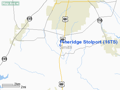
Pineridge Stolport Airport |
Location & QuickFacts
| FAA Information Effective: | 2008-09-25 |
| Airport Identifier: | 16TS |
| Airport Status: | Operational |
| Longitude/Latitude: | 095-19-04.8250W/32-13-21.5540N
-95.318007/32.222654 (Estimated) |
| Elevation: | 420 ft / 128.02 m (Estimated) |
| Land: | 50 acres |
| From nearest city: | 7 nautical miles S of Tyler, TX |
| Location: | Smith County, TX |
| Magnetic Variation: | 06E (1986) |
Owner & Manager
| Ownership: | Privately owned |
| Owner: | Jeff Wright |
| Address: | 6705 Glen Eagle Drive
Tyler, TX 75703 |
| Phone number: | 903-509-3464 |
| Manager: | Jeff Wright |
| Address: | 6705 Glen Eagle Drive
Tyler, TX 75703 |
| Phone number: | 903-509-3463 |
Airport Operations and Facilities
| Airport Use: | Private |
| Wind indicator: | Yes |
| Segmented Circle: | No |
| Control Tower: | No |
| Sectional chart: | Dallas-ft Worth |
| Region: | ASW - Southwest |
| Boundary ARTCC: | ZFW - Fort Worth |
| Tie-in FSS: | FTW - Fort Worth |
| FSS Phone: | 817-541-3474 |
| FSS Toll Free: | 1-800-WX-BRIEF |
Runway Information
Runway 17/35
| Dimension: | 1500 x 30 ft / 457.2 x 9.1 m |
| Surface: | TURF, |
| |
Runway 17 |
Runway 35 |
| Traffic Pattern: | Left | Left |
|
Radio Navigation Aids
| ID |
Type |
Name |
Ch |
Freq |
Var |
Dist |
| TY | NDB | Tyler | | 320.00 | 06E | 13.9 nm |
| JSO | NDB | Cherokee County | | 263.00 | 05E | 21.8 nm |
| HNO | NDB | Henderson | | 371.00 | 06E | 23.3 nm |
| ABG | NDB | Ambassador | | 404.00 | 07E | 24.2 nm |
| AHX | NDB | Athens | | 269.00 | 06E | 26.3 nm |
| PSN | NDB | Palestine | | 375.00 | 04E | 33.0 nm |
| CSZ | NDB | Crossroads | | 215.00 | 08E | 33.9 nm |
| LIQ | NDB | Lochridge Ranch | | 335.00 | 09E | 34.7 nm |
| GXD | NDB | Nacogdoches | | 391.00 | 05E | 46.6 nm |
| PYF | NDB | Pyramid | | 418.00 | 06E | 49.8 nm |
| TYR | VOR/DME | Tyler | 089X | 114.20 | 06E | 9.1 nm |
| FZT | VOR/DME | Frankston | 051X | 111.40 | 06E | 14.0 nm |
| UIM | VOR/DME | Quitman | 087X | 114.00 | 08E | 39.6 nm |
| GGG | VORTAC | Gregg County | 070X | 112.30 | 07E | 31.0 nm |
| CQY | VORTAC | Cedar Creek | 095X | 114.80 | 06E | 45.8 nm |
Images and information placed above are from
http://www.airport-data.com/airport/16TS/
We thank them for the data!
| General Info
|
| Country |
United States
|
| State |
TEXAS
|
| FAA ID |
16TS
|
| Latitude |
32-13-21.554N
|
| Longitude |
095-19-04.825W
|
| Elevation |
420 feet
|
| Near City |
TYLER
|
We don't guarantee the information is fresh and accurate. The data may
be wrong or outdated.
For more up-to-date information please refer to other sources.
|
|


