 |
|
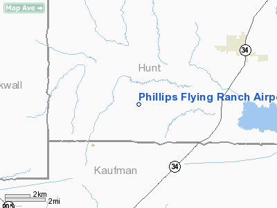
Phillips Flying Ranch Airport |
| Phillips Flying Ranch Airport |
| IATA: none – ICAO: none – FAA LID: T48 |
| Summary |
| Airport type |
Public |
| Location |
Rockwall, Texas |
| Elevation AMSL |
500 ft / 152 m |
| Coordinates |
32°52′05″N 096°13′09″W / 32.86806°N 96.21917°W / 32.86806; -96.21917Coordinates: 32°52′05″N 096°13′09″W / 32.86806°N 96.21917°W / 32.86806; -96.21917 |
| Runways |
| Direction |
Length |
Surface |
| ft |
m |
| 13/31 |
3,344 |
1,019 |
Turf |
Phillips Flying Ranch Airport (FAA LID: T48) is a public airport located fifteen miles (24.1 km) southeast of the central business district (CBD) of Rockwall, in Rockwall County, Texas, USA.
The airport is used solely for general aviation purposes.
Facilities
Phillips Flying Ranch Airport has one runway:
- Runway 13/31: 3,344 x 50 ft. (1,019 x 15 m), Surface: Turf
The above content comes from Wikipedia and is published under free licenses – click here to read more.
Location & QuickFacts
| FAA Information Effective: | 2008-09-25 |
| Airport Identifier: | T48 |
| Airport Status: | Operational |
| Longitude/Latitude: | 096-13-08.9100W/32-52-05.2400N
-96.219142/32.868122 (Estimated) |
| Elevation: | 500 ft / 152.40 m (Estimated) |
| Land: | 250 acres |
| From nearest city: | 15 nautical miles SE of Rockwall, TX |
| Location: | Hunt County, TX |
| Magnetic Variation: | 06E (1985) |
Owner & Manager
| Ownership: | Privately owned |
| Owner: | Jim G. Phillips |
| Address: | 10053 Co. Road 2322
Terrell, TX 75160 |
| Phone number: | 972-563-3765 |
| Manager: | Phillips Flying Ranch |
| Address: | 10053 Co. Road 2322
Terrell, TX 75160 |
| Phone number: | 972-563-3765 |
Airport Operations and Facilities
| Airport Use: | Open to public |
| Wind indicator: | Yes |
| Segmented Circle: | No |
| Control Tower: | No |
| Landing fee charge: | No |
| Sectional chart: | Dallas-ft Worth |
| Region: | ASW - Southwest |
| Boundary ARTCC: | ZFW - Fort Worth |
| Tie-in FSS: | FTW - Fort Worth |
| FSS on Airport: | No |
| FSS Phone: | 817-541-3474 |
| FSS Toll Free: | 1-800-WX-BRIEF |
| NOTAMs Facility: | FTW (NOTAM-d service avaliable) |
Airport Communications
| CTAF: | 123.000 |
| Unicom: | 123.000 |
Airport Services
| Airframe Repair: | MAJOR |
| Power Plant Repair: | MAJOR |
| Bottled Oxygen: | NONE |
| Bulk Oxygen: | NONE |
Runway Information
Runway 13/31
| Dimension: | 3344 x 50 ft / 1019.3 x 15.2 m |
| Surface: | TURF-TRTD, Good Condition |
| |
Runway 13 |
Runway 31 |
| Traffic Pattern: | Left | Left |
| Displaced threshold: | 335.00 ft | 336.00 ft |
| Obstruction: | 35 ft trees, 277.0 ft from runway, 7:1 slope to clear
APCH RATIO 17:1 TO DSPLCD THLD. | , 50:1 slope to clear |
|
Radio Navigation Aids
| ID |
Type |
Name |
Ch |
Freq |
Var |
Dist |
| AVZ | NDB | Travis | | 260.00 | 06E | 6.7 nm |
| SYW | NDB | Cash | | 428.00 | 05E | 10.3 nm |
| MII | NDB | Caddo Mills | | 316.00 | 06E | 10.5 nm |
| PQF | NDB | Mesquite | | 248.00 | 06E | 16.0 nm |
| JUG | NDB | Jecca | | 388.00 | 06E | 19.9 nm |
| LNC | NDB | Lancaster | | 239.00 | 06E | 30.8 nm |
| RBD | NDB | Redbird | | 287.00 | 06E | 34.9 nm |
| XQH | NDB | Cedar Hill | | 353.00 | 08E | 41.8 nm |
| HJM | NDB | Rayburn | | 415.00 | 06E | 44.9 nm |
| TY | NDB | Tyler | | 320.00 | 06E | 46.7 nm |
| AHX | NDB | Athens | | 269.00 | 06E | 46.9 nm |
| CGQ | NDB | Powell | | 344.00 | 06E | 49.5 nm |
| MJF | TACAN | Arvilla | 033X | | 05E | 14.3 nm |
| CVE | VOR/DME | Cowboy | 109X | 116.20 | 06E | 34.6 nm |
| SLR | VOR/DME | Sulphur Springs | 027X | 109.00 | 08E | 39.5 nm |
| TTT | VOR/DME | Maverick | 078X | 113.10 | 06E | 41.5 nm |
| UIM | VOR/DME | Quitman | 087X | 114.00 | 08E | 43.0 nm |
| BYP | VORTAC | Bonham | 093X | 114.60 | 06E | 40.2 nm |
| CQY | VORTAC | Cedar Creek | 095X | 114.80 | 06E | 41.0 nm |
| FUZ | VORTAC | Ranger | 104X | 115.70 | 06E | 48.5 nm |
| DAL | VOT | Dallas Love Field | | 113.30 | | 32.0 nm |
Remarks
- WATCH FOR WILDLIFE ON RY.
- VFR OPNS ONLY.
Images and information placed above are from
http://www.airport-data.com/airport/T48/
We thank them for the data!
| General Info
|
| Country |
United States
|
| State |
TEXAS
|
| FAA ID |
T48
|
| Latitude |
32-52-05.240N
|
| Longitude |
096-13-08.910W
|
| Elevation |
500 feet
|
| Near City |
ROCKWALL
|
We don't guarantee the information is fresh and accurate. The data may
be wrong or outdated.
For more up-to-date information please refer to other sources.
|
|


