 |
|
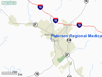
Peterson Regional Medical Center Heliport |
Location & QuickFacts
| FAA Information Effective: | 2008-09-25 |
| Airport Identifier: | 20TX |
| Airport Status: | Operational |
| Longitude/Latitude: | 099-09-04.0000W/30-02-37.0000N
-99.151111/30.043611 (Estimated) |
| Elevation: | 1639 ft / 499.57 m (Estimated) |
| Land: | 0 acres |
| From nearest city: | 0 nautical miles N of Kerrville, TX |
| Location: | Kerr County, TX |
| Magnetic Variation: | 07E (2000) |
Owner & Manager
| Ownership: | Privately owned |
| Owner: | Sid Peterson Memorial Hospital |
| Address: | 710 Water Street
Kerrville, TX 78028 |
| Phone number: | 830-896-4200 |
| Manager: | Critical Air Medicine |
| Address: | 1403 Northern Blvd
San Antonio, TX 78216 |
| Phone number: | 210-824-1758 |
Airport Operations and Facilities
| Airport Use: | Private
MEDICAL. |
| Wind indicator: | Yes |
| Segmented Circle: | No |
| Control Tower: | No |
| Lighting Schedule: | DUSK-DAWN |
| Sectional chart: | San Antonio |
| Region: | ASW - Southwest |
| Boundary ARTCC: | ZHU - Houston |
| Tie-in FSS: | SJT - San Angelo |
| FSS Toll Free: | 1-800-WX-BRIEF |
Runway Information
Helipad H1
| Dimension: | 60 x 50 ft / 18.3 x 15.2 m |
| Surface: | CONC, |
| |
Runway H1 |
Runway |
| Traffic Pattern: | Left | Left |
|
Radio Navigation Aids
| ID |
Type |
Name |
Ch |
Freq |
Var |
Dist |
| ER | NDB | Shein | | 263.00 | 08E | 10.7 nm |
| HMA | NDB | Hondo | | 329.00 | 08E | 40.3 nm |
| CVB | NDB | Castroville | | 338.00 | 08E | 44.8 nm |
| KSY | TACAN | Kelly | 057X | | 07E | 49.2 nm |
| HDO | VOR/DME | Hondo | 31X | 109.40 | 08E | 41.8 nm |
| CSI | VORTAC | Center Point | 122X | 117.50 | 08E | 8.0 nm |
| STV | VORTAC | Stonewall | 085X | 113.80 | 08E | 25.1 nm |
| SAT | VORTAC | San Antonio | 115X | 116.80 | 08E | 43.2 nm |
| JCT | VORTAC | Junction | 107X | 116.00 | 08E | 48.0 nm |
| LLO | VORTAC | Llano | 019X | 108.20 | 08E | 49.0 nm |
| SAT | VOT | San Antonio Intl | | 110.40 | | 46.9 nm |
Images and information placed above are from
http://www.airport-data.com/airport/20TX/
We thank them for the data!
| General Info
|
| Country |
United States
|
| State |
TEXAS
|
| FAA ID |
20TX
|
| Latitude |
30-02-50.750N
|
| Longitude |
099-08-30.140W
|
| Elevation |
1676 feet
|
| Near City |
KERRVILLE
|
We don't guarantee the information is fresh and accurate. The data may
be wrong or outdated.
For more up-to-date information please refer to other sources.
|
|


