 |
|
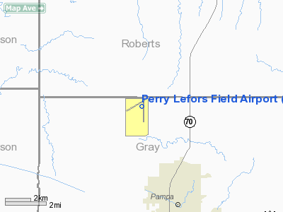
Perry Lefors Field Airport |
Location & QuickFacts
| FAA Information Effective: | 2008-09-25 |
| Airport Identifier: | PPA |
| Airport Status: | Operational |
| Longitude/Latitude: | 100-59-46.5445W/35-36-46.7990N
-100.996262/35.613000 (Estimated) |
| Elevation: | 3245 ft / 989.08 m (Surveyed) |
| Land: | 250 acres |
| From nearest city: | 5 nautical miles NW of Pampa, TX |
| Location: | Gray County, TX |
| Magnetic Variation: | 08E (2000) |
Owner & Manager
| Ownership: | Publicly owned |
| Owner: | Gray County |
| Address: | Gray Co Courthouse
Pampa, TX 79065 |
| Phone number: | 806-669-8007 |
| Manager: | Ron Unruh |
| Address: | 9041 Fm 282
Pampa, TX 79065 |
| Phone number: | 806-665-1881 |
Airport Operations and Facilities
| Airport Use: | Open to public |
| Wind indicator: | Yes |
| Segmented Circle: | Yes |
| Control Tower: | No |
| Lighting Schedule: | DUSK-DAWN
MIRL RYS 05/23 & 17/35 PRESET LOW INTST; TO INCR INTST ACTVT - CTAF. |
| Beacon Color: | Clear-Green (lighted land airport)
ROTG BCN OTS INDEFLY. |
| Landing fee charge: | No |
| Sectional chart: | Dallas-ft Worth |
| Region: | ASW - Southwest |
| Boundary ARTCC: | ZAB - Albuquerque |
| Tie-in FSS: | FTW - Fort Worth |
| FSS on Airport: | No |
| FSS Phone: | 817-541-3474 |
| FSS Toll Free: | 1-800-WX-BRIEF |
| NOTAMs Facility: | PPA (NOTAM-d service avaliable) |
| Federal Agreements: | NGRY |
Airport Communications
| CTAF: | 122.700 |
| Unicom: | 122.700 |
Airport Services
| Fuel available: | 100LLA1+
FOR FUEL AFT HRS CALL 806-665-0251. |
| Airframe Repair: | MAJOR |
| Power Plant Repair: | MAJOR |
| Bottled Oxygen: | NONE |
| Bulk Oxygen: | NONE |
Runway Information
Runway 05/23
| Dimension: | 4500 x 75 ft / 1371.6 x 22.9 m |
| Surface: | ASPH, Good Condition |
| Weight Limit: | Single wheel: 17000 lbs. |
| Edge Lights: | Medium
MIRL OTS INDEFLY. |
| |
Runway 05 |
Runway 23 |
| Longitude: | 101-00-21.5652W | 100-59-34.3540W |
| Latitude: | 35-36-47.6687N | 35-37-09.8894N |
| Elevation: | 3242.00 ft | 3238.00 ft |
| Alignment: | 60 | 127 |
| Traffic Pattern: | Left | Left |
| Markings: | Basic, Good Condition | Basic, Good Condition |
| Obstruction: | , 50:1 slope to clear | 25 ft pline, 900.0 ft from runway, 25 ft right of centerline, 28:1 slope to clear |
|
Runway 17/35
| Dimension: | 5866 x 100 ft / 1788.0 x 30.5 m |
| Surface: | ASPH, Good Condition |
| Weight Limit: | Single wheel: 16000 lbs. |
| Edge Lights: | Medium
MIRL OTS INDEFLY. |
| |
Runway 17 |
Runway 35 |
| Longitude: | 100-59-37.7733W | 100-59-37.7995W |
| Latitude: | 35-37-06.6078N | 35-36-08.6077N |
| Elevation: | 3239.00 ft | 3241.00 ft |
| Alignment: | 127 | 0 |
| Traffic Pattern: | Left | Left |
| Markings: | Non-precision instrument, Good Condition | Non-precision instrument, Good Condition |
| Crossing Height: | 45.00 ft | 45.00 ft |
| VASI: | pulsating/steady burning on left side | pulsating/steady burning on left side |
| Visual Glide Angle: | 3.00° | 3.00° |
| Runway End Identifier: | Yes
REIL OTS INDEFLY. | Yes
REIL OTS INDEFLY. |
| Obstruction: | 10 ft road, 610.0 ft from runway, 41:1 slope to clear
TAIL HEIGHT OF AIRPLANE ON RY 05/23; 173 FT FM CENTERLINE TO THLD. | , 50:1 slope to clear |
|
Radio Navigation Aids
| ID |
Type |
Name |
Ch |
Freq |
Var |
Dist |
| PPA | NDB | Pampa | | 368.00 | 09E | 0.2 nm |
| HHF | NDB | Hemphill County | | 400.00 | 08E | 33.3 nm |
| AM | NDB | Pande | | 251.00 | 09E | 48.6 nm |
| PYX | NDB | Perryton | | 266.00 | 09E | 49.5 nm |
| BGD | VORTAC | Borger | 023X | 108.60 | 11E | 22.2 nm |
| PNH | VORTAC | Panhandle | 113X | 116.60 | 08E | 41.2 nm |
Remarks
- ANTELOPE ON & INVOF RY.
- NO LINE OF SIGHT BTN BOTH RY ENDS.
Images and information placed above are from
http://www.airport-data.com/airport/PPA/
We thank them for the data!
| General Info
|
| Country |
United States
|
| State |
TEXAS
|
| FAA ID |
PPA
|
| Latitude |
35-36-46.757N
|
| Longitude |
100-59-46.539W
|
| Elevation |
3244 feet
|
| Near City |
PAMPA
|
We don't guarantee the information is fresh and accurate. The data may
be wrong or outdated.
For more up-to-date information please refer to other sources.
|
|


