 |
|
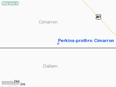
Perkins-prothro Cimarron Ranch Airport |
Location & QuickFacts
| FAA Information Effective: | 2008-09-25 |
| Airport Identifier: | 5TE4 |
| Airport Status: | Operational |
| Longitude/Latitude: | 102-23-31.6510W/36-30-30.0930N
-102.392125/36.508359 (Estimated) |
| Elevation: | 3995 ft / 1217.68 m (Surveyed) |
| Land: | 0 acres |
| From nearest city: | 7 nautical miles W of Kerrick, TX |
| Location: | Cimarron County, OK |
| Magnetic Variation: | 10E (1985) |
Owner & Manager
| Ownership: | Privately owned |
| Owner: | Charles N. Prothro |
| Address: | P.0.b0x 360
Wichita Falls, TX 76307 |
| Phone number: | 817-723-7163 |
| Manager: | Kenneth D. Edwards |
| Address: | P.0 B0x 360
Wichita Falls, TX 76307 |
| Phone number: | 817-723-7163 |
Airport Operations and Facilities
| Airport Use: | Private |
| Wind indicator: | Yes |
| Segmented Circle: | No |
| Control Tower: | No |
| Landing fee charge: | No |
| Sectional chart: | Wichita |
| Region: | ASW - Southwest |
| Boundary ARTCC: | ZAB - Albuquerque |
| Tie-in FSS: | FTW - Fort Worth |
| FSS on Airport: | No |
| FSS Phone: | 817-541-3474 |
| FSS Toll Free: | 1-800-WX-BRIEF |
Airport Services
| Airframe Repair: | NONE |
| Power Plant Repair: | NONE |
Runway Information
Runway 01/19
| Dimension: | 4300 x 35 ft / 1310.6 x 10.7 m |
| Surface: | ASPH, Fair Condition |
| |
Runway 01 |
Runway 19 |
| Traffic Pattern: | Left | Left |
|
Radio Navigation Aids
| ID |
Type |
Name |
Ch |
Freq |
Var |
Dist |
| BCY | NDB | Thorp | | 212.00 | 10E | 16.4 nm |
| CAO | NDB | Clayton | | 332.00 | 09E | 36.8 nm |
| EHA | NDB | Elkhart | | 377.00 | 10E | 38.4 nm |
| DUX | NDB | Durrett | | 414.00 | 09E | 42.9 nm |
| GUY | NDB | Guymon | | 275.00 | 09E | 44.4 nm |
| DHT | VORTAC | Dalhart | 057X | 112.00 | 12E | 26.1 nm |
Remarks
- ARPT 1/4 MILE NORTH OF TX/OK STATE LINE IN OK.
- COWS ON RY.
Images and information placed above are from
http://www.airport-data.com/airport/5TE4/
We thank them for the data!
| General Info
|
| Country |
United States
|
| State |
TEXAS
|
| FAA ID |
5TE4
|
| Latitude |
36-30-30.093N
|
| Longitude |
102-23-31.651W
|
| Elevation |
3995 feet
|
| Near City |
KERRICK
|
We don't guarantee the information is fresh and accurate. The data may
be wrong or outdated.
For more up-to-date information please refer to other sources.
|
|


