 |
|
Coordinates: 29°31′17″N 095°14′32″W / 29.52139°N 95.24222°W / 29.52139; -95.24222
| Pearland Regional Airport |
| IATA: none – ICAO: KLVJ – FAA LID: LVJ |
| Summary |
| Airport type |
Privately-owned, Public use |
| Owner |
Clover Acquisition Corp. |
| Serves |
Houston, Texas |
| Location |
Brazoria County, Texas |
| Elevation AMSL |
44 ft / 13 m |
| Runways |
| Direction |
Length |
Surface |
| ft |
m |
| 14/32 |
4,313 |
1,315 |
Concrete |
| Statistics (2000) |
| Aircraft operations |
87,125 |
| Based aircraft |
175 |
| Source: Federal Aviation Administration |
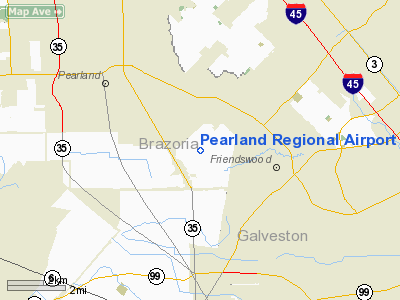
Pearland Regional Airport (ICAO: KLVJ, FAA LID: LVJ) is a public-use general aviation airport located in unincorporated Brazoria County, Texas, United States south of the city limits of Pearland and 17 miles (27 km) south of the central business district of Houston. It is privately owned by the Clover Acquisition Corporation and was formerly known as Clover Field.
Although most U.S. airports use the same three-letter location identifier for the FAA and IATA, Pearland Regional Airport is assigned LVJ by the FAA but has no designation from the IATA.
Facilities and aircraft
Pearland Regional Airport covers an area of 450 acres (182 ha) which contains one runway designated 14/32 with a 4,313 x 75 ft (1315 x 23 m) concrete surface. For the 12-month period ending May 30, 2000, the airport had 87,125 aircraft operations, an average of 238 per day: 99.7% general aviation and 0.3% air taxi. At that time there were 175 aircraft based at this airport: 94% single-engine, 2% multi-engine and 4% helicopter.
The above content comes from Wikipedia and is published under free licenses – click here to read more.
Location & QuickFacts
| FAA Information Effective: | 2008-09-25 |
| Airport Identifier: | LVJ |
| Airport Status: | Operational |
| Longitude/Latitude: | 095-14-31.7000W/29-31-16.6000N
-95.242139/29.521278 (Estimated) |
| Elevation: | 44 ft / 13.41 m (Surveyed) |
| Land: | 450 acres |
| From nearest city: | 17 nautical miles S of Houston, TX |
| Location: | Brazoria County, TX |
| Magnetic Variation: | 06E (1980) |
Owner & Manager
| Ownership: | Privately owned |
| Owner: | Clover Acquisition Corp.
ANDY RIVERA ARPT DIRECTOR. |
| Address: | 17622 Airfield Ln
Pearland, TX 77581 |
| Phone number: | 281-482-7551 |
| Manager: | Andy Rivera |
| Address: | Po Box 2379
Friendswood, TX 77549-2379 |
| Phone number: | 281-482-7551 |
Airport Operations and Facilities
| Airport Use: | Open to public |
| Wind indicator: | Yes |
| Segmented Circle: | No |
| Control Tower: | No |
| Lighting Schedule: | DUSK-DAWN |
| Beacon Color: | Clear-Green (lighted land airport) |
| Landing fee charge: | No |
| Sectional chart: | Houston |
| Region: | ASW - Southwest |
| Traffic Pattern Alt: | 1000 ft |
| Boundary ARTCC: | ZHU - Houston |
| Tie-in FSS: | CXO - Montgomery County |
| FSS on Airport: | No |
| FSS Toll Free: | 1-800-WX-BRIEF
FOR FP FILING CALL CXO FSS 1-800-833-5602 |
| NOTAMs Facility: | LVJ (NOTAM-d service avaliable) |
| Federal Agreements: | N |
Airport Communications
| CTAF: | 122.800 |
| Unicom: | 122.800 |
Airport Services
| Fuel available: | 100LLA |
| Airframe Repair: | MAJOR |
| Power Plant Repair: | MAJOR |
Runway Information
Runway 14/32
| Dimension: | 4313 x 75 ft / 1314.6 x 22.9 m |
| Surface: | ASPH, Good Condition |
| Weight Limit: | Single wheel: 8000 lbs. |
| Edge Lights: | Medium |
| |
Runway 14 |
Runway 32 |
| Longitude: | 095-14-45.8550W | 095-14-17.6293W |
| Latitude: | 29-31-34.0521N | 29-30-59.2212N |
| Elevation: | 44.00 ft | 39.00 ft |
| Alignment: | 127 | 127 |
| Traffic Pattern: | Left | Left |
| Markings: | Non-precision instrument, Good Condition | Non-precision instrument, Good Condition |
| Runway End Identifier: | Yes | Yes |
| Obstruction: | 60 ft trees, 600.0 ft from runway, 250 ft right of centerline, 6:1 slope to clear
+25-+50 FT TREE AT THLD 135 FT LEFT. | 40 ft tree, 600.0 ft from runway, 106 ft left of centerline, 10:1 slope to clear |
|
Radio Navigation Aids
| ID |
Type |
Name |
Ch |
Freq |
Var |
Dist |
| SYG | NDB | Sandy Point | | 402.00 | 05E | 11.9 nm |
| JPA | NDB | Sanjac | | 347.00 | 05E | 12.6 nm |
| SGR | NDB | Hull | | 388.00 | 05E | 22.6 nm |
| GLS | NDB | Galveston | | 206.00 | 08E | 27.8 nm |
| BVP | NDB | Nixin | | 326.00 | 05E | 28.4 nm |
| LYD | NDB | Lakeside | | 249.00 | 05E | 28.8 nm |
| EYQ | NDB | Weiser | | 286.00 | 06E | 32.4 nm |
| CBC | NDB | Anahuac | | 413.00 | 05E | 33.8 nm |
| DWH | NDB | David Hooks | | 521.00 | 05E | 40.1 nm |
| BYY | NDB | Bay City | | 344.00 | 06E | 46.2 nm |
| EFD | TACAN | Ellington | 031X | | 05E | 6.7 nm |
| HUB | VOR/DME | Hobby | 118X | 117.10 | 05E | 8.3 nm |
| MHF | VOR/DME | Trinity | 083X | 113.60 | 07E | 25.9 nm |
| VUH | VORTAC | Scholes | 077X | 113.00 | 06E | 24.8 nm |
| IAH | VORTAC | Humble | 113X | 116.60 | 05E | 26.7 nm |
| HOU | VOT | Houston Wm P Hobby | | 108.40 | | 7.7 nm |
Remarks
- RY 14 25 FT LGTD POLES IN TREES 520 FT FM THLD.
- LGTD OIL DERRICK 116 FT AGL .65 NM SE OF ARPT.
- BANNER TOWING SR-SS.
- PREDATES ACT.
Images and information placed above are from
http://www.airport-data.com/airport/LVJ/
We thank them for the data!
| General Info
|
| Country |
United States
|
| State |
TEXAS
|
| FAA ID |
LVJ
|
| Latitude |
29-31-16.700N
|
| Longitude |
095-14-31.800W
|
| Elevation |
43 feet
|
| Near City |
HOUSTON
|
We don't guarantee the information is fresh and accurate. The data may
be wrong or outdated.
For more up-to-date information please refer to other sources.
|
|


