 |
|
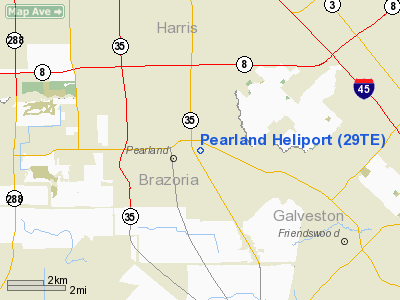
Location & QuickFacts
| FAA Information Effective: | 2008-09-25 |
| Airport Identifier: | 29TE |
| Airport Status: | Operational |
| Longitude/Latitude: | 095-16-50.9000W/29-33-31.1000N
-95.280806/29.558639 (Estimated) |
| Elevation: | 51 ft / 15.54 m (Estimated) |
| Land: | 11 acres |
| From nearest city: | 0 nautical miles SE of Pearland, TX |
| Location: | Brazoria County, TX |
| Magnetic Variation: | 06E (1985) |
Owner & Manager
| Ownership: | Privately owned |
| Owner: | Houston Helicopters, Inc. |
| Address: | Po Box 830
Pearland, TX 77588-0830 |
| Phone number: | 281-485-1777 |
| Manager: | Felton M. Baker |
| Address: | 3506 Lockheed Ave.
Pearland, TX 77581 |
| Phone number: | 281-485-1777 |
Airport Operations and Facilities
| Airport Use: | Private |
| Wind indicator: | Yes |
| Segmented Circle: | No |
| Control Tower: | No |
| Lighting Schedule: | DUSK-DAWN |
| Beacon Color: | Clear-Green (lighted land airport) |
| Landing fee charge: | No |
| Sectional chart: | Houston |
| Region: | ASW - Southwest |
| Traffic Pattern Alt: | 649 ft |
| Boundary ARTCC: | ZHU - Houston |
| Tie-in FSS: | CXO - Montgomery County |
| FSS on Airport: | No |
| FSS Toll Free: | 1-800-WX-BRIEF
FOR FP FILING CALL CXO FSS 1-800-833-5602 |
Airport Services
| Fuel available: | A |
| Airframe Repair: | MAJOR
AIRFRAME REPAIRS FOR HELICOPTERS ONLY. |
| Power Plant Repair: | MAJOR |
| Bottled Oxygen: | NONE |
| Bulk Oxygen: | NONE |
Runway Information
Helipad H1
| Dimension: | 20 x 20 ft / 6.1 x 6.1 m |
| Surface: | ASPH, Good Condition |
| |
Runway H1 |
Runway |
| Traffic Pattern: | Left | Left |
| Markings: | Nonstandard,
NSTD HELIPORT MKGS; 6 INCH WHITE LINES MARKING EDGES. | ,
NSTD HELIPORT MKGS; 6 INCH WHITE LINES MARKING EDGES. |
|
Radio Navigation Aids
| ID |
Type |
Name |
Ch |
Freq |
Var |
Dist |
| SYG | NDB | Sandy Point | | 402.00 | 05E | 10.4 nm |
| JPA | NDB | Sanjac | | 347.00 | 05E | 12.8 nm |
| SGR | NDB | Hull | | 388.00 | 05E | 20.1 nm |
| LYD | NDB | Lakeside | | 249.00 | 05E | 25.9 nm |
| BVP | NDB | Nixin | | 326.00 | 05E | 26.4 nm |
| EYQ | NDB | Weiser | | 286.00 | 06E | 29.4 nm |
| GLS | NDB | Galveston | | 206.00 | 08E | 30.6 nm |
| CBC | NDB | Anahuac | | 413.00 | 05E | 34.8 nm |
| DWH | NDB | David Hooks | | 521.00 | 05E | 37.2 nm |
| BYY | NDB | Bay City | | 344.00 | 06E | 46.5 nm |
| ARM | NDB | Wharton | | 245.00 | 06E | 49.1 nm |
| EFD | TACAN | Ellington | 031X | | 05E | 6.9 nm |
| HUB | VOR/DME | Hobby | 118X | 117.10 | 05E | 5.8 nm |
| MHF | VOR/DME | Trinity | 083X | 113.60 | 07E | 27.9 nm |
| IAH | VORTAC | Humble | 113X | 116.60 | 05E | 24.2 nm |
| VUH | VORTAC | Scholes | 077X | 113.00 | 06E | 27.8 nm |
| HOU | VOT | Houston Wm P Hobby | | 108.40 | | 5.2 nm |
Remarks
- ALL REPAIRS ON CALL 713-485-1777.
- FREQ 129.15 AVBL.
- HELIPORT DETERMINATION-NO OBJECTION
Images and information placed above are from
http://www.airport-data.com/airport/29TE/
We thank them for the data!
| General Info
|
| Country |
United States
|
| State |
TEXAS
|
| FAA ID |
29TE
|
| Latitude |
29-33-31.100N
|
| Longitude |
095-16-50.900W
|
| Elevation |
51 feet
|
| Near City |
PEARLAND
|
We don't guarantee the information is fresh and accurate. The data may
be wrong or outdated.
For more up-to-date information please refer to other sources.
|
|


