 |
|
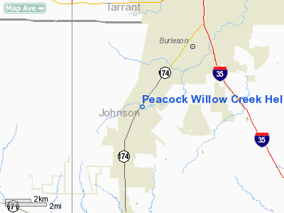
Peacock Willow Creek Heliport |
Location & QuickFacts
| FAA Information Effective: | 2008-09-25 |
| Airport Identifier: | 99TA |
| Airport Status: | Operational |
| Longitude/Latitude: | 097-22-11.0610W/32-29-38.5010N
-97.369739/32.494028 (Estimated) |
| Elevation: | 786 ft / 239.57 m (Surveyed) |
| Land: | 0 acres |
| From nearest city: | 4 nautical miles SW of Burleson, TX |
| Location: | Johnson County, TX |
| Magnetic Variation: | 07E (1985) |
Owner & Manager
| Ownership: | Privately owned |
| Owner: | Larry Guy Peacock |
| Address: | P O Box 232
Joshua, TX 76058 |
| Phone number: | 817-295-9190 |
| Manager: | Larry Guy Peacock |
| Address: | 2901 Sw Wilshire Blvd
Burleson, TX 76028 |
| Phone number: | 817-295-9190 |
Airport Operations and Facilities
| Airport Use: | Private |
| Wind indicator: | Yes |
| Segmented Circle: | No |
| Control Tower: | No |
| Lighting Schedule: | RDO-CTL
ACTVT ROTG BCN - 122.75. |
| Beacon Color: | Clear-Green-Yellow (heliport) |
| Sectional chart: | Dallas-ft Worth |
| Region: | ASW - Southwest |
| Boundary ARTCC: | ZFW - Fort Worth |
| Tie-in FSS: | FTW - Fort Worth |
| FSS Phone: | 817-541-3474 |
| FSS Toll Free: | 1-800-WX-BRIEF
FOR FP FILING CALL CXO FSS 1-800-833-5602. |
Runway Information
Helipad H1
| Dimension: | 20 x 20 ft / 6.1 x 6.1 m |
| Surface: | CONC, |
| |
Runway H1 |
Runway |
| Traffic Pattern: | Left | Left |
|
Radio Navigation Aids
| ID |
Type |
Name |
Ch |
Freq |
Var |
Dist |
| XQH | NDB | Cedar Hill | | 353.00 | 08E | 20.8 nm |
| RBD | NDB | Redbird | | 287.00 | 06E | 27.5 nm |
| LNC | NDB | Lancaster | | 239.00 | 06E | 33.2 nm |
| MWL | NDB | Mineral Wells | | 266.00 | 06E | 39.0 nm |
| JUG | NDB | Jecca | | 388.00 | 06E | 43.7 nm |
| PQF | NDB | Mesquite | | 248.00 | 06E | 46.6 nm |
| NFW | TACAN | Nas Jrb Fort Worth | 024X | | 07E | 17.0 nm |
| TTT | VOR/DME | Maverick | 078X | 113.10 | 06E | 28.0 nm |
| CVE | VOR/DME | Cowboy | 109X | 116.20 | 06E | 33.5 nm |
| FUZ | VORTAC | Ranger | 104X | 115.70 | 06E | 25.6 nm |
| JEN | VORTAC | Glen Rose | 097X | 115.00 | 06E | 32.7 nm |
| MQP | VORTAC | Millsap | 124X | 117.70 | 09E | 34.7 nm |
| FTW | VOT | Fort Worth Meacham | | 108.20 | | 19.5 nm |
| DAL | VOT | Dallas Love Field | | 113.30 | | 33.7 nm |
Remarks
- CAUTION LIVESTOCK IN VICINITY OF ARPT
- DO NOT MAKE APP/DEP OVER HOUSES OR RESIDENTIAL AREAS
Images and information placed above are from
http://www.airport-data.com/airport/99TA/
We thank them for the data!
| General Info
|
| Country |
United States
|
| State |
TEXAS
|
| FAA ID |
99TA
|
| Latitude |
32-29-38.501N
|
| Longitude |
097-22-11.061W
|
| Elevation |
786 feet
|
| Near City |
BURLESON
|
We don't guarantee the information is fresh and accurate. The data may
be wrong or outdated.
For more up-to-date information please refer to other sources.
|
|


