 |
|
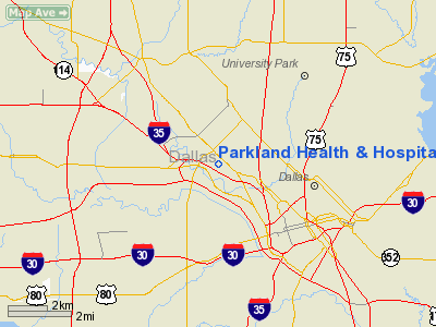
Parkland Health & Hospital System Heliport |
Location & QuickFacts
| FAA Information Effective: | 2008-09-25 |
| Airport Identifier: | TE43 |
| Airport Status: | Operational |
| Longitude/Latitude: | 096-50-22.2000W/32-48-35.1400N
-96.839500/32.809761 (Estimated) |
| Elevation: | 486 ft / 148.13 m (Estimated) |
| Land: | 0 acres |
| From nearest city: | 0 nautical miles N of Dallas, TX |
| Location: | Dallas County, TX |
| Magnetic Variation: | 06E (1985) |
Owner & Manager
| Ownership: | Publicly owned |
| Owner: | Dallas County Hospital Dist |
| Address: | 5201 Harry Hines Blvd
Dallas, TX 75235 |
| Phone number: | 214-590-5110 |
| Manager: | Duke Dengle |
| Address: | 5201 Harry Hines Blvd
Dallas, TX 75235 |
| Phone number: | 214-590-5110 |
Airport Operations and Facilities
| Airport Use: | Private
MEDICAL |
| Wind indicator: | Yes |
| Segmented Circle: | No |
| Control Tower: | No |
| Lighting Schedule: | PHONE REQ
FOR ROTG BCN CALL 214-590-5505. |
| Beacon Color: | Clear-Green-Yellow (heliport) |
| Sectional chart: | Dallas-ft Worth |
| Region: | ASW - Southwest |
| Boundary ARTCC: | ZFW - Fort Worth |
| Tie-in FSS: | FTW - Fort Worth |
| FSS Phone: | 817-541-3474 |
| FSS Toll Free: | 1-800-WX-BRIEF |
Runway Information
Helipad H1
| Dimension: | 56 x 56 ft / 17.1 x 17.1 m |
| Surface: | CONC, |
| |
Runway H1 |
Runway |
| Traffic Pattern: | Left | Left |
|
Helipad H2
| Dimension: | 56 x 56 ft / 17.1 x 17.1 m |
| Surface: | CONC, |
| |
Runway H2 |
Runway |
| Traffic Pattern: | Left | Left |
|
Radio Navigation Aids
| ID |
Type |
Name |
Ch |
Freq |
Var |
Dist |
| RBD | NDB | Redbird | | 287.00 | 06E | 8.1 nm |
| XQH | NDB | Cedar Hill | | 353.00 | 08E | 14.8 nm |
| LNC | NDB | Lancaster | | 239.00 | 06E | 15.2 nm |
| PQF | NDB | Mesquite | | 248.00 | 06E | 15.7 nm |
| JUG | NDB | Jecca | | 388.00 | 06E | 17.7 nm |
| AVZ | NDB | Travis | | 260.00 | 06E | 30.0 nm |
| MII | NDB | Caddo Mills | | 316.00 | 06E | 32.9 nm |
| SYW | NDB | Cash | | 428.00 | 05E | 40.3 nm |
| CGQ | NDB | Powell | | 344.00 | 06E | 49.4 nm |
| NFW | TACAN | Nas Jrb Fort Worth | 024X | | 07E | 30.4 nm |
| MJF | TACAN | Arvilla | 033X | | 05E | 42.2 nm |
| CVE | VOR/DME | Cowboy | 109X | 116.20 | 06E | 5.8 nm |
| TTT | VOR/DME | Maverick | 078X | 113.10 | 06E | 10.8 nm |
| FUZ | VORTAC | Ranger | 104X | 115.70 | 06E | 17.8 nm |
| CQY | VORTAC | Cedar Creek | 095X | 114.80 | 06E | 49.0 nm |
| DAL | VOT | Dallas Love Field | | 113.30 | | 2.3 nm |
| FTW | VOT | Fort Worth Meacham | | 108.20 | | 26.2 nm |
Remarks
- HELIPAD H2 LCTD 2000 FT NORTH OF H1.
- PRVDD ALL ARRIVING/DEPARTING HELICOPTERS CONTACT DALLAS LOVE FIELD ATCT ON 118.7 PRIOR TO ENTERING TFC AREA; USE NW OR SE APCH/DEPARTURE PATH OVER STEMMONS FREEWAY; AND OPERATE AT AN ALTITUDE NOT TO EXCEED 1200' MSL WHILE IN DALLAS LOVE FIELD ARPT TFC AREA.
Images and information placed above are from
http://www.airport-data.com/airport/TE43/
We thank them for the data!
| General Info
|
| Country |
United States
|
| State |
TEXAS
|
| FAA ID |
TE43
|
| Latitude |
32-48-39.600N
|
| Longitude |
095-50-19.800W
|
| Elevation |
548 feet
|
| Near City |
DALLAS
|
We don't guarantee the information is fresh and accurate. The data may
be wrong or outdated.
For more up-to-date information please refer to other sources.
|
|


