 |
|
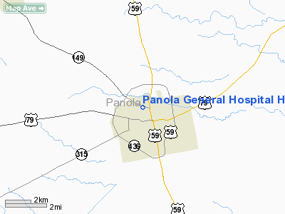
Panola General Hospital Heliport |
Location & QuickFacts
| FAA Information Effective: | 2008-09-25 |
| Airport Identifier: | 0TX3 |
| Airport Status: | Operational |
| Longitude/Latitude: | 094-20-45.7120W/32-09-58.5810N
-94.346031/32.166272 (Estimated) |
| Elevation: | 296 ft / 90.22 m (Estimated) |
| Land: | 0 acres |
| From nearest city: | 1 nautical miles N of Carthage, TX |
| Location: | Panola County, TX |
| Magnetic Variation: | 05E (1985) |
Owner & Manager
| Ownership: | Publicly owned |
| Owner: | Panola General Hospital |
| Address: | 409 W. Cottage
Carthage, TX 75633 |
| Phone number: | 214-693-3841 |
| Manager: | Administrator |
| Address: | 409 W. Cottage
Carthage, TX 75633 |
| Phone number: | 214-693-3841 |
Airport Operations and Facilities
| Airport Use: | Private
MEDICAL. |
| Wind indicator: | Yes |
| Segmented Circle: | No |
| Control Tower: | No |
| Sectional chart: | Memphis |
| Region: | ASW - Southwest |
| Boundary ARTCC: | ZFW - Fort Worth |
| Tie-in FSS: | FTW - Fort Worth |
| FSS on Airport: | No |
| FSS Phone: | 817-541-3474 |
| FSS Toll Free: | 1-800-WX-BRIEF |
Runway Information
Helipad H1
| Dimension: | 20 x 20 ft / 6.1 x 6.1 m |
| Surface: | CONC, |
| |
Runway H1 |
Runway |
| Traffic Pattern: | Left | Left |
|
Radio Navigation Aids
| ID |
Type |
Name |
Ch |
Freq |
Var |
Dist |
| RPF | NDB | Carthage | | 332.00 | 04E | 2.7 nm |
| CZJ | NDB | Amason | | 341.00 | 04E | 22.3 nm |
| HNO | NDB | Henderson | | 371.00 | 06E | 26.2 nm |
| MSD | NDB | Mansfield | | 414.00 | 04E | 30.2 nm |
| GXD | NDB | Nacogdoches | | 391.00 | 05E | 36.1 nm |
| VIV | NDB | Vivian | | 284.00 | 06E | 45.0 nm |
| OC | NDB | Nados | | 253.00 | 05E | 45.2 nm |
| ABG | NDB | Ambassador | | 404.00 | 07E | 46.4 nm |
| JSO | NDB | Cherokee County | | 263.00 | 05E | 47.8 nm |
| BAD | TACAN | Barksdale | 105X | | 05E | 40.0 nm |
| DTN | VOR | Downtown | | 108.60 | 07E | 38.0 nm |
| GGG | VORTAC | Gregg County | 070X | 112.30 | 07E | 25.6 nm |
| EMG | VORTAC | Elm Grove | 049X | 111.20 | 07E | 40.7 nm |
| EIC | VORTAC | Belcher | 121X | 117.40 | 07E | 45.4 nm |
| SHV | VOT | Shreveport Regional | | 108.20 | | 37.3 nm |
Remarks
- PRVDD PVT USE AND INGRESS/EGRESS IS CONDUCTED ONLY TO/FROM THE NORTH.
Images and information placed above are from
http://www.airport-data.com/airport/0TX3/
We thank them for the data!
| General Info
|
| Country |
United States
|
| State |
TEXAS
|
| FAA ID |
0TX3
|
| Latitude |
32-09-58.581N
|
| Longitude |
094-20-45.712W
|
| Elevation |
296 feet
|
| Near City |
CARTHAGE
|
We don't guarantee the information is fresh and accurate. The data may
be wrong or outdated.
For more up-to-date information please refer to other sources.
|
|


