 |
|
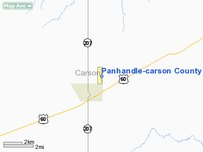
Panhandle-carson County Airport |
Location & QuickFacts
| FAA Information Effective: | 2008-09-25 |
| Airport Identifier: | T45 |
| Airport Status: | Operational |
| Longitude/Latitude: | 101-21-54.3000W/35-21-42.1000N
-101.365083/35.361694 (Estimated) |
| Elevation: | 3454 ft / 1052.78 m (Surveyed) |
| Land: | 70 acres |
| From nearest city: | 1 nautical miles NE of Panhandle, TX |
| Location: | Carson County, TX |
| Magnetic Variation: | 08E (1995) |
Owner & Manager
| Ownership: | Publicly owned |
| Owner: | City Of Panhandle & Carson Co |
| Address: | City Hall
Panhandle, TX 79068 |
| Phone number: | 806-537-3517 |
| Manager: | Loren Brand
CITY MANAGER. |
| Address: | P O Box 129
Panhandle, TX 79068 |
| Phone number: | 806-537-3517 |
Airport Operations and Facilities
| Airport Use: | Open to public |
| Wind indicator: | Yes |
| Segmented Circle: | Yes |
| Control Tower: | No |
| Lighting Schedule: | DUSK-DAWN
MIRL RY 17/35 PRESET LOW INTST; TO INCR INTST ACTVT - 123.5. |
| Beacon Color: | Clear-Green (lighted land airport) |
| Sectional chart: | Dallas-ft Worth |
| Region: | ASW - Southwest |
| Boundary ARTCC: | ZAB - Albuquerque |
| Tie-in FSS: | FTW - Fort Worth |
| FSS Phone: | 817-541-3474 |
| FSS Toll Free: | 1-800-WX-BRIEF |
| NOTAMs Facility: | FTW (NOTAM-d service avaliable) |
Airport Communications
| CTAF: | 122.700 |
| Unicom: | 122.700 |
Airport Services
Runway Information
Runway 17/35
| Dimension: | 4405 x 60 ft / 1342.6 x 18.3 m |
| Surface: | ASPH, Good Condition |
| Weight Limit: | Single wheel: 12500 lbs. |
| Edge Lights: | Medium |
| |
Runway 17 |
Runway 35 |
| Longitude: | 101-21-54.3120W | 101-21-54.2460W |
| Latitude: | 35-22-03.8430N | 35-21-20.2870N |
| Elevation: | 3451.00 ft | 3452.00 ft |
| Alignment: | 127 | 127 |
| Traffic Pattern: | Left | Right |
| Markings: | Non-precision instrument, Good Condition | Non-precision instrument, Good Condition |
| Obstruction: | , 50:1 slope to clear | 15 ft road, 200.0 ft from runway, 210 ft right of centerline
+15 FT ROAD AT THLD 210 FT R. |
|
Radio Navigation Aids
| ID |
Type |
Name |
Ch |
Freq |
Var |
Dist |
| PPA | NDB | Pampa | | 368.00 | 09E | 23.7 nm |
| AM | NDB | Pande | | 251.00 | 09E | 25.2 nm |
| DUX | NDB | Durrett | | 414.00 | 09E | 43.7 nm |
| PNH | VORTAC | Panhandle | 113X | 116.60 | 08E | 18.1 nm |
| BGD | VORTAC | Borger | 023X | 108.60 | 11E | 26.8 nm |
Images and information placed above are from
http://www.airport-data.com/airport/T45/
We thank them for the data!
| General Info
|
| Country |
United States
|
| State |
TEXAS
|
| FAA ID |
T45
|
| Latitude |
35-21-42.100N
|
| Longitude |
101-21-54.300W
|
| Elevation |
3454 feet
|
| Near City |
PANHANDLE
|
We don't guarantee the information is fresh and accurate. The data may
be wrong or outdated.
For more up-to-date information please refer to other sources.
|
|


