 |
|
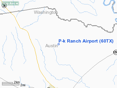
Location & QuickFacts
| FAA Information Effective: | 2008-09-25 |
| Airport Identifier: | 60TX |
| Airport Status: | Operational |
| Longitude/Latitude: | 096-15-48.8680W/30-02-00.7980N
-96.263574/30.033555 (Estimated) |
| Elevation: | 350 ft / 106.68 m (Estimated) |
| Land: | 0 acres |
| From nearest city: | 5 nautical miles N of Bellville, TX |
| Location: | Austin County, TX |
| Magnetic Variation: | 06E (1985) |
Owner & Manager
| Ownership: | Privately owned |
| Owner: | Porta-kamp Mfg Co Inc |
| Address: | Po Box 7064
Houston, TX 77008 |
| Phone number: | 409-865-3921 |
| Manager: | F. E. Bigelow, Chm Of The Bd |
| Address: | Po Box 7064
Houston, TX 77008 |
| Phone number: | 713-674-3163 |
Airport Operations and Facilities
| Airport Use: | Private |
| Wind indicator: | Yes |
| Segmented Circle: | No |
| Control Tower: | No |
| Lighting Schedule: | PHONE REQ
FOR RWY LGTS, PHONE 409-865-3921. |
| Sectional chart: | Houston |
| Region: | ASW - Southwest |
| Boundary ARTCC: | ZHU - Houston |
| Tie-in FSS: | CXO - Montgomery County |
| FSS on Airport: | No |
| FSS Toll Free: | 1-800-WX-BRIEF
FOR FP FILING CALL CXO FSS 1-800-833-5602. |
Airport Services
| Airframe Repair: | NONE |
| Power Plant Repair: | NONE |
Runway Information
Runway 16/34
| Dimension: | 3600 x 40 ft / 1097.3 x 12.2 m |
| Surface: | TRTD, |
| Edge Lights: | Low
LIRL OTS INDEFLY. |
| |
Runway 16 |
Runway 34 |
| Traffic Pattern: | Left | Left |
| Obstruction: | 60 ft trees | , 30.0 ft from runway |
|
Radio Navigation Aids
| ID |
Type |
Name |
Ch |
Freq |
Var |
Dist |
| BNH | NDB | Brenham | | 362.00 | 06E | 12.7 nm |
| EYQ | NDB | Weiser | | 286.00 | 06E | 33.0 nm |
| LYD | NDB | Lakeside | | 249.00 | 05E | 33.2 nm |
| DWH | NDB | David Hooks | | 521.00 | 05E | 36.7 nm |
| GYB | NDB | Lee County | | 385.00 | 07E | 38.1 nm |
| SGR | NDB | Hull | | 388.00 | 05E | 39.8 nm |
| ARM | NDB | Wharton | | 245.00 | 06E | 47.2 nm |
| ELA | VOR/DME | Eagle Lake | 111X | 116.40 | 08E | 22.5 nm |
| IDU | VORTAC | Industry | 039X | 110.20 | 08E | 16.2 nm |
| TNV | VORTAC | Navasota | 106X | 115.90 | 08E | 18.7 nm |
| CLL | VORTAC | College Station | 080X | 113.30 | 08E | 35.3 nm |
| IAH | VORTAC | Humble | 113X | 116.60 | 05E | 48.0 nm |
Remarks
- VEHICLES AND LIVESTOCK OFTEN ON OR CROSSING THE RWY.
Images and information placed above are from
http://www.airport-data.com/airport/60TX/
We thank them for the data!
| General Info
|
| Country |
United States
|
| State |
TEXAS
|
| FAA ID |
60TX
|
| Latitude |
30-02-00.798N
|
| Longitude |
096-15-48.868W
|
| Elevation |
350 feet
|
| Near City |
BELLVILLE
|
We don't guarantee the information is fresh and accurate. The data may
be wrong or outdated.
For more up-to-date information please refer to other sources.
|
|


