 |
|
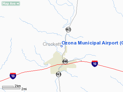
Location & QuickFacts
| FAA Information Effective: | 2008-09-25 |
| Airport Identifier: | OZA |
| Airport Status: | Operational |
| Longitude/Latitude: | 101-12-10.6990W/30-44-07.0090N
-101.202972/30.735280 (Estimated) |
| Elevation: | 2381 ft / 725.73 m (Surveyed) |
| Land: | 143 acres |
| From nearest city: | 1 nautical miles N of Ozona, TX |
| Location: | Crockett County, TX |
| Magnetic Variation: | 08E (1985) |
Owner & Manager
| Ownership: | Publicly owned |
| Owner: | Crockett County |
| Address: | Po Box 1857 County Courthouse
Ozona, TX 76943 |
| Phone number: | 325-392-2965 |
| Manager: | Charles Mcclearly |
| Address: | Box 426
Ozona, TX 76943
911 ADDRESS 319CR308. |
| Phone number: | 325-392-2030 |
Airport Operations and Facilities
| Airport Use: | Open to public |
| Wind indicator: | Yes |
| Segmented Circle: | Yes |
| Control Tower: | No |
| Lighting Schedule: | DUSK-DAWN
MIRL RY 16/34 PRESET LOW INTST; TO INCR INTST & ACTVT PAPI RYS 16 & 34 - CTAF. |
| Beacon Color: | Clear-Green (lighted land airport) |
| Landing fee charge: | No |
| Sectional chart: | San Antonio |
| Region: | ASW - Southwest |
| Boundary ARTCC: | ZHU - Houston |
| Tie-in FSS: | SJT - San Angelo |
| FSS on Airport: | No |
| FSS Toll Free: | 1-800-WX-BRIEF |
| NOTAMs Facility: | SJT (NOTAM-d service avaliable) |
| Federal Agreements: | N |
Airport Communications
| CTAF: | 122.800 |
| Unicom: | 122.800 |
Airport Services
| Fuel available: | 100LLA
FOR FUEL AFTER HRS & WKENDS CALL 325-392-2789. |
| Airframe Repair: | MAJOR |
| Power Plant Repair: | MAJOR |
Runway Information
Runway 16/34
| Dimension: | 6000 x 75 ft / 1828.8 x 22.9 m |
| Surface: | ASPH, Good Condition |
| Weight Limit: | Single wheel: 30000 lbs. |
| Edge Lights: | Medium |
| |
Runway 16 |
Runway 34 |
| Longitude: | 101-12-15.2400W | 101-12-00.6100W |
| Latitude: | 30-44-35.7300N | 30-43-37.6900N |
| Elevation: | 2377.00 ft | 2355.00 ft |
| Alignment: | 127 | 127 |
| Traffic Pattern: | Left | Left |
| Markings: | Non-precision instrument, Fair Condition | Non-precision instrument, Fair Condition |
| Crossing Height: | 39.00 ft | 35.00 ft |
| VASI: | 4-light PAPI on left side | 4-light PAPI on left side |
| Visual Glide Angle: | 3.00° | 3.00° |
| Obstruction: | 46 ft trees, 950.0 ft from runway, 16:1 slope to clear | 43 ft pole, 1193.0 ft from runway, 51 ft right of centerline, 23:1 slope to clear |
|
Radio Navigation Aids
| ID |
Type |
Name |
Ch |
Freq |
Var |
Dist |
| SOA | NDB | Sonora | | 371.00 | 08E | 30.2 nm |
Images and information placed above are from
http://www.airport-data.com/airport/OZA/
We thank them for the data!
| General Info
|
| Country |
United States
|
| State |
TEXAS
|
| FAA ID |
OZA
|
| Latitude |
30-44-07.009N
|
| Longitude |
101-12-10.699W
|
| Elevation |
2381 feet
|
| Near City |
OZONA
|
We don't guarantee the information is fresh and accurate. The data may
be wrong or outdated.
For more up-to-date information please refer to other sources.
|
|


