 |
|
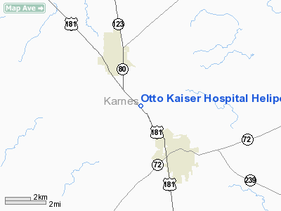
Otto Kaiser Hospital Heliport |
Location & QuickFacts
| FAA Information Effective: | 2008-09-25 |
| Airport Identifier: | 62TE |
| Airport Status: | Operational |
| Longitude/Latitude: | 097-52-44.0060W/28-51-00.9230N
-97.878891/28.850256 (Estimated) |
| Elevation: | 395 ft / 120.40 m (Estimated) |
| Land: | 0 acres |
| From nearest city: | 2 nautical miles N of Kenedy, TX |
| Location: | Karnes County, TX |
| Magnetic Variation: | 07E (1985) |
Owner & Manager
| Ownership: | Publicly owned |
| Owner: | Otto Kaiser Memorial Hospital |
| Address: | 3349 S. Hwy 181
Kenedy, TX 78119 |
| Phone number: | 830-583-3401 |
| Manager: | Nancy Kinkler |
| Address: | 3349 S. Hwy 181
Kenedy, TX 78119 |
| Phone number: | 830-583-3401 |
Airport Operations and Facilities
| Airport Use: | Private
MEDICAL. |
| Wind indicator: | Yes |
| Segmented Circle: | No |
| Control Tower: | No |
| Lighting Schedule: | PHONE REQ
FOR PERIMETER LGTS CALL 830-583-3401. |
| Landing fee charge: | No |
| Sectional chart: | San Antonio |
| Region: | ASW - Southwest |
| Boundary ARTCC: | ZHU - Houston |
| Tie-in FSS: | SJT - San Angelo |
| FSS on Airport: | No |
| FSS Toll Free: | 1-800-WX-BRIEF |
Runway Information
Helipad H1
| Dimension: | 90 x 90 ft / 27.4 x 27.4 m |
| Surface: | CONC, |
| |
Runway H1 |
Runway |
| Traffic Pattern: | Left | Left |
|
Radio Navigation Aids
| ID |
Type |
Name |
Ch |
Freq |
Var |
Dist |
| BEA | NDB | Beeville | | 284.00 | 07E | 29.3 nm |
| PEZ | NDB | Pleasanton | | 275.00 | 07E | 34.2 nm |
| OKT | NDB | Yoakum | | 350.00 | 06E | 47.8 nm |
| MNO | NDB | Mellon Ranch | | 375.00 | 06E | 49.4 nm |
| DHK | TACAN | Randolph | 036X | | 09E | 46.0 nm |
| KSY | TACAN | Kelly | 057X | | 07E | 49.2 nm |
| SSF | VOR | Stinson | | 108.40 | 09E | 38.5 nm |
| VCT | VOR/DME | Victoria | 027X | 109.00 | 06E | 47.5 nm |
| THX | VORTAC | Three Rivers | 051X | 111.40 | 08E | 25.2 nm |
| RND | VORTAC | Randolph | 70X | 112.30 | 09E | 45.5 nm |
Remarks
Images and information placed above are from
http://www.airport-data.com/airport/62TE/
We thank them for the data!
| General Info
|
| Country |
United States
|
| State |
TEXAS
|
| FAA ID |
62TE
|
| Latitude |
28-51-00.923N
|
| Longitude |
097-52-44.006W
|
| Elevation |
395 feet
|
| Near City |
KENEDY
|
We don't guarantee the information is fresh and accurate. The data may
be wrong or outdated.
For more up-to-date information please refer to other sources.
|
|


