 |
|
Coordinates: 30°04′09″N 093°48′13″W / 30.06917°N 93.80361°W / 30.06917; -93.80361
| Orange County Airport |
| IATA: none – ICAO: KORG – FAA LID: ORG |
| Summary |
| Airport type |
Public |
| Owner |
Orange County |
| Serves |
Orange, Texas |
| Elevation AMSL |
13 ft / 4 m |
| Runways |
| Direction |
Length |
Surface |
| ft |
m |
| 4/22 |
4,396 |
1,340 |
Asphalt |
| 13/31 |
3,000 |
914 |
Turf |
| Statistics (2004) |
| Aircraft operations |
11,332 |
| Source: Federal Aviation Administration |
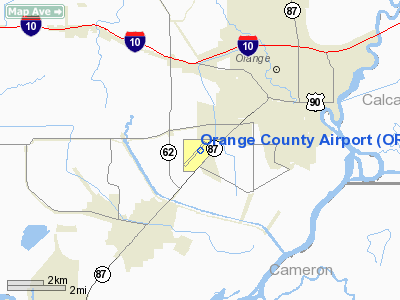
Orange County Airport (ICAO: KORG, FAA LID: ORG) is a county-owned public-use airport located three miles (5 km) southwest of the central business district of Orange, in Orange County, Texas, United States.
Although most U.S. airports use the same three-letter location identifier for the FAA and IATA, Orange County Airport is assigned ORG by the FAA but has no designation from the IATA (which assigned ORG to Zorg en Hoop Airport in Paramaribo, Suriname).
Facilities and aircraft
Orange County Airport covers an area of 820 acres (332 ha) which contains two runways: 4/22 has an asphalt pavement measuring 4,396 x 75 ft (1,340 x 23 m) and 13/31 has a turf surface measuring 3,000 x 50 ft (914 x 15 m). For the 12-month period ending December 15, 2004, the airport had 11,332 aircraft operations, an average of 31 per day: 93% general aviation and 7% air taxi.
The above content comes from Wikipedia and is published under free licenses – click here to read more.
Location & QuickFacts
| FAA Information Effective: | 2008-09-25 |
| Airport Identifier: | ORG |
| Airport Status: | Operational |
| Longitude/Latitude: | 093-48-13.0000W/30-04-09.0000N
-93.803611/30.069167 (Estimated) |
| Elevation: | 13 ft / 3.96 m (Surveyed) |
| Land: | 820 acres |
| From nearest city: | 3 nautical miles SW of Orange, TX |
| Location: | Orange County, TX |
| Magnetic Variation: | 05E (1985) |
Owner & Manager
| Ownership: | Publicly owned |
| Owner: | Orange County
TURF RY LEASED FM E.W. BROWN JR. |
| Address: | Orange Co Ct House
Orange, TX 77630 |
| Phone number: | 409-883-7740 |
| Manager: | Don Anderson |
| Address: | 2520 S. Hwy 87
Orange, TX 77630 |
| Phone number: | 409-882-7895 |
Airport Operations and Facilities
| Airport Use: | Open to public |
| Wind indicator: | Yes |
| Segmented Circle: | Yes |
| Control Tower: | No |
| Lighting Schedule: | DUSK-DAWN
MIRL RY 04/22 PRESET LOW INTST; TO INCR INTST ACTVT - CTAF. |
| Beacon Color: | Clear-Green (lighted land airport) |
| Landing fee charge: | No |
| Sectional chart: | Houston |
| Region: | ASW - Southwest |
| Boundary ARTCC: | ZHU - Houston |
| Tie-in FSS: | CXO - Montgomery County |
| FSS on Airport: | No |
| FSS Toll Free: | 1-800-WX-BRIEF |
| NOTAMs Facility: | CXO (NOTAM-d service avaliable) |
| Federal Agreements: | NGPY |
Airport Communications
| CTAF: | 122.800 |
| Unicom: | 122.800 |
Airport Services
Runway Information
Runway 04/22
| Dimension: | 4396 x 75 ft / 1339.9 x 22.9 m
SOUTH 500 FT CLSD INDEFLY. |
| Surface: | ASPH, Good Condition
RY NOT REGULARLY MAINTAINED; CALL FOR CONDITIONS. |
| Weight Limit: | Single wheel: 27000 lbs. |
| Edge Lights: | Medium |
| |
Runway 04 |
Runway 22 |
| Longitude: | 093-48-20.0750W | 093-47-46.4857W |
| Latitude: | 30-03-52.9071N | 30-04-25.1574N |
| Elevation: | 9.00 ft | 12.00 ft |
| Alignment: | 42 | 127 |
| Traffic Pattern: | Left | Left |
| Markings: | Non-precision instrument, Fair Condition | Non-precision instrument, Fair Condition |
| VASI: | 2-light PAPI on left side
PAPI OTS INDEFLY. | 2-light PAPI on left side |
| Obstruction: | 80 ft tree, 684.0 ft from runway, 280 ft right of centerline, 6:1 slope to clear | , 50:1 slope to clear |
|
Runway 13/31
| Dimension: | 3000 x 50 ft / 914.4 x 15.2 m
SOUTH 500 FT CLSD INDEFLY. |
| Surface: | TURF, Good Condition
RY NOT REGULARLY MAINTAINED; CALL FOR CONDITIONS. |
| |
Runway 13 |
Runway 31 |
| Longitude: | 093-48-38.9070W | 093-48-15.6170W |
| Latitude: | 30-04-19.9590N | 30-03-58.1820N |
| Elevation: | 10.00 ft | 10.00 ft |
| Alignment: | 127 | 127 |
| Traffic Pattern: | Left | Left |
| Obstruction: | 30 ft trees, 50 ft right of centerline | 30 ft trees, 760.0 ft from runway, 40 ft left of centerline, 25:1 slope to clear |
|
Radio Navigation Aids
| ID |
Type |
Name |
Ch |
Freq |
Var |
Dist |
| ORG | NDB | Orange | | 211.00 | 05E | 0.5 nm |
| GDE | NDB | Goodhue | | 368.00 | 07E | 20.7 nm |
| UX | NDB | Sulfy | | 278.00 | 04E | 21.4 nm |
| DQU | NDB | De Quincy | | 410.00 | 05E | 28.1 nm |
| HRD | NDB | Hardin County | | 524.00 | 04E | 28.7 nm |
| DR | NDB | Idder | | 385.00 | 04E | 47.7 nm |
| CBC | NDB | Anahuac | | 413.00 | 05E | 48.2 nm |
| BPT | VOR/DME | Beaumont | 092X | 114.50 | 07E | 13.3 nm |
| SBI | VOR/DME | Sabine Pass | 101X | 115.40 | 07E | 26.0 nm |
| LCH | VORTAC | Lake Charles | 081X | 113.40 | 07E | 36.6 nm |
| DAS | VORTAC | Daisetta | 116X | 116.90 | 05E | 44.3 nm |
Remarks
- TREEES OBSTRUCT PRIMARY SFC RY 13/31.
- PREDATES ACT.
Images and information placed above are from
http://www.airport-data.com/airport/ORG/
We thank them for the data!
| General Info
|
| Country |
United States
|
| State |
TEXAS
|
| FAA ID |
ORG
|
| Latitude |
30-04-09.036N
|
| Longitude |
093-48-13.006W
|
| Elevation |
13 feet
|
| Near City |
ORANGE
|
We don't guarantee the information is fresh and accurate. The data may
be wrong or outdated.
For more up-to-date information please refer to other sources.
|
|


