 |
|
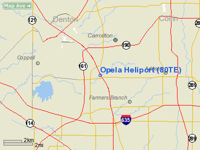
Location & QuickFacts
| FAA Information Effective: | 2008-09-25 |
| Airport Identifier: | 80TE |
| Airport Status: | Operational |
| Longitude/Latitude: | 096-54-47.0000W/32-57-21.0000N
-96.913056/32.955833 (Estimated) |
| Elevation: | 445 ft / 135.64 m (Estimated) |
| Land: | 0 acres |
| From nearest city: | 0 nautical miles NW of Carrollton, TX |
| Location: | Dallas County, TX |
| Magnetic Variation: | 05E (2000) |
Owner & Manager
| Ownership: | Privately owned |
| Owner: | Goff Income Properties, Inc |
| Address: | 1221 N. Interstate 35e
Carrollton, TX 75006 |
| Phone number: | 972-245-5768 |
| Manager: | Tommy Goff, President |
| Address: | 1221 N. Interstate 35e
Carrollton, TX 75006 |
| Phone number: | 972-245-5768 |
Airport Operations and Facilities
| Airport Use: | Private |
| Segmented Circle: | No |
| Control Tower: | No |
| Sectional chart: | Dallas-ft Worth |
| Region: | ASW - Southwest |
| Boundary ARTCC: | ZFW - Fort Worth |
| Tie-in FSS: | FTW - Fort Worth |
| FSS Phone: | 817-541-3474 |
| FSS Toll Free: | 1-800-WX-BRIEF |
Runway Information
Helipad H1
| Dimension: | 60 x 60 ft / 18.3 x 18.3 m |
| Surface: | CONC, |
| |
Runway H1 |
Runway |
| Traffic Pattern: | Left | Left |
|
Radio Navigation Aids
| ID |
Type |
Name |
Ch |
Freq |
Var |
Dist |
| RBD | NDB | Redbird | | 287.00 | 06E | 16.9 nm |
| PQF | NDB | Mesquite | | 248.00 | 06E | 21.3 nm |
| XQH | NDB | Cedar Hill | | 353.00 | 08E | 22.1 nm |
| LNC | NDB | Lancaster | | 239.00 | 06E | 24.7 nm |
| JUG | NDB | Jecca | | 388.00 | 06E | 25.9 nm |
| MII | NDB | Caddo Mills | | 316.00 | 06E | 33.9 nm |
| AVZ | NDB | Travis | | 260.00 | 06E | 35.5 nm |
| SYW | NDB | Cash | | 428.00 | 05E | 42.7 nm |
| GLE | NDB | Gainesville | | 330.00 | 06E | 48.0 nm |
| NFW | TACAN | Nas Jrb Fort Worth | 024X | | 07E | 28.8 nm |
| MJF | TACAN | Arvilla | 033X | | 05E | 43.4 nm |
| CVE | VOR/DME | Cowboy | 109X | 116.20 | 06E | 4.0 nm |
| TTT | VOR/DME | Maverick | 078X | 113.10 | 06E | 8.3 nm |
| FUZ | VORTAC | Ranger | 104X | 115.70 | 06E | 14.0 nm |
| BYP | VORTAC | Bonham | 093X | 114.60 | 06E | 48.9 nm |
| DAL | VOT | Dallas Love Field | | 113.30 | | 7.2 nm |
| FTW | VOT | Fort Worth Meacham | | 108.20 | | 24.0 nm |
Remarks
- PRVDD CTC IS MADE WITH DALLAS-FT WORTH APCH/DEP CTL TO DISCUSS OPNS INSIDE THE ENHANCED CLASS B AIRSPACE.
Images and information placed above are from
http://www.airport-data.com/airport/80TE/
We thank them for the data!
| General Info
|
| Country |
United States
|
| State |
TEXAS
|
| FAA ID |
80TE
|
| Latitude |
32-56-54.600N
|
| Longitude |
096-54-24.800W
|
| Elevation |
445 feet
|
| Near City |
CARROLLTON
|
We don't guarantee the information is fresh and accurate. The data may
be wrong or outdated.
For more up-to-date information please refer to other sources.
|
|


