 |
|
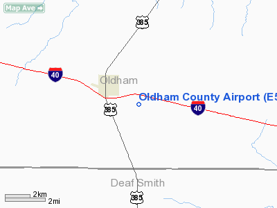
Location & QuickFacts
| FAA Information Effective: | 2008-09-25 |
| Airport Identifier: | E52 |
| Airport Status: | Operational |
| Longitude/Latitude: | 102-23-56.7350W/35-13-55.1940N
-102.399093/35.231998 (Estimated) |
| Elevation: | 3995 ft / 1217.68 m (Estimated) |
| Land: | 80 acres |
| From nearest city: | 2 nautical miles SE of Vega, TX |
| Location: | Oldham County, TX |
| Magnetic Variation: | 09E (1985) |
Owner & Manager
| Ownership: | Publicly owned |
| Owner: | Oldham County |
| Address: | Oldham Co Courthouse
Vega, TX 79092 |
| Phone number: | 806-267-2607 |
| Manager: | Donnie Knox
COUNTY COMMISSIONER. |
| Address: | Po Box 104
Vega, TX 79092 |
| Phone number: | 806-267-2432 |
Airport Operations and Facilities
| Airport Use: | Open to public |
| Wind indicator: | Yes |
| Segmented Circle: | Yes |
| Control Tower: | No |
| Lighting Schedule: | DUSK-DAWN
ACTVT MIRL RY 17/35 & PAPI RY 17 - CTAF. |
| Beacon Color: | Clear-Green (lighted land airport) |
| Landing fee charge: | No |
| Sectional chart: | Albuquerque |
| Region: | ASW - Southwest |
| Boundary ARTCC: | ZAB - Albuquerque |
| Tie-in FSS: | FTW - Fort Worth |
| FSS on Airport: | No |
| FSS Phone: | 817-541-3474 |
| FSS Toll Free: | 1-800-WX-BRIEF |
| NOTAMs Facility: | FTW (NOTAM-d service avaliable) |
| Federal Agreements: | N |
Airport Communications
Airport Services
| Airframe Repair: | NONE |
| Power Plant Repair: | NONE |
| Bottled Oxygen: | NONE |
| Bulk Oxygen: | NONE |
Runway Information
Runway 17/35
| Dimension: | 4200 x 60 ft / 1280.2 x 18.3 m |
| Surface: | ASPH, Good Condition |
| Weight Limit: | Single wheel: 20000 lbs. |
| Edge Lights: | Medium |
| |
Runway 17 |
Runway 35 |
| Traffic Pattern: | Left | Left |
| Markings: | Basic, Good Condition | Basic, Good Condition |
| VASI: | 2-light PAPI on left side | |
| Obstruction: | 32 ft pline, 1133.0 ft from runway, 29:1 slope to clear | , 50:1 slope to clear |
|
Radio Navigation Aids
| ID |
Type |
Name |
Ch |
Freq |
Var |
Dist |
| HRX | NDB | Hereford | | 341.00 | 09E | 22.8 nm |
| AM | NDB | Pande | | 251.00 | 09E | 29.6 nm |
| DUX | NDB | Durrett | | 414.00 | 09E | 42.4 nm |
| PNH | VORTAC | Panhandle | 113X | 116.60 | 08E | 34.4 nm |
| TXO | VORTAC | Texico | 059X | 112.20 | 11E | 49.3 nm |
Images and information placed above are from
http://www.airport-data.com/airport/E52/
We thank them for the data!
| General Info
|
| Country |
United States
|
| State |
TEXAS
|
| FAA ID |
E52
|
| Latitude |
35-13-55.194N
|
| Longitude |
102-23-56.735W
|
| Elevation |
3995 feet
|
| Near City |
VEGA
|
We don't guarantee the information is fresh and accurate. The data may
be wrong or outdated.
For more up-to-date information please refer to other sources.
|
|


