 |
|
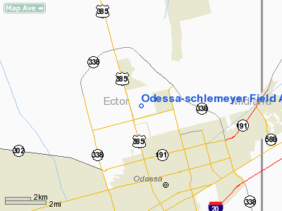
Odessa-schlemeyer Field Airport |
Location & QuickFacts
| FAA Information Effective: | 2008-09-25 |
| Airport Identifier: | ODO |
| Airport Status: | Operational |
| Longitude/Latitude: | 102-23-13.5000W/31-55-14.0000N
-102.387083/31.920556 (Estimated) |
| Elevation: | 3004 ft / 915.62 m (Surveyed) |
| Land: | 1110 acres |
| From nearest city: | 5 nautical miles NE of Odessa, TX |
| Location: | Ector County, TX |
| Magnetic Variation: | 08E (2000) |
Owner & Manager
| Ownership: | Publicly owned |
| Owner: | Ector County |
| Address: | Ector Co Courthouse Annex, 1010 East 8th St
Odessa, TX 79761 |
| Phone number: | 432-335-3110 |
| Manager: | Fred Crawford |
| Address: | 1010 E 8th St
Odessa, TX 79761 |
| Phone number: | 432-498-4041 |
Airport Operations and Facilities
| Airport Use: | Open to public |
| Wind indicator: | Yes |
| Segmented Circle: | Yes |
| Control Tower: | No |
| Lighting Schedule: | DUSK-DAWN
MIRL RYS 02/20, 11/29 & 16/34 PRESET LOW INTST; TO INCR INTST ACTVT - CTAF. |
| Beacon Color: | Clear-Green (lighted land airport) |
| Landing fee charge: | No |
| Sectional chart: | San Antonio |
| Region: | ASW - Southwest |
| Traffic Pattern Alt: | 1000 ft |
| Boundary ARTCC: | ZFW - Fort Worth |
| Tie-in FSS: | SJT - San Angelo |
| FSS on Airport: | No |
| FSS Toll Free: | 1-800-WX-BRIEF |
| NOTAMs Facility: | ODO (NOTAM-d service avaliable) |
| Federal Agreements: | NGY |
Airport Communications
| CTAF: | 123.000 |
| Unicom: | 123.000 |
Airport Services
| Fuel available: | 100LLA1+
FOR FUEL AFT HRS CALL 432-367-5881. |
| Airframe Repair: | MAJOR |
| Power Plant Repair: | MAJOR |
| Bottled Oxygen: | LOW |
Runway Information
Runway 02/20
| Dimension: | 5703 x 75 ft / 1738.3 x 22.9 m |
| Surface: | ASPH, Good Condition |
| Weight Limit: | Single wheel: 14000 lbs. |
| Edge Lights: | Medium |
| |
Runway 02 |
Runway 20 |
| Longitude: | 102-23-33.6311W | 102-23-00.8853W |
| Latitude: | 31-54-50.6382N | 31-55-39.6687N |
| Elevation: | 2952.00 ft | 3004.00 ft |
| Alignment: | 30 | 127 |
| Traffic Pattern: | Left | Left |
| Markings: | Non-precision instrument, Fair Condition | Non-precision instrument, Fair Condition |
| Crossing Height: | 38.00 ft | 38.00 ft |
| VASI: | pulsating/steady burning on left side
PVASI OTS INDEFLY. | pulsating/steady burning on left side |
| Visual Glide Angle: | 3.00° | 3.00° |
| Obstruction: | 15 ft road, 500.0 ft from runway, 270 ft left of centerline, 20:1 slope to clear | 30 ft pline, 1220.0 ft from runway, 310 ft right of centerline, 34:1 slope to clear |
|
Runway 11/29
| Dimension: | 3420 x 60 ft / 1042.4 x 18.3 m |
| Surface: | ASPH, Fair Condition |
| Weight Limit: | Single wheel: 14000 lbs. |
| Edge Lights: | Medium |
| |
Runway 11 |
Runway 29 |
| Longitude: | 102-23-15.9531W | 102-22-41.4839W |
| Latitude: | 31-55-16.3745N | 31-54-59.6294N |
| Elevation: | 2971.00 ft | 2971.00 ft |
| Alignment: | 120 | 127 |
| Traffic Pattern: | Left | Left |
| Markings: | Basic, Fair Condition | Basic, Fair Condition |
| Obstruction: | , 50:1 slope to clear | 30 ft pline, 1120.0 ft from runway, 217 ft left of centerline, 30:1 slope to clear |
|
Runway 16/34
| Dimension: | 5003 x 75 ft / 1524.9 x 22.9 m |
| Surface: | ASPH, Good Condition |
| Weight Limit: | Single wheel: 14000 lbs. |
| Edge Lights: | Medium |
| |
Runway 16 |
Runway 34 |
| Longitude: | 102-23-26.9510W | 102-23-11.6097W |
| Latitude: | 31-55-40.7775N | 31-54-53.0404N |
| Elevation: | 2987.00 ft | 2958.00 ft |
| Alignment: | 127 | 127 |
| Traffic Pattern: | Left | Left |
| Markings: | Non-precision instrument, Fair Condition | Non-precision instrument, Good Condition |
| Crossing Height: | 34.00 ft | 34.00 ft |
| VASI: | 2-box on left side | 2-box on left side |
| Visual Glide Angle: | 4.00° | 4.00° |
| Obstruction: | 45 ft ant, 1104.0 ft from runway, 185 ft left of centerline, 20:1 slope to clear | 30 ft pline, 960.0 ft from runway, 25:1 slope to clear |
|
Radio Navigation Aids
| ID |
Type |
Name |
Ch |
Freq |
Var |
Dist |
| MA | NDB | Farly | | 326.00 | 09E | 5.1 nm |
| ANR | NDB | Andrews | | 245.00 | 09E | 26.8 nm |
| OHE | NDB | Monahans | | 214.00 | 09E | 33.5 nm |
| GNC | NDB | Gaines County | | 344.00 | 09E | 47.0 nm |
| MAF | VORTAC | Midland | 095X | 114.80 | 11E | 11.4 nm |
| INK | VORTAC | Wink | 058X | 112.10 | 11E | 43.8 nm |
| MAF | VOT | Midland International | | 108.20 | | 9.3 nm |
Remarks
- GLIDER ACTIVITY ON & INVOF ARPT.
Images and information placed above are from
http://www.airport-data.com/airport/ODO/
We thank them for the data!
| General Info
|
| Country |
United States
|
| State |
TEXAS
|
| FAA ID |
ODO
|
| Latitude |
31-55-14.042N
|
| Longitude |
102-23-13.521W
|
| Elevation |
3004 feet
|
| Near City |
ODESSA
|
We don't guarantee the information is fresh and accurate. The data may
be wrong or outdated.
For more up-to-date information please refer to other sources.
|
|


