 |
|
Location & QuickFacts
| FAA Information Effective: | 2008-09-25 |
| Airport Identifier: | RBO |
| Airport Status: | Operational |
| Longitude/Latitude: | 097-41-25.8860W/27-46-42.7550N
-97.690524/27.778543 (Estimated) |
| Elevation: | 79 ft / 24.08 m (Surveyed) |
| Land: | 225 acres |
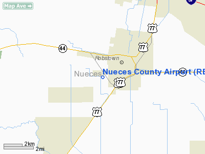
| From nearest city: | 2 nautical miles SW of Robstown, TX |
| Location: | Nueces County, TX |
| Magnetic Variation: | 06E (2000) |
Owner & Manager
| Ownership: | Publicly owned |
| Owner: | County Of Nueces |
| Address: | County Courthouse
Corpus Christi, TX 78401 |
| Phone number: | 361-888-0490 |
| Manager: | Glen Sullivan, P. E.
DIRECTOR OF PUBLIC WORKS. |
| Address: | 901 Leopard Street, Suite 103
Corpus Christi, TX 78401 |
| Phone number: | 361-888-0857 |
Airport Operations and Facilities
| Airport Use: | Open to public |
| Wind indicator: | Yes |
| Segmented Circle: | Yes |
| Control Tower: | No |
| Lighting Schedule: | DUSK-DAWN
MIRL RY 13/31 PRESET LOW INTST; TO INCR INTST ACTVT - 122.8. |
| Beacon Color: | Clear-Green (lighted land airport) |
| Landing fee charge: | No |
| Sectional chart: | Brownsville |
| Region: | ASW - Southwest |
| Boundary ARTCC: | ZHU - Houston |
| Tie-in FSS: | SJT - San Angelo |
| FSS on Airport: | No |
| FSS Toll Free: | 1-800-WX-BRIEF |
| NOTAMs Facility: | RBO (NOTAM-d service avaliable) |
| Federal Agreements: | NPY1 |
Airport Communications
Airport Services
| Fuel available: | 100LL
CASH OR CHECKS ONLY, NO CREDIT CARDS. |
| Airframe Repair: | MINOR |
| Power Plant Repair: | MINOR |
| Bottled Oxygen: | NONE |
| Bulk Oxygen: | NONE |
Runway Information
Runway 13/31
| Dimension: | 3700 x 75 ft / 1127.8 x 22.9 m |
| Surface: | ASPH, Good Condition |
| Weight Limit: | Single wheel: 11000 lbs. |
| Edge Lights: | Medium |
| |
Runway 13 |
Runway 31 |
| Longitude: | 097-41-40.4670W | 097-41-11.3050W |
| Latitude: | 27-46-55.6930N | 27-46-29.8170N |
| Elevation: | 79.00 ft | 77.00 ft |
| Alignment: | 127 | 127 |
| Traffic Pattern: | Left | Left |
| Markings: | Non-precision instrument, Good Condition | Non-precision instrument, Good Condition |
| Obstruction: | 15 ft road, 601.0 ft from runway, 187 ft left of centerline, 26:1 slope to clear | , 50:1 slope to clear |
|
Radio Navigation Aids
| ID |
Type |
Name |
Ch |
Freq |
Var |
Dist |
| TKB | NDB | Kleberg County | | 347.00 | 06E | 23.5 nm |
| BEA | NDB | Beeville | | 284.00 | 07E | 35.9 nm |
| RKP | NDB | Rockport | | 391.00 | 06E | 39.0 nm |
| MNO | NDB | Mellon Ranch | | 375.00 | 06E | 39.6 nm |
| BKS | NDB | Brooks County | | 353.00 | 06E | 41.3 nm |
| NQI | TACAN | Kingsville | 125X | | 09E | 17.9 nm |
| NOG | TACAN | Orange Grove | 063X | | 09E | 20.0 nm |
| ALI | VOR | Alice | | 114.50 | 06E | 17.7 nm |
| CRP | VORTAC | Corpus Christi | 102X | 115.50 | 09E | 15.1 nm |
| NGP | VORTAC | Truax | 087X | 114.00 | 06E | 21.8 nm |
Remarks
- 1049 FT MSL TOWERS 3 NM EAST OF ARPT.
Images and information placed above are from
http://www.airport-data.com/airport/RBO/
We thank them for the data!
| General Info
|
| Country |
United States
|
| State |
TEXAS
|
| FAA ID |
RBO
|
| Latitude |
27.778544
27° 46' 42.76" N
|
| Longitude |
-97.690525
097° 41' 25.89" W
|
| Elevation |
79 feet
24 meters
|
| Magnetic Variation |
005° E (01/06)
|
| Beacon |
Yes
|
| Operating Agency |
U.S.CIVIL AIRPORT WHEREIN PERMIT COVERS USE BY TRANSIT MILITARY AIRCRAFT
|
| Daylight Saving Time |
Second Sunday in March at 0200 to first Sunday in November at 0200 local time (Exception Arizona and that portion of Indiana in the Eastern Time Zone)
|
We don't guarantee the information is fresh and accurate. The data may
be wrong or outdated.
For more up-to-date information please refer to other sources.
|
|


