|
|
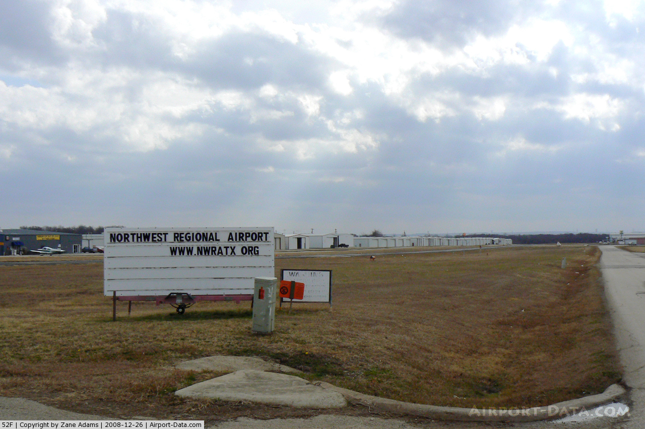
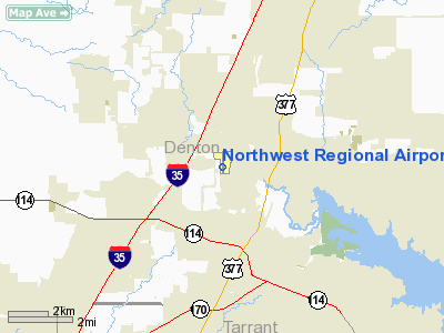
| Northwest Regional Airport |
| IATA: 52f – ICAO: none |
| Summary |
| Airport type |
Private |
| Operator |
Texas Air Classics |
| Location |
Roanoke, Texas |
| Elevation AMSL |
643 ft / 196 m |
| Coordinates |
33°02′59″N 97°13′56″W / 33.04972°N 97.23222°W / 33.04972; -97.23222Coordinates: 33°02′59″N 97°13′56″W / 33.04972°N 97.23222°W / 33.04972; -97.23222 |
| Runways |
| Direction |
Length |
Surface |
| ft |
m |
| 17/35 |
3,500 |
1,067 |
Asphalt |
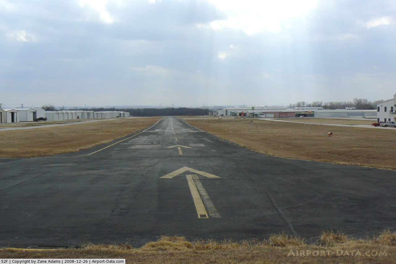
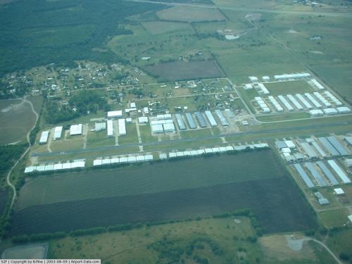
Northwest Regional Airport (FAA LID: 52f) is a private airport located two miles (3.2 km) north of the central business district (CBD) of Roanoke, in Denton County, Texas, USA.
The airport is used solely for general aviation purposes. There is a landing fee for flight school aircraft not based at the field. This airport was the site of an accident between an aircraft operated by US Flight Academy and a local resident that made national news.
The above content comes from Wikipedia and is published under free licenses – click here to read more.
 |
(Click on the photo to enlarge) |
 |
(Click on the photo to enlarge) |
 |
(Click on the photo to enlarge) |
 |
(Click on the photo to enlarge) |
Location & QuickFacts
| FAA Information Effective: | 2008-09-25 |
| Airport Identifier: | 52F |
| Airport Status: | Operational |
| Longitude/Latitude: | 097-13-56.0550W/33-02-59.4410N
-97.232237/33.049845 (Estimated) |
| Elevation: | 643 ft / 195.99 m (Estimated) |
| Land: | 81 acres |
| From nearest city: | 3 nautical miles NW of Roanoke, TX |
| Location: | Denton County, TX |
| Magnetic Variation: | 07E (1985) |
Owner & Manager
| Ownership: | Privately owned |
| Owner: | Texas Air Classics |
| Address: | Po Box 1542
Roanoke, TX 76092 |
| Phone number: | 817-430-1905 |
| Manager: | Glen Hyde |
| Address: | Po Box 1542
Roanoke, TX 76262 |
| Phone number: | 817-430-1905 |
Airport Operations and Facilities
| Airport Use: | Open to public |
| Wind indicator: | Yes |
| Segmented Circle: | Yes |
| Control Tower: | No |
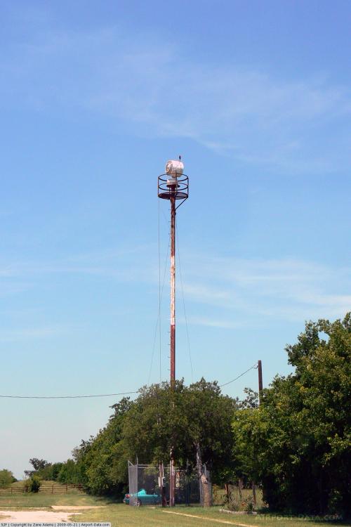
| Lighting Schedule: | DUSK-DAWN |
| Beacon Color: | Clear-Green (lighted land airport) |
| Landing fee charge: | Yes
LNDG FEE FOR NON-BASED FLIGHT SCHOOL ACFT. |
| Sectional chart: | Dallas-ft Worth |
| Region: | ASW - Southwest |
| Boundary ARTCC: | ZFW - Fort Worth |
| Tie-in FSS: | FTW - Fort Worth |
| FSS on Airport: | No |
| FSS Phone: | 817-541-3474 |
| FSS Toll Free: | 1-800-WX-BRIEF |
| NOTAMs Facility: | FTW (NOTAM-d service avaliable) |
Airport Communications
Airport Services
| Fuel available: | 100LL
SELF SERVE FUEL AVBL. |
| Airframe Repair: | MAJOR |
| Power Plant Repair: | MAJOR |
| Bottled Oxygen: | NONE |
| Bulk Oxygen: | NONE |
Runway Information
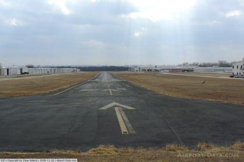
Runway 17/35
| Dimension: | 3500 x 40 ft / 1066.8 x 12.2 m |
| Surface: | ASPH, Fair Condition |
| Weight Limit: | Single wheel: 8000 lbs. |
| Edge Lights: | Medium |
| |
Runway 17 |
Runway 35 |
| Traffic Pattern: | Left | Left |
| Markings: | Nonstandard, Fair Condition
RY NRS SHORTER & NARROWER THAN STD. NSTD DSPLCD THLD ONLY 1 FT BAR. | Nonstandard, Fair Condition
RY NRS SHORTER & NARROWER THAN STD. NSTD DSPLCD THLD ONLY 1 FT BAR. |
| Displaced threshold: | 400.00 ft | 320.00 ft |
| VASI: | 2-box on right side | 2-box on left side |
| Visual Glide Angle: | 4.50° | 5.25° |
| Obstruction: | 10 ft hill, 200.0 ft from runway
APCH RATIO 18:1 FM DSPLCD THLD TO POWER POLE 468 FT FM DSPLCD THLD 182 FT RIGHT.
ROAD 30 FT FM END OF RUNWAY. | 50 ft trees, 200.0 ft from runway
APCH RATIO 9:1 FM DSPLCD THLD TO 50 FT TREES 487 FT FM DSPLCD THLD 0 FT BOTH.
+5 FT FENCE 25 FT FM END OF RY ACROSS APCH, +32 FT TREE 55 FT FM THLD 35 FT R. |
|
Radio Navigation Aids
| ID |
Type |
Name |
Ch |
Freq |
Var |
Dist |
| RBD | NDB | Redbird | | 287.00 | 06E | 28.9 nm |
| XQH | NDB | Cedar Hill | | 353.00 | 08E | 30.4 nm |
| PQF | NDB | Mesquite | | 248.00 | 06E | 38.3 nm |
| LNC | NDB | Lancaster | | 239.00 | 06E | 38.4 nm |
| GLE | NDB | Gainesville | | 330.00 | 06E | 40.2 nm |
| JUG | NDB | Jecca | | 388.00 | 06E | 42.1 nm |
| GMZ | NDB | Grindstone Mountain | | 356.00 | 07E | 43.1 nm |
| MWL | NDB | Mineral Wells | | 266.00 | 06E | 44.6 nm |
| MII | NDB | Caddo Mills | | 316.00 | 06E | 49.6 nm |
| NFW | TACAN | Nas Jrb Fort Worth | 024X | | 07E | 19.7 nm |
| TTT | VOR/DME | Maverick | 078X | 113.10 | 06E | 14.5 nm |
| CVE | VOR/DME | Cowboy | 109X | 116.20 | 06E | 19.1 nm |
| FUZ | VORTAC | Ranger | 104X | 115.70 | 06E | 10.0 nm |
| UKW | VORTAC | Bowie | 071X | 112.40 | 06E | 41.6 nm |
| MQP | VORTAC | Millsap | 124X | 117.70 | 09E | 43.2 nm |
| FTW | VOT | Fort Worth Meacham | | 108.20 | | 15.3 nm |
| DAL | VOT | Dallas Love Field | | 113.30 | | 22.7 nm |
Remarks
- PILOTS ARE REQUESTED TO CALL 817-430-1905 30 MINUTES PRIOR TO ARRIVAL FOR FIELD CONDITIONS.
- DUE TO RUNWAY WIDTH & HEAVY LOCAL TRAFFIC, PILOTS ARE ADVISED TO CONTACT AIRPORT PRIOR TO LANDING.
Images and information placed above are from
http://www.airport-data.com/airport/52F/
We thank them for the data!
| General Info
|
| Country |
United States
|
| State |
TEXAS
|
| FAA ID |
52F
|
| Latitude |
33-02-59.441N
|
| Longitude |
097-13-56.055W
|
| Elevation |
643 feet
|
| Near City |
ROANOKE
|
We don't guarantee the information is fresh and accurate. The data may
be wrong or outdated.
For more up-to-date information please refer to other sources.
|
|