 |
|
New Braunfels Muni Airport |
Coordinates: 29°42′16″N 098°02′32″W / 29.70444°N 98.04222°W / 29.70444; -98.04222
| New Braunfels Municipal Airport |
| IATA: none – ICAO: KBAZ – FAA LID: BAZ |
| Summary |
| Airport type |
Public |
| Owner |
City of New Braunfels |
| Serves |
New Braunfels, Texas |
| Elevation AMSL |
651 ft / 198 m |
| Runways |
| Direction |
Length |
Surface |
| ft |
m |
| 13/31 |
5,352 |
1,631 |
Asphalt |
| 17/35 |
5,364 |
1,635 |
Asphalt |
| Statistics (2007) |
| Aircraft operations |
26,000 |
| Based aircraft |
145 |
| Source: Federal Aviation Administration |
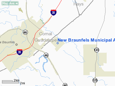
New Braunfels Municipal Airport (ICAO: KBAZ, FAA LID: BAZ) is a public-use airport located in Guadalupe County, Texas, United States. It is four miles (6 km) east of the central business district of the City of New Braunfels, which owns this airport.
Although most U.S. airports use the same three-letter location identifier for the FAA and IATA, New Braunfels Municipal is assigned BAZ by the FAA but has no designation from the IATA (which assigned BAZ to Barcelos, Amazonas, Brazil).
Facilities and aircraft
New Braunfels Municipal Airport covers an area of 900 acres (364 ha) which contains two asphalt paved runways: 13/31 measuring 5,352 x 100 ft (1,631 x 30 m) and 17/35 measuring 5,364 x 100 ft (1,635 x 30 m).
For the 12-month period ending May 31, 2007, the airport had 26,000 aircraft operations, an average of 71 per day: 96% general aviation and 4% air taxi. There are 145 aircraft based at this airport: 79% single-engine, 12% multi-engine, 4% jet and 4% helicopter.
The above content comes from Wikipedia and is published under free licenses – click here to read more.
Location & QuickFacts
| FAA Information Effective: | 2008-09-25 |
| Airport Identifier: | BAZ |
| Airport Status: | Operational |
| Longitude/Latitude: | 098-02-32.0000W/29-42-16.2000N
-98.042222/29.704500 (Estimated) |
| Elevation: | 651 ft / 198.42 m (Surveyed) |
| Land: | 900 acres |
| From nearest city: | 4 nautical miles E of New Braunfels, TX |
| Location: | Guadalupe County, TX |
| Magnetic Variation: | 08E (1975) |
Owner & Manager
| Ownership: | Publicly owned |
| Owner: | City Of New Braunfels |
| Address: | Po Box 311747
New Braunfels, TX 78130 |
| Phone number: | 830-608-2100 |
| Manager: | Andy Spinks |
| Address: | 2333 Fm 758
New Braunfels, TX 78130 |
| Phone number: | 830-625-1501 |
Airport Operations and Facilities
| Airport Use: | Open to public |
| Wind indicator: | Yes |
| Segmented Circle: | Yes |
| Control Tower: | Yes |
| Lighting Schedule: | DUSK-DAWN
ACTVT MIRL RYS 13/31 & 17/35 - CTAF. |
| Beacon Color: | Clear-Green (lighted land airport) |
| Landing fee charge: | No |
| Sectional chart: | San Antonio |
| Region: | ASW - Southwest |
| Traffic Pattern Alt: | 1000 ft |
| Boundary ARTCC: | ZHU - Houston |
| Tie-in FSS: | SJT - San Angelo |
| FSS on Airport: | No |
| FSS Toll Free: | 1-800-WX-BRIEF |
| NOTAMs Facility: | BAZ (NOTAM-d service avaliable) |
| Federal Agreements: | NGPY |
Airport Communications
| CTAF: | 127.050 |
| Unicom: | 122.700 |
Airport Services
| Fuel available: | 100LLA
FOR FUEL CALL 830-625-1501; AFT HRS CALL 830-608-2179. 24 HR SELF SVC AVBL WITH MAJOR CREDIT CARD. |
| Airframe Repair: | MAJOR |
| Power Plant Repair: | MAJOR |
| Bulk Oxygen: | NONE |
Runway Information
Runway 13/31
| Dimension: | 5352 x 100 ft / 1631.3 x 30.5 m |
| Surface: | ASPH, Good Condition |
| Weight Limit: | Single wheel: 30000 lbs. |
| Edge Lights: | Medium |
| |
Runway 13 |
Runway 31 |
| Longitude: | 098-02-47.7403W | 098-02-05.3780W |
| Latitude: | 29-42-43.6016N | 29-42-05.6740N |
| Elevation: | 649.00 ft | 642.00 ft |
| Alignment: | 127 | 127 |
| Traffic Pattern: | Left | Left |
| Markings: | Non-precision instrument, Fair Condition | Non-precision instrument, Fair Condition |
| VASI: | 4-light PAPI on left side | 4-light PAPI on left side |
| Visual Glide Angle: | 3.00° | 3.00° |
| Runway End Identifier: | Yes | |
| Obstruction: | 20 ft tree, 1045.0 ft from runway, 350 ft right of centerline, 42:1 slope to clear | 47 ft tree, 975.0 ft from runway, 230 ft left of centerline, 16:1 slope to clear |
|
Runway 17/35
| Dimension: | 5364 x 100 ft / 1634.9 x 30.5 m |
| Surface: | ASPH, Good Condition |
| Weight Limit: | Single wheel: 25000 lbs. |
| Edge Lights: | Medium |
| |
Runway 17 |
Runway 35 |
| Longitude: | 098-02-37.0698W | 098-02-37.8302W |
| Latitude: | 29-42-34.2617N | 29-41-41.1666N |
| Elevation: | 646.00 ft | 644.00 ft |
| Alignment: | 127 | 1 |
| Traffic Pattern: | Left | Left |
| Markings: | Non-precision instrument, Fair Condition | Non-precision instrument, Fair Condition |
| Displaced threshold: | 522.00 ft | 0.00 ft |
|
Radio Navigation Aids
| ID |
Type |
Name |
Ch |
Freq |
Var |
Dist |
| CVB | NDB | Castroville | | 338.00 | 08E | 47.4 nm |
| DHK | TACAN | Randolph | 036X | | 09E | 15.5 nm |
| KSY | TACAN | Kelly | 057X | | 07E | 33.9 nm |
| SSF | VOR | Stinson | | 108.40 | 09E | 34.1 nm |
| RND | VORTAC | Randolph | 70X | 112.30 | 09E | 16.9 nm |
| SAT | VORTAC | San Antonio | 115X | 116.80 | 08E | 22.2 nm |
| STV | VORTAC | Stonewall | 085X | 113.80 | 08E | 45.9 nm |
| CWK | VORTAC | Centex | 075X | 112.80 | 06E | 48.5 nm |
| SAT | VOT | San Antonio Intl | | 110.40 | | 24.6 nm |
Remarks
- REMOTE RADIO FREQ 134.75 FROM RAMP TO SAN ANTONIO APCH CTL.
- 7 FT CULTIVATION AT END OF RY 35 OCCASIONALLY.
- NUMEROUS BIRDS INVOF ARPT.
- HIGH PERFORMANCE MILITARY ACFT OPERATING AT RANDOLPH AFB AUX (SEGUIN) AIRFIELD.
- EXISTED PRIOR TO 1959.
Images and information placed above are from
http://www.airport-data.com/airport/BAZ/
We thank them for the data!
| General Info
|
| Country |
United States
|
| State |
TEXAS
|
| FAA ID |
BAZ
|
| Latitude |
29-42-16.200N
|
| Longitude |
098-02-32.000W
|
| Elevation |
651 feet
|
| Near City |
NEW BRAUNFELS
|
We don't guarantee the information is fresh and accurate. The data may
be wrong or outdated.
For more up-to-date information please refer to other sources.
|
|


