 |
|
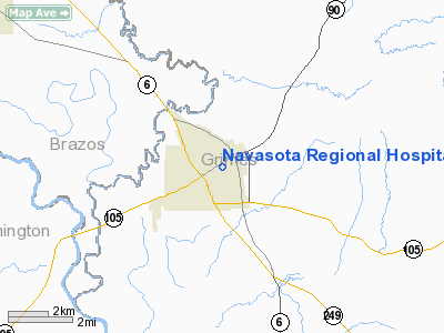
Navasota Rgnl Hospital Heliport |
Location & QuickFacts
| FAA Information Effective: | 2008-09-25 |
| Airport Identifier: | 7TA1 |
| Airport Status: | Operational |
| Longitude/Latitude: | 096-04-38.8440W/30-23-32.7430N
-96.077457/30.392429 (Estimated) |
| Elevation: | 248 ft / 75.59 m (Estimated) |
| Land: | 0 acres |
| From nearest city: | 0 nautical miles N of Navasota, TX |
| Location: | Grimes County, TX |
| Magnetic Variation: | 06E (1985) |
Owner & Manager
| Ownership: | Privately owned |
| Owner: | Navasota Regional Hospital |
| Address: | 210 S. Judson St.
Navasota, TX 77868 |
| Phone number: | 409-825-6585 |
| Manager: | Molly Hurst |
| Address: | 210 S. Judson St.
Navasota, TX 77868 |
| Phone number: | 409-825-6585 |
Airport Operations and Facilities
| Airport Use: | Private
MEDICAL. |
| Wind indicator: | Yes |
| Segmented Circle: | No |
| Control Tower: | No |
| Lighting Schedule: | PHONE REQ
FOR PERIMETER LGTS CALL 409-825-6585. |
| Landing fee charge: | No |
| Sectional chart: | Houston |
| Region: | ASW - Southwest |
| Boundary ARTCC: | ZHU - Houston |
| Tie-in FSS: | CXO - Montgomery County |
| FSS on Airport: | No |
| FSS Toll Free: | 1-800-WX-BRIEF
FOR FP FILING CALL CXO FSS 1-800-833-5602. |
Runway Information
Helipad H1
| Dimension: | 20 x 20 ft / 6.1 x 6.1 m |
| Surface: | CONC, |
| |
Runway H1 |
Runway |
| Traffic Pattern: | Left | Left |
|
Radio Navigation Aids
| ID |
Type |
Name |
Ch |
Freq |
Var |
Dist |
| BNH | NDB | Brenham | | 362.00 | 06E | 18.5 nm |
| DWH | NDB | David Hooks | | 521.00 | 05E | 31.0 nm |
| UTS | NDB | Huntsville | | 308.00 | 06E | 32.7 nm |
| EYQ | NDB | Weiser | | 286.00 | 06E | 35.7 nm |
| LYD | NDB | Lakeside | | 249.00 | 05E | 40.4 nm |
| GYB | NDB | Lee County | | 385.00 | 07E | 48.7 nm |
| ELA | VOR/DME | Eagle Lake | 111X | 116.40 | 08E | 45.6 nm |
| TNV | VORTAC | Navasota | 106X | 115.90 | 08E | 6.3 nm |
| CLL | VORTAC | College Station | 080X | 113.30 | 08E | 21.9 nm |
| IDU | VORTAC | Industry | 039X | 110.20 | 08E | 36.4 nm |
| LOA | VORTAC | Leona | 045X | 110.80 | 08E | 44.3 nm |
| IAH | VORTAC | Humble | 113X | 116.60 | 05E | 46.2 nm |
Images and information placed above are from
http://www.airport-data.com/airport/7TA1/
We thank them for the data!
| General Info
|
| Country |
United States
|
| State |
TEXAS
|
| FAA ID |
7TA1
|
| Latitude |
30-23-32.743N
|
| Longitude |
096-04-38.844W
|
| Elevation |
248 feet
|
| Near City |
NAVASOTA
|
We don't guarantee the information is fresh and accurate. The data may
be wrong or outdated.
For more up-to-date information please refer to other sources.
|
|


