 |
|
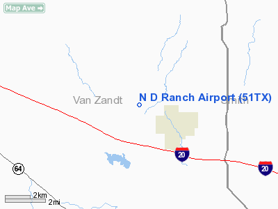
Location & QuickFacts
| FAA Information Effective: | 2008-09-25 |
| Airport Identifier: | 51TX |
| Airport Status: | Operational |
| Longitude/Latitude: | 095-40-05.8640W/32-32-22.4930N
-95.668296/32.539581 (Estimated) |
| Elevation: | 540 ft / 164.59 m (Estimated) |
| Land: | 0 acres |
| From nearest city: | 2 nautical miles NW of Van, TX |
| Location: | Van Zandt County, TX |
| Magnetic Variation: | 06E (1985) |
Owner & Manager
| Ownership: | Privately owned |
| Owner: | Nettie Swinney |
| Address: | Rt 1 Box 293
Van, TX 75790 |
| Phone number: | 214-963-7355 |
| Address: |
|
Airport Operations and Facilities
| Airport Use: | Private |
| Wind indicator: | Yes |
| Segmented Circle: | No |
| Control Tower: | No |
| Sectional chart: | Dallas-ft Worth |
| Region: | ASW - Southwest |
| Boundary ARTCC: | ZFW - Fort Worth |
| Tie-in FSS: | FTW - Fort Worth |
| FSS on Airport: | No |
| FSS Phone: | 817-541-3474 |
| FSS Toll Free: | 1-800-WX-BRIEF |
Runway Information
Runway 18/36
| Dimension: | 2500 x 30 ft / 762.0 x 9.1 m |
| Surface: | TURF, |
| |
Runway 18 |
Runway 36 |
| Traffic Pattern: | Left | Left |
| Obstruction: | 60 ft trees, 650.0 ft from runway | |
|
Radio Navigation Aids
| ID |
Type |
Name |
Ch |
Freq |
Var |
Dist |
| TY | NDB | Tyler | | 320.00 | 06E | 12.5 nm |
| AHX | NDB | Athens | | 269.00 | 06E | 24.3 nm |
| ABG | NDB | Ambassador | | 404.00 | 07E | 28.3 nm |
| CSZ | NDB | Crossroads | | 215.00 | 08E | 32.2 nm |
| AVZ | NDB | Travis | | 260.00 | 06E | 32.2 nm |
| SYW | NDB | Cash | | 428.00 | 05E | 33.4 nm |
| LIQ | NDB | Lochridge Ranch | | 335.00 | 09E | 34.9 nm |
| MII | NDB | Caddo Mills | | 316.00 | 06E | 42.0 nm |
| JUG | NDB | Jecca | | 388.00 | 06E | 44.4 nm |
| PSN | NDB | Palestine | | 375.00 | 04E | 45.7 nm |
| HNO | NDB | Henderson | | 371.00 | 06E | 46.1 nm |
| JSO | NDB | Cherokee County | | 263.00 | 05E | 46.4 nm |
| PQF | NDB | Mesquite | | 248.00 | 06E | 46.5 nm |
| CGQ | NDB | Powell | | 344.00 | 06E | 48.0 nm |
| CRS | NDB | Corsicana | | 396.00 | 06E | 48.1 nm |
| PYF | NDB | Pyramid | | 418.00 | 06E | 48.8 nm |
| MJF | TACAN | Arvilla | 033X | | 05E | 37.4 nm |
| TYR | VOR/DME | Tyler | 089X | 114.20 | 06E | 17.4 nm |
| UIM | VOR/DME | Quitman | 087X | 114.00 | 08E | 25.5 nm |
| FZT | VOR/DME | Frankston | 051X | 111.40 | 06E | 28.8 nm |
| SLR | VOR/DME | Sulphur Springs | 027X | 109.00 | 08E | 40.1 nm |
| CQY | VORTAC | Cedar Creek | 095X | 114.80 | 06E | 35.1 nm |
| GGG | VORTAC | Gregg County | 070X | 112.30 | 07E | 47.0 nm |
Images and information placed above are from
http://www.airport-data.com/airport/51TX/
We thank them for the data!
| General Info
|
| Country |
United States
|
| State |
TEXAS
|
| FAA ID |
51TX
|
| Latitude |
32-32-22.493N
|
| Longitude |
095-40-05.864W
|
| Elevation |
540 feet
|
| Near City |
VAN
|
We don't guarantee the information is fresh and accurate. The data may
be wrong or outdated.
For more up-to-date information please refer to other sources.
|
|


