 |
|
Location & QuickFacts
| FAA Information Effective: | 2008-09-25 |
| Airport Identifier: | 1TX6 |
| Airport Status: | Operational |
| Longitude/Latitude: | 098-05-47.1200W/31-41-54.5560N
-98.096422/31.698488 (Estimated) |
| Elevation: | 1210 ft / 368.81 m (Estimated) |
| Land: | 0 acres |
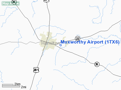
| From nearest city: | 2 nautical miles E of Hamilton, TX |
| Location: | Hamilton County, TX |
| Magnetic Variation: | 07E (1985) |
Owner & Manager
| Ownership: | Privately owned |
| Owner: | Neil & Lynn Muxworthy |
| Address: | Route 1 Box 274m
Hamilton, TX 76531 |
| Phone number: | 817-386-8330 |
| Manager: | Neil & Lynn Muxworthy |
| Address: | Route 1 Box 274m
Hamilton, TX 76531 |
| Phone number: | 817-386-8330 |
Airport Operations and Facilities
| Airport Use: | Private |
| Wind indicator: | Yes |
| Segmented Circle: | No |
| Control Tower: | No |
| Lighting Schedule: | PHONE REQ
FOR LIRL RY 07/25 CALL 817-386-8330. |
| Landing fee charge: | No |
| Sectional chart: | San Antonio |
| Region: | ASW - Southwest |
| Boundary ARTCC: | ZFW - Fort Worth |
| Tie-in FSS: | FTW - Fort Worth |
| FSS on Airport: | No |
| FSS Phone: | 817-541-3474 |
| FSS Toll Free: | 1-800-WX-BRIEF |
Airport Services
| Airframe Repair: | NONE |
| Power Plant Repair: | NONE |
Runway Information
Runway 07/25
| Dimension: | 3000 x 40 ft / 914.4 x 12.2 m |
| Surface: | ASPH, |
| Edge Lights: | Low |
| |
Runway 07 |
Runway 25 |
| Traffic Pattern: | Left | Left |
|
Runway 12/30
| Dimension: | 1900 x 100 ft / 579.1 x 30.5 m |
| Surface: | TURF, |
| |
Runway 12 |
Runway 30 |
| Traffic Pattern: | Left | Left |
|
Radio Navigation Aids
| ID |
Type |
Name |
Ch |
Freq |
Var |
Dist |
| MNZ | NDB | Hamilton | | 251.00 | 07E | 5.4 nm |
| GR | NDB | Starn | | 323.00 | 07E | 33.8 nm |
| HLR | NDB | Hood | | 347.00 | 07E | 39.5 nm |
| IL | NDB | Iresh | | 278.00 | 07E | 45.2 nm |
| GRK | VOR/DME | Gray | 055X | 111.80 | 07E | 42.6 nm |
| TPL | VOR/DME | Temple | 041X | 110.40 | 09E | 45.3 nm |
| BWD | VOR/DME | Brownwood | 023X | 108.60 | 08E | 45.5 nm |
| JEN | VORTAC | Glen Rose | 097X | 115.00 | 06E | 29.9 nm |
| LZZ | VORTAC | Lampasas | 072X | 112.50 | 08E | 30.9 nm |
| ACT | VORTAC | Waco | 100X | 115.30 | 09E | 42.4 nm |
Remarks
- PRVDD LNDG THRS ARE LCTD SO APCH OF 20:1 WILL CLEAR PLINES & PRVD 15' VER CLNC OVER PUB ROADS IN APCH AREAS.
Images and information placed above are from
http://www.airport-data.com/airport/1TX6/
We thank them for the data!
| General Info
|
| Country |
United States
|
| State |
TEXAS
|
| FAA ID |
1TX6
|
| Latitude |
31-41-54.556N
|
| Longitude |
098-05-47.120W
|
| Elevation |
1210 feet
|
| Near City |
HAMILTON
|
We don't guarantee the information is fresh and accurate. The data may
be wrong or outdated.
For more up-to-date information please refer to other sources.
|
|


