 |
|
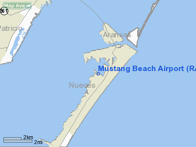
Location & QuickFacts
| FAA Information Effective: | 2008-09-25 |
| Airport Identifier: | RAS |
| Airport Status: | Operational |
| Longitude/Latitude: | 097-05-19.5000W/27-48-42.6000N
-97.088750/27.811833 (Estimated) |
| Elevation: | 5 ft / 1.52 m (Estimated) |
| Land: | 30 acres |
| From nearest city: | 2 nautical miles SW of Port Aransas, TX |
| Location: | Nueces County, TX |
| Magnetic Variation: | 05E (2005) |
Owner & Manager
| Ownership: | Publicly owned |
| Owner: | City Of Port Aransas |
| Address: | 710 W. Ave A
Port Aransas, TX 78373-4128 |
| Phone number: | 361-749-4111 |
| Manager: | Pat Garrett |
| Address: | 710 W. Ave A
Port Aransas, TX 78373-4128 |
| Phone number: | 361-749-4111 |
Airport Operations and Facilities
| Airport Use: | Open to public |
| Wind indicator: | Yes |
| Segmented Circle: | Yes |
| Control Tower: | No |
| Lighting Schedule: | DUSK-DAWN |
| Beacon Color: | Clear-Green (lighted land airport) |
| Landing fee charge: | No
OVERNIGHT TIEDOWN FEE. |
| Sectional chart: | Brownsville |
| Region: | ASW - Southwest |
| Boundary ARTCC: | ZHU - Houston |
| Tie-in FSS: | SJT - San Angelo |
| FSS on Airport: | No |
| FSS Toll Free: | 1-800-WX-BRIEF |
| NOTAMs Facility: | RAS (NOTAM-d service avaliable) |
Airport Communications
Airport Services
| Fuel available: | 100LL
SELF SERVE. |
Runway Information
Runway 12/30
| Dimension: | 3482 x 70 ft / 1061.3 x 21.3 m |
| Surface: | ASPH, Good Condition |
| Edge Lights: | Low |
| |
Runway 12 |
Runway 30 |
| Longitude: | 097-05-35.3392W | 097-05-03.7113W |
| Latitude: | 27-48-52.5264N | 27-48-32.5790N |
| Elevation: | 4.00 ft | 4.00 ft |
| Alignment: | 125 | 127 |
| Traffic Pattern: | Left | Left |
| Markings: | Basic, Good Condition | Basic, Good Condition |
| Crossing Height: | 35.00 ft | 35.00 ft |
| VASI: | 2-light PAPI on left side | 2-light PAPI on left side |
| Visual Glide Angle: | 3.00° | 3.00° |
| Obstruction: | , 50:1 slope to clear | 37 ft pline, 1139.0 ft from runway, 25:1 slope to clear |
|
Radio Navigation Aids
| ID |
Type |
Name |
Ch |
Freq |
Var |
Dist |
| RKP | NDB | Rockport | | 391.00 | 06E | 16.9 nm |
| MNO | NDB | Mellon Ranch | | 375.00 | 06E | 28.8 nm |
| NQI | TACAN | Kingsville | 125X | | 09E | 42.5 nm |
| ALI | VOR | Alice | | 114.50 | 06E | 49.8 nm |
| NGP | VORTAC | Truax | 087X | 114.00 | 06E | 13.3 nm |
| CRP | VORTAC | Corpus Christi | 102X | 115.50 | 09E | 19.7 nm |
Remarks
- RY 12 HAS A -3 FT DROP OFF NEAR END OF RY; RY 30 HAS A 3 FT DITCH 180 FT FM END OF RY.
- MAY BE EXEMPT UNDER GRANDFATHER CLAUSE.
Images and information placed above are from
http://www.airport-data.com/airport/RAS/
We thank them for the data!
| General Info
|
| Country |
United States
|
| State |
TEXAS
|
| FAA ID |
RAS
|
| Latitude |
27.811833
27° 48' 42.60" N
|
| Longitude |
-97.088750
097° 05' 19.50" W
|
| Elevation |
5 feet
2 meters
|
| Magnetic Variation |
005° E (01/06)
|
| Beacon |
Yes
|
| Operating Agency |
MUNICIPAL
|
| Daylight Saving Time |
Second Sunday in March at 0200 to first Sunday in November at 0200 local time (Exception Arizona and that portion of Indiana in the Eastern Time Zone)
|
We don't guarantee the information is fresh and accurate. The data may
be wrong or outdated.
For more up-to-date information please refer to other sources.
|
|


