 |
|
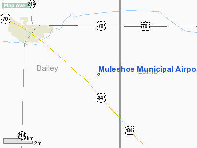
Location & QuickFacts
| FAA Information Effective: | 2008-09-25 |
| Airport Identifier: | 2T1 |
| Airport Status: | Operational |
| Longitude/Latitude: | 102-38-27.9530W/34-11-06.4910N
-102.641098/34.185136 (Estimated) |
| Elevation: | 3779 ft / 1151.84 m (Surveyed) |
| Land: | 330 acres |
| From nearest city: | 4 nautical miles SE of Muleshoe, TX |
| Location: | Bailey County, TX |
| Magnetic Variation: | 09E (1990) |
Owner & Manager
| Ownership: | Publicly owned |
| Owner: | City Of Muleshoe |
| Address: | 215 S First St
Muleshoe, TX 79347 |
| Phone number: | 806-272-4528 |
| Manager: | David Brunson, City Mgr |
| Address: | 215 S First St
Muleshoe, TX 79347 |
| Phone number: | 806-272-4528 |
Airport Operations and Facilities
| Airport Use: | Open to public |
| Wind indicator: | Yes |
| Segmented Circle: | Yes |
| Control Tower: | No |
| Lighting Schedule: | DUSK-DAWN
ACTVT MIRL RY 07/25 - 122.8. |
| Beacon Color: | Clear-Green (lighted land airport) |
| Sectional chart: | Albuquerque |
| Region: | ASW - Southwest |
| Boundary ARTCC: | ZFW - Fort Worth |
| Tie-in FSS: | FTW - Fort Worth |
| FSS on Airport: | No |
| FSS Phone: | 817-541-3474 |
| FSS Toll Free: | 1-800-WX-BRIEF |
| NOTAMs Facility: | FTW (NOTAM-d service avaliable) |
| Federal Agreements: | NGY |
Airport Communications
Airport Services
| Fuel available: | 100LL
FOR EMERGENCY FUEL CALL 806-272-4556. |
Runway Information
Runway 07/25
| Dimension: | 5100 x 60 ft / 1554.5 x 18.3 m |
| Surface: | ASPH, Good Condition |
| Weight Limit: | Single wheel: 12500 lbs. |
| Edge Lights: | Medium |
| |
Runway 07 |
Runway 25 |
| Longitude: | 102-38-57.5730W | 102-37-58.2990W |
| Latitude: | 34-11-01.0540N | 34-11-11.9180N |
| Elevation: | 3779.00 ft | 3767.00 ft |
| Alignment: | 78 | 127 |
| Traffic Pattern: | Left | Left |
| Markings: | Non-precision instrument, Good Condition | Non-precision instrument, Good Condition |
| Crossing Height: | 40.00 ft | 40.00 ft |
| VASI: | 2-light PAPI on left side | 2-light PAPI on left side |
| Visual Glide Angle: | 3.00° | 3.00° |
| Obstruction: | 50 ft pole, 1600.0 ft from runway, 28:1 slope to clear | , 50:1 slope to clear |
|
Radio Navigation Aids
| ID |
Type |
Name |
Ch |
Freq |
Var |
Dist |
| LIU | NDB | Littlefield | | 212.00 | 10E | 20.4 nm |
| PRZ | NDB | Portales | | 407.00 | 09E | 38.1 nm |
| LLN | NDB | Levelland | | 266.00 | 09E | 40.1 nm |
| HRX | NDB | Hereford | | 341.00 | 09E | 43.3 nm |
| CVS | TACAN | Cannon | 053X | | 10E | 35.8 nm |
| PVW | VOR/DME | Plainview | 076X | 112.90 | 11E | 42.8 nm |
| TXO | VORTAC | Texico | 059X | 112.20 | 11E | 21.1 nm |
| LBB | VORTAC | Lubbock | 029X | 109.20 | 11E | 46.3 nm |
Remarks
Images and information placed above are from
http://www.airport-data.com/airport/2T1/
We thank them for the data!
| General Info
|
| Country |
United States
|
| State |
TEXAS
|
| FAA ID |
2T1
|
| Latitude |
34-11-06.491N
|
| Longitude |
102-38-27.953W
|
| Elevation |
3779 feet
|
| Near City |
MULESHOE
|
We don't guarantee the information is fresh and accurate. The data may
be wrong or outdated.
For more up-to-date information please refer to other sources.
|
|


