 |
|
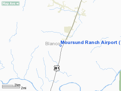
Location & QuickFacts
| FAA Information Effective: | 2008-09-25 |
| Airport Identifier: | 71TE |
| Airport Status: | Operational |
| Longitude/Latitude: | 098-22-34.0830W/30-22-40.7080N
-98.376134/30.377974 (Estimated) |
| Elevation: | 1471 ft / 448.36 m (Estimated) |
| Land: | 18 acres |
| From nearest city: | 3 nautical miles SW of Round Mountain, TX |
| Location: | Blanco County, TX |
| Magnetic Variation: | 07E (1985) |
Owner & Manager
| Ownership: | Privately owned |
| Owner: | A W Moursund |
| Address: | Po Box 1
Round Mountain, TX 78663 |
| Phone number: | 210-825-3215 |
| Manager: | A W Moursund |
| Address: | Po Box 1
Round Mountain, TX 78663 |
| Phone number: | 210-825-3233 |
Airport Operations and Facilities
| Airport Use: | Private |
| Wind indicator: | Yes |
| Segmented Circle: | No |
| Control Tower: | No |
| Lighting Schedule: | DUSK-DAWN |
| Landing fee charge: | No |
| Sectional chart: | San Antonio |
| Region: | ASW - Southwest |
| Boundary ARTCC: | ZHU - Houston |
| Tie-in FSS: | SJT - San Angelo |
| FSS on Airport: | No |
| FSS Toll Free: | 1-800-WX-BRIEF |
Airport Services
| Airframe Repair: | NONE |
| Power Plant Repair: | NONE |
Runway Information
Runway 18/36
| Dimension: | 3450 x 40 ft / 1051.6 x 12.2 m
10 FT TREATED SHOULDERS EACH SIDE OF RY. |
| Surface: | ASPH, |
| Edge Lights: | Medium |
| |
Runway 18 |
Runway 36 |
| Traffic Pattern: | Left | Left |
|
Radio Navigation Aids
| ID |
Type |
Name |
Ch |
Freq |
Var |
Dist |
| MFS | NDB | Horseshoe Bay Resort | | 403.00 | 07E | 8.8 nm |
| BMQ | NDB | Burnet | | 341.00 | 07E | 22.9 nm |
| GUO | NDB | Georgetown | | 332.00 | 06E | 40.5 nm |
| ER | NDB | Shein | | 263.00 | 08E | 43.1 nm |
| GRK | VOR/DME | Gray | 055X | 111.80 | 07E | 48.9 nm |
| STV | VORTAC | Stonewall | 085X | 113.80 | 08E | 20.0 nm |
| LLO | VORTAC | Llano | 019X | 108.20 | 08E | 32.9 nm |
| CWK | VORTAC | Centex | 075X | 112.80 | 06E | 43.9 nm |
| SAT | VORTAC | San Antonio | 115X | 116.80 | 08E | 44.3 nm |
Images and information placed above are from
http://www.airport-data.com/airport/71TE/
We thank them for the data!
| General Info
|
| Country |
United States
|
| State |
TEXAS
|
| FAA ID |
71TE
|
| Latitude |
30-22-40.708N
|
| Longitude |
098-22-34.083W
|
| Elevation |
1471 feet
|
| Near City |
ROUND MOUNTAIN
|
We don't guarantee the information is fresh and accurate. The data may
be wrong or outdated.
For more up-to-date information please refer to other sources.
|
|


