 |
|
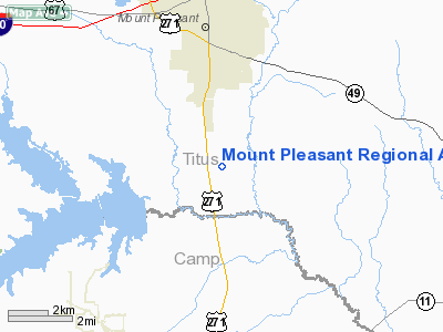
Mount Pleasant Rgnl Airport |
Location & QuickFacts
| FAA Information Effective: | 2008-09-25 |
| Airport Identifier: | OSA |
| Airport Status: | Operational |
| Longitude/Latitude: | 094-57-41.4600W/33-05-43.9200N
-94.961517/33.095533 (Estimated) |
| Elevation: | 363 ft / 110.64 m (Estimated) |
| Land: | 284 acres |
| From nearest city: | 3 nautical miles S of Mount Pleasant, TX |
| Location: | Titus County, TX |
| Magnetic Variation: | 04E (2000) |
Owner & Manager
| Ownership: | Publicly owned |
| Owner: | City Of Mount Pleasant |
| Address: | 501 North Madison
Mount Pleasant, TX 75455 |
| Phone number: | 903-575-4000 |
| Manager: | Paul Henderson |
| Address: | 501 Mike Hall Parkway
Mount Pleasant, TX 75455 |
| Phone number: | 903-575-4020 |
Airport Operations and Facilities
| Airport Use: | Open to public |
| Wind indicator: | Yes |
| Segmented Circle: | Yes |
| Control Tower: | No |
| Lighting Schedule: | DUSK-DAWN
MIRL RY 17/35 PRESET LOW INTST; TO INCR INTST & ACTVT PAPI & REIL RYS 17 & 35 (DAYTIME ONLY) - CTAF. |
| Beacon Color: | Clear-Green (lighted land airport) |
| Sectional chart: | Memphis |
| Region: | ASW - Southwest |
| Boundary ARTCC: | ZFW - Fort Worth |
| Tie-in FSS: | FTW - Fort Worth |
| FSS Phone: | 817-541-3474 |
| FSS Toll Free: | 1-800-WX-BRIEF |
| NOTAMs Facility: | OSA (NOTAM-d service avaliable) |
| Federal Agreements: | NG |
Airport Communications
| CTAF: | 122.700 |
| Unicom: | 122.700 |
Airport Services
| Fuel available: | 100LLA
100LL AVBL 24 HRS SELF SERVICE WITH CREDIT CARD. FOR JET A AFT HRS CALL 903-575-4004. |
Runway Information
Runway 17/35
| Dimension: | 5000 x 75 ft / 1524.0 x 22.9 m |
| Surface: | ASPH, Good Condition |
| Weight Limit: | Single wheel: 30000 lbs. |
| Edge Lights: | Medium |
| |
Runway 17 |
Runway 35 |
| Longitude: | 094-57-45.5500W | 094-57-37.3700W |
| Latitude: | 33-06-08.4100N | 33-05-19.4200N |
| Elevation: | 363.00 ft | 341.00 ft |
| Alignment: | 127 | 127 |
| Traffic Pattern: | Left | Left |
| Markings: | Non-precision instrument, Good Condition | Non-precision instrument, Good Condition |
| Crossing Height: | 39.00 ft | 44.00 ft |
| VASI: | 4-light PAPI on left side | 4-light PAPI on left side |
| Visual Glide Angle: | 3.00° | 3.00° |
| Runway End Identifier: | Yes | Yes |
|
Radio Navigation Aids
| ID |
Type |
Name |
Ch |
Freq |
Var |
Dist |
| LST | NDB | Lone Star | | 305.00 | 05E | 14.9 nm |
| ABG | NDB | Ambassador | | 404.00 | 07E | 31.6 nm |
| ATA | NDB | Atlanta | | 347.00 | 04E | 38.8 nm |
| TY | NDB | Tyler | | 320.00 | 06E | 48.3 nm |
| IBO | NDB | Idabel | | 271.00 | 03E | 49.1 nm |
| UIM | VOR/DME | Quitman | 087X | 114.00 | 08E | 24.2 nm |
| SLR | VOR/DME | Sulphur Springs | 027X | 109.00 | 08E | 29.9 nm |
| PRX | VOR/DME | Paris | 083X | 113.60 | 07E | 36.3 nm |
| TYR | VOR/DME | Tyler | 089X | 114.20 | 06E | 49.8 nm |
| GGG | VORTAC | Gregg County | 070X | 112.30 | 07E | 42.1 nm |
Remarks
- DEER & WILDLIFE ON & INVOF ARPT.
- NO LINE OF SIGHT BETWEEN RUNWAY ENDS.
Images and information placed above are from
http://www.airport-data.com/airport/OSA/
We thank them for the data!
| General Info
|
| Country |
United States
|
| State |
TEXAS
|
| FAA ID |
OSA
|
| Latitude |
33-05-43.920N
|
| Longitude |
094-57-41.460W
|
| Elevation |
363 feet
|
| Near City |
MOUNT PLEASANT
|
We don't guarantee the information is fresh and accurate. The data may
be wrong or outdated.
For more up-to-date information please refer to other sources.
|
|


