 |
|
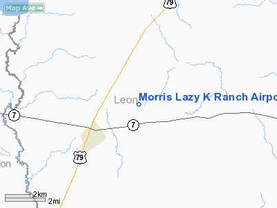
Morris Lazy K Ranch Airport |
Location & QuickFacts
| FAA Information Effective: | 2008-09-25 |
| Airport Identifier: | TA23 |
| Airport Status: | Operational |
| Longitude/Latitude: | 096-12-58.8730W/31-15-40.6470N
-96.216354/31.261291 (Estimated) |
| Elevation: | 360 ft / 109.73 m (Estimated) |
| Land: | 0 acres |
| From nearest city: | 3 nautical miles NE of Marquez, TX |
| Location: | Leon County, TX |
| Magnetic Variation: | 06E (1985) |
Owner & Manager
| Ownership: | Privately owned |
| Owner: | David H. Morris |
| Address: | Po Box 188
Houston, TX 77001 |
| Phone number: | 214-529-3661 |
| Manager: | David H. Morris Ii |
| Address: | Rt. 1 Box 33
Marquez, TX 77865 |
| Phone number: | 903-529-3661 |
Airport Operations and Facilities
| Airport Use: | Private |
| Wind indicator: | Yes |
| Segmented Circle: | Yes |
| Control Tower: | No |
| Landing fee charge: | No |
| Sectional chart: | Houston |
| Region: | ASW - Southwest |
| Boundary ARTCC: | ZHU - Houston |
| Tie-in FSS: | CXO - Montgomery County |
| FSS on Airport: | No |
| FSS Toll Free: | 1-800-WX-BRIEF
FOR FP FILING CALL CXO FSS 1-800-833-5602. |
Runway Information
Runway 15/33
| Dimension: | 4000 x 100 ft / 1219.2 x 30.5 m |
| Surface: | TURF, |
| |
Runway 15 |
Runway 33 |
| Traffic Pattern: | Left | Left |
| Obstruction: | 50 ft trees, 500.0 ft from runway | 50 ft trees, 250.0 ft from runway |
|
Radio Navigation Aids
| ID |
Type |
Name |
Ch |
Freq |
Var |
Dist |
| LXY | NDB | Mexia | | 329.00 | 07E | 27.3 nm |
| PYF | NDB | Pyramid | | 418.00 | 06E | 36.2 nm |
| PSN | NDB | Palestine | | 375.00 | 04E | 40.9 nm |
| UTS | NDB | Huntsville | | 308.00 | 06E | 44.9 nm |
| ROB | NDB | Robinson | | 400.00 | 07E | 46.1 nm |
| CRS | NDB | Corsicana | | 396.00 | 06E | 47.0 nm |
| LIQ | NDB | Lochridge Ranch | | 335.00 | 09E | 47.0 nm |
| CGQ | NDB | Powell | | 344.00 | 06E | 49.5 nm |
| GNL | VOR/DME | Groesbeck | 025X | 108.80 | 05E | 25.7 nm |
| LOA | VORTAC | Leona | 045X | 110.80 | 08E | 15.2 nm |
| CLL | VORTAC | College Station | 080X | 113.30 | 08E | 40.8 nm |
Remarks
Images and information placed above are from
http://www.airport-data.com/airport/TA23/
We thank them for the data!
| General Info
|
| Country |
United States
|
| State |
TEXAS
|
| FAA ID |
TA23
|
| Latitude |
31-15-40.647N
|
| Longitude |
096-12-58.873W
|
| Elevation |
360 feet
|
| Near City |
MARQUEZ
|
We don't guarantee the information is fresh and accurate. The data may
be wrong or outdated.
For more up-to-date information please refer to other sources.
|
|


