 |
|
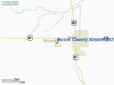
Location & QuickFacts
| FAA Information Effective: | 2008-09-25 |
| Airport Identifier: | DUX |
| Airport Status: | Operational |
| Longitude/Latitude: | 102-00-47.1229W/35-51-28.5519N
-102.013090/35.857931 (Estimated) |
| Elevation: | 3705 ft / 1129.28 m (Surveyed) |
| Land: | 326 acres |
| From nearest city: | 2 nautical miles W of Dumas, TX |
| Location: | Moore County, TX |
| Magnetic Variation: | 09E (1990) |
Owner & Manager
| Ownership: | Publicly owned |
| Owner: | Moore County |
| Address: | 715 Dumas Ave. Rm 202
Dumas, TX 79029 |
| Phone number: | 806-935-5588 |
| Manager: | Brandon Cox |
| Address: | 715 Dumas Ave. Rm. 202
Dumas, TX 79029 |
| Phone number: | 806-935-6995 |
Airport Operations and Facilities
| Airport Use: | Open to public |
| Wind indicator: | Yes |
| Segmented Circle: | Yes |
| Control Tower: | No |
| Lighting Schedule: | DUSK-DAWN
MIRL RY 01/19 PRESET LOW INTST; TO INCR INTST ACTVT - CTAF. |
| Beacon Color: | Clear-Green (lighted land airport) |
| Landing fee charge: | No |
| Sectional chart: | Albuquerque |
| Region: | ASW - Southwest |
| Traffic Pattern Alt: | 1000 ft |
| Boundary ARTCC: | ZAB - Albuquerque |
| Tie-in FSS: | FTW - Fort Worth |
| FSS on Airport: | No |
| FSS Phone: | 817-541-3474 |
| FSS Toll Free: | 1-800-WX-BRIEF |
| NOTAMs Facility: | DUX (NOTAM-d service avaliable) |
| Federal Agreements: | NGY |
Airport Communications
| CTAF: | 122.800 |
| Unicom: | 122.800 |
Airport Services
| Fuel available: | 100LLA
SELF-SERVE FUEL AVBL 24 HRS WITH MAJOR CREDIT CARD. |
| Bottled Oxygen: | NONE |
| Bulk Oxygen: | NONE |
Runway Information
Runway 01/19
| Dimension: | 5474 x 75 ft / 1668.5 x 22.9 m |
| Surface: | ASPH, Good Condition |
| Weight Limit: | Single wheel: 30000 lbs.
Dual wheel: 45000 lbs. |
| Edge Lights: | Medium |
| |
Runway 01 |
Runway 19 |
| Longitude: | 102-01-01.0582W | 102-00-34.9316W |
| Latitude: | 35-51-00.4990N | 35-51-50.2641N |
| Elevation: | 3705.00 ft | 3698.00 ft |
| Alignment: | 23 | 127 |
| Traffic Pattern: | Left | Left |
| Markings: | Non-precision instrument, Good Condition | Non-precision instrument, Fair Condition |
| Crossing Height: | 26.00 ft | 26.00 ft |
| VASI: | pulsating/steady burning on left side | pulsating/steady burning on left side |
| Visual Glide Angle: | 3.00° | 3.00° |
| Obstruction: | , 50:1 slope to clear | 15 ft road, 500.0 ft from runway, 295 ft right of centerline, 20:1 slope to clear |
|
Runway 14/32
| Dimension: | 3100 x 60 ft / 944.9 x 18.3 m |
| Surface: | ASPH, Good Condition |
| Weight Limit: | Single wheel: 21000 lbs.
Dual wheel: 32000 lbs. |
| Edge Lights: | Medium |
| |
Runway 14 |
Runway 32 |
| Longitude: | 102-00-54.5447W | 102-00-36.6182W |
| Latitude: | 35-51-47.6247N | 35-51-20.6751N |
| Elevation: | 3698.00 ft | 3700.00 ft |
| Alignment: | 127 | 127 |
| Traffic Pattern: | Left | Left |
| Markings: | Basic, Good Condition | Basic, Good Condition |
| Obstruction: | 29 ft pline, 790.0 ft from runway, 190 ft left of centerline, 20:1 slope to clear | , 50:1 slope to clear |
|
Radio Navigation Aids
| ID |
Type |
Name |
Ch |
Freq |
Var |
Dist |
| DUX | NDB | Durrett | | 414.00 | 09E | 0.3 nm |
| AM | NDB | Pande | | 251.00 | 09E | 44.0 nm |
| DHT | VORTAC | Dalhart | 057X | 112.00 | 12E | 29.4 nm |
| BGD | VORTAC | Borger | 023X | 108.60 | 11E | 30.9 nm |
| PNH | VORTAC | Panhandle | 113X | 116.60 | 08E | 40.5 nm |
Remarks
- EXTENSIVE CROP DUSTING IN SUMMER.
Images and information placed above are from
http://www.airport-data.com/airport/DUX/
We thank them for the data!
| General Info
|
| Country |
United States
|
| State |
TEXAS
|
| FAA ID |
DUX
|
| Latitude |
35-51-28.542N
|
| Longitude |
102-00-47.152W
|
| Elevation |
3705 feet
|
| Near City |
DUMAS
|
We don't guarantee the information is fresh and accurate. The data may
be wrong or outdated.
For more up-to-date information please refer to other sources.
|
|


