 |
|
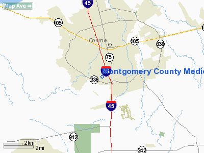
Montgomery County Medical Center Hospital Heliport |
Location & QuickFacts
| FAA Information Effective: | 2008-09-25 |
| Airport Identifier: | 55TA |
| Airport Status: | Operational |
| Longitude/Latitude: | 095-28-03.7840W/30-17-05.7600N
-95.467718/30.284933 (Estimated) |
| Elevation: | 162 ft / 49.38 m (Estimated) |
| Land: | 0 acres |
| From nearest city: | 2 nautical miles SW of Conroe, TX |
| Location: | Montgomery County, TX |
| Magnetic Variation: | 06E (1985) |
Owner & Manager
| Ownership: | Privately owned |
| Owner: | Montgomery Cty Hospital Dist |
| Address: | 504 Medical Center Blvd.
Conroe, TX 77304 |
| Phone number: | 409-539-7080 |
| Manager: | John Single, Admin. |
| Address: | Po Box 1538
Conroe, TX 77305 |
| Phone number: | 409-539-7080 |
Airport Operations and Facilities
| Airport Use: | Private
MEDICAL. |
| Wind indicator: | Yes |
| Segmented Circle: | Yes |
| Control Tower: | No |
| Lighting Schedule: | DUSK-DAWN |
| Beacon Color: | Clear (unlighted land airport) |
| Landing fee charge: | No |
| Sectional chart: | Houston |
| Region: | ASW - Southwest |
| Boundary ARTCC: | ZHU - Houston |
| Tie-in FSS: | CXO - Montgomery County |
| FSS on Airport: | No |
| FSS Toll Free: | 1-800-WX-BRIEF
FOR FP FILING CALL CXO FSS 1-800-833-5602. |
Runway Information
Helipad H1
| Dimension: | 40 x 40 ft / 12.2 x 12.2 m |
| Surface: | CONC,
ROOFTOP. |
| |
Runway H1 |
Runway |
| Traffic Pattern: | Left | Left |
|
Radio Navigation Aids
| ID |
Type |
Name |
Ch |
Freq |
Var |
Dist |
| DWH | NDB | David Hooks | | 521.00 | 05E | 10.9 nm |
| BVP | NDB | Nixin | | 326.00 | 05E | 21.9 nm |
| EYQ | NDB | Weiser | | 286.00 | 06E | 22.9 nm |
| UTS | NDB | Huntsville | | 308.00 | 06E | 28.1 nm |
| LYD | NDB | Lakeside | | 249.00 | 05E | 30.2 nm |
| SGR | NDB | Hull | | 388.00 | 05E | 40.4 nm |
| JPA | NDB | Sanjac | | 347.00 | 05E | 42.5 nm |
| SYG | NDB | Sandy Point | | 402.00 | 05E | 47.0 nm |
| BNH | NDB | Brenham | | 362.00 | 06E | 47.2 nm |
| EFD | TACAN | Ellington | 031X | | 05E | 43.9 nm |
| HUB | VOR/DME | Hobby | 118X | 117.10 | 05E | 39.1 nm |
| IAH | VORTAC | Humble | 113X | 116.60 | 05E | 20.7 nm |
| TNV | VORTAC | Navasota | 106X | 115.90 | 08E | 30.7 nm |
| DAS | VORTAC | Daisetta | 116X | 116.90 | 05E | 43.1 nm |
| HOU | VOT | Houston Wm P Hobby | | 108.40 | | 39.7 nm |
Images and information placed above are from
http://www.airport-data.com/airport/55TA/
We thank them for the data!
| General Info
|
| Country |
United States
|
| State |
TEXAS
|
| FAA ID |
55TA
|
| Latitude |
30-17-05.760N
|
| Longitude |
095-28-03.784W
|
| Elevation |
162 feet
|
| Near City |
CONROE
|
We don't guarantee the information is fresh and accurate. The data may
be wrong or outdated.
For more up-to-date information please refer to other sources.
|
|


