 |
|
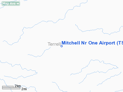
Location & QuickFacts
| FAA Information Effective: | 2008-09-25 |
| Airport Identifier: | TS75 |
| Airport Status: | Operational |
| Longitude/Latitude: | 102-09-31.4860W/30-30-10.6220N
-102.158746/30.502951 (Estimated) |
| Elevation: | 2700 ft / 822.96 m (Estimated) |
| Land: | 0 acres |
| From nearest city: | 25 nautical miles NE of Sanderson, TX |
| Location: | Terrell County, TX |
| Magnetic Variation: | 09E (1984) |
Owner & Manager
| Ownership: | Privately owned |
| Owner: | N. M. Mitchell |
| Address: | Po Box 666
Sanderson, TX 79848 |
| Phone number: | 915-753-2320 |
| Address: |
|
Airport Operations and Facilities
| Airport Use: | Private |
| Segmented Circle: | No |
| Control Tower: | No |
| Sectional chart: | San Antonio |
| Region: | ASW - Southwest |
| Boundary ARTCC: | ZHU - Houston |
| Tie-in FSS: | SJT - San Angelo |
| FSS Toll Free: | 1-800-WX-BRIEF |
Runway Information
Runway 11/29
| Dimension: | 2300 x 75 ft / 701.0 x 22.9 m |
| Surface: | DIRT, |
| |
Runway 11 |
Runway 29 |
| Traffic Pattern: | Left | Left |
|
Radio Navigation Aids
| ID |
Type |
Name |
Ch |
Freq |
Var |
Dist |
Remarks
- OWNER DESIRES ARPT NOT TO BE CHARTED.
Images and information placed above are from
http://www.airport-data.com/airport/TS75/
We thank them for the data!
| General Info
|
| Country |
United States
|
| State |
TEXAS
|
| FAA ID |
TS75
|
| Latitude |
30-30-10.622N
|
| Longitude |
102-09-31.486W
|
| Elevation |
2700 feet
|
| Near City |
SANDERSON
|
We don't guarantee the information is fresh and accurate. The data may
be wrong or outdated.
For more up-to-date information please refer to other sources.
|
|


