|
|
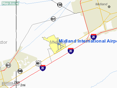
| Midland/Odessa International Airport |
 |
 |
| IATA: MAF – ICAO: KMAF – FAA LID: MAF |
| Summary |
| Airport type |
Public |
| Operator |
City of Midland |
| Location |
Midland County, between Midland and Odessa, Texas, USA |
| Elevation AMSL |
2,871 ft / 875 m |
| Coordinates |
31°56′33″N 102°12′07″W / 31.9425°N 102.20194°W / 31.9425; -102.20194 |
| Website |
www.FlyMAF.com |
| Runways |
| Direction |
Length |
Surface |
| ft |
m |
| 4/22 |
4,605 |
1,404 |
Asphalt |
| 10/28 |
8,302 |
2,530 |
Asphalt |
| 16L/34R |
4,339 |
1,323 |
Asphalt |
| 16R/34L |
9,501 |
2,896 |
Asphalt |
| Statistics (2007) |
| Aircraft operations |
86,384 |
| Based aircraft |
78 |
| Sources: airport website and FAA |
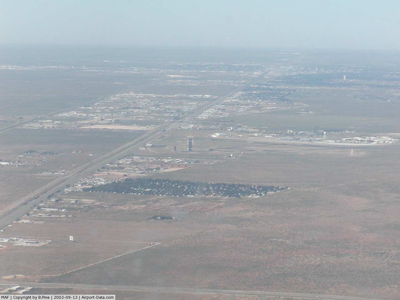
Midland International Airport (IATA: MAF, ICAO: KMAF, FAA LID: MAF) is a city-owned public-use airport located eight nautical miles (15 km) southwest of the central business district of Midland, a city in Midland County, Texas, United States. The airport is also northeast of central Odessa.
Midland International Airport is the 9th busiest airport in Texas. Since 1991 it has been the headquarters of the Commemorative Air Force(CAF) and the American Airpower Heritage Museum. The CAF hosts an annual airshow every fall. The airport has four airlines, three of which serve hubs with regional jets, and one that offers mainline jet service to various destinations. Southwest Airlines is the largest carrier at the airport. In 2007 491,834 passengers were enplaned, up 4% from 2006. History
Midland-Odessa Regional Airport (MAF) opened its new passenger terminal in the early 1960s. At the time, MAF was served by Continental and Trans-Texas, both of whom operated popular point-to-point services linking West Texas towns.
The terminal was identified by its scalloped roofline, which allowed a column-free interior. All services - ticketing, baggage claim and concessions, were located inside the building, and a single departure lounge opened up onto the apron. Continental and Trans-Texas both introduced DC9 jet flights in the late 1960s.
This layout served the airport well until the late 1970s 'oil boom' hit Midland-Odessa. Rapid economic growth in the two cities led to a dramatic increase in flights, by both the incumbent airlines and new-entrant carriers like Southwest Airlines. After airline deregulation in 1978, American and Delta began flights, followed by start-up America West a few years later.
To cope with the rising demand, a new gate area was constructed along the apron. Included in the plan were four second-level gates equipped with jetbridges, concession space, and escalator wells linking the addition to the existing terminal. The south end of the main terminal was extended to include more ticketing space, and the original terminal was modernized (the scalloped roofline was removed).
By the 1990s, several of the new-entrant carriers had pulled out and most of the remaining airlines had downgraded to regional jets. Only Southwest, the airport's largest carrier, operated mainline jet flights.
The terminal building, however, had begun to look tired, and airport officials began planning for a more modern replacement. Construction began on the facility (which would be located in the infield parking lot) in 1996. The first half of the new terminal was opened in early 1999, at which point the 1966 terminal was closed and demolished. The second half of the new terminal was finished in late 1999.
Until the September 11th attacks, everyone was allowed access to the second floor; since then, however, only passengers are allowed past the security checkpoints.
In 2008, Southwest Airlines dropped all direct flight to El Paso, due to decreased passenger counts to that city. An afternoon flight to Austin has also been dropped even though negotiations are underway to keep that flight.
Facilities and aircraft
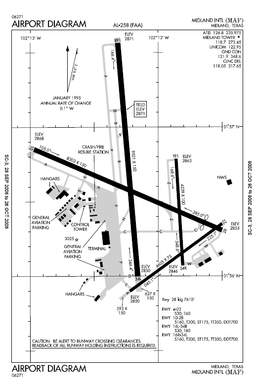
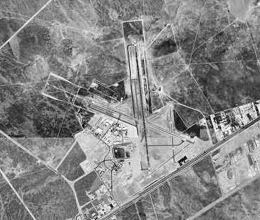
Midland International Airport covers an area of 1,600 acres (647 ha) at an elevation of 2,871 feet (875 m) above mean sea level. It has four runways:
- Runway 4/22 measuring: 4,605 x 75 ft (1,404 x 23 m), Surface: Asphalt
- Runway 10/28: 8,302 x 150 ft (2,530 x 46 m), Surface: Asphalt
- Runway 16L/34R: 4,339 x 100 ft (1,323 x 30 m), Surface: Asphalt
- Runway 16R/34L: 9,501 x 150 ft (2,896 x 46 m), Surface: Asphalt
For the 12-month period ending February 29, 2008, the airport had 86,384 aircraft operations, an average of 237 per day: 39% military, 34% general aviation, 16% air taxi and 11% scheduled commercial. At that time there were 78 aircraft based at this airport: 39% single-engine, 47% multi-engine , 12% jet and 2% helicopter.
Airlines and destinations
| Airlines |
Destinations |
| American Eagle |
Dallas/Fort Worth |
| Continental Express operated by ExpressJet Airlines |
Houston-Intercontinental |
| Southwest Airlines |
Albuquerque, Dallas-Love, Houston-Hobby, Las Vegas |
| United Express operated by SkyWest Airlines |
Denver |
The above content comes from Wikipedia and is published under free licenses – click here to read more.
 |
(Click on the photo to enlarge) |
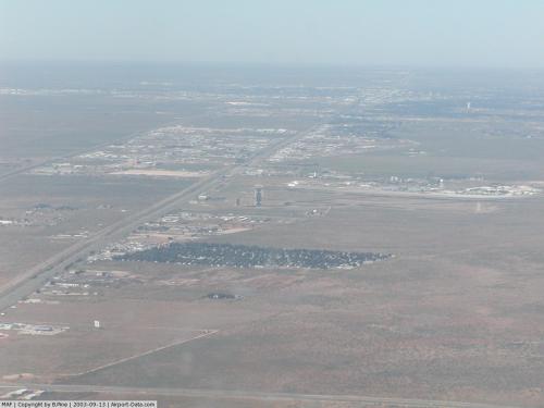 |
(Click on the photo to enlarge) |
Location & QuickFacts
| FAA Information Effective: | 2008-09-25 |
| Airport Identifier: | MAF |
| Airport Status: | Operational |
| Longitude/Latitude: | 102-12-06.8900W/31-56-33.1000N
-102.201914/31.942528 (Estimated) |
| Elevation: | 2871 ft / 875.08 m (Surveyed) |
| Land: | 1600 acres |
| From nearest city: | 8 nautical miles SW of Midland, TX |
| Location: | Midland County, TX |
| Magnetic Variation: | 09E (1985) |
Owner & Manager
| Ownership: | Publicly owned |
| Owner: | City Of Midland |
| Address: | Po Box 1152
Midland, TX 79702 |
| Phone number: | 432-685-7100 |
| Manager: | Marv Esterly |
| Address: | Po Box 60305
Midland, TX 79711 |
| Phone number: | 432-560-2200 |
Airport Operations and Facilities
| Airport Use: | Open to public |
| Wind indicator: | Yes |
| Segmented Circle: | Yes |
| Control Tower: | Yes |
| Lighting Schedule: | DUSK-DAWN
WHEN ATCT CLSD HIRL RYS 10/28 & 16R/34L PRESET ON MED INTST; MIRL RYS 04/22 & 16L/34R PRESET ON MED INTST DURG EXPECTED IFR CONDS ONLY. WHEN ATCT CLSD ACTVT MALSR RY 10 & MALS RY 28 - CTAF. |
| Beacon Color: | Clear-Green (lighted land airport) |
| Landing fee charge: | Yes |
| Sectional chart: | San Antonio |
| Region: | ASW - Southwest |
| Boundary ARTCC: | ZFW - Fort Worth |
| Tie-in FSS: | SJT - San Angelo |
| FSS on Airport: | No |
| FSS Toll Free: | 1-800-WX-BRIEF |
| NOTAMs Facility: | MAF (NOTAM-d service avaliable) |
| Certification type/date: | I B S 05/1973
FOR ARFF SVC BTN 0000-0600 DLY CONTACT FSS AT 800-992-7433. |
| Federal Agreements: | NGPY |
Airport Communications
| CTAF: | 118.700 |
| Unicom: | 122.950 |
Airport Services
| Fuel available: | 100LLA A1 A1+ B |
| Airframe Repair: | MAJOR |
| Power Plant Repair: | MAJOR |
| Bottled Oxygen: | LOW |
| Bulk Oxygen: | LOW |
Runway Information
Runway 04/22
| Dimension: | 4605 x 75 ft / 1403.6 x 22.9 m
EAST 692 FT CLSD TO ACFT OVER 60000 LBS. |
| Surface: | ASPH, Good Condition |
| Weight Limit: | Single wheel: 30000 lbs.
Dual wheel: 60000 lbs. |
| Edge Lights: | Medium |
| |
Runway 04 |
Runway 22 |
| Longitude: | 102-12-13.5240W | 102-11-30.4600W |
| Latitude: | 31-55-54.1290N | 31-56-21.1290N |
| Elevation: | 2850.00 ft | 2853.00 ft |
| Alignment: | 54 | 127 |
| Traffic Pattern: | Left | Left |
| Markings: | Non-precision instrument, Good Condition | Non-precision instrument, Good Condition |
| Obstruction: | 57 ft pole, 2688.0 ft from runway, 390 ft right of centerline, 43:1 slope to clear | 23 ft road, 1333.0 ft from runway, 9 ft left of centerline, 49:1 slope to clear |
| Decleard distances: | Take off run available 4605.00 ft
Take off distance available 4605.00 ft
Actual stop distance available 4605.00 ft
Landing distance available 4605.00 ft
| Take off run available 4605.00 ft
Take off distance available 4605.00 ft
Actual stop distance available 4605.00 ft
Landing distance available 4605.00 ft
|
|
Runway 10/28
| Dimension: | 8302 x 150 ft / 2530.4 x 45.7 m
EAST 692 FT CLSD TO ACFT OVER 60000 LBS. |
| Surface: | ASPH, Good Condition |
| Surface Treatment: | Saw-cut or plastic Grooved |
| Weight Limit: | Single wheel: 160000 lbs.
Dual wheel: 200000 lbs.
Dual tandem wheel: 350000 lbs.
Dual dual tandem wheel: 700000 lbs. |
| Edge Lights: | High |
| |
Runway 10 |
Runway 28 |
| Longitude: | 102-12-58.8640W | 102-11-30.5820W |
| Latitude: | 31-56-51.5190N | 31-56-18.6500N |
| Elevation: | 2868.00 ft | 2853.00 ft |
| Alignment: | 114 | 127 |
| ILS Type: | ILS/DME
| |
| Traffic Pattern: | Left | Left |
| Markings: | Precision instrument, Good Condition | Precision instrument, Good Condition |
| Crossing Height: | 54.00 ft | 52.00 ft |
| Displaced threshold: | 0.00 ft | 692.00 ft |
| VASI: | 4-box on left side | 4-box on left side |
| Visual Glide Angle: | 3.00° | 3.00° |
| RVR Equipment: | touchdown | |
| Approach lights: | MALSR | MALS |
| Decleard distances: | Take off run available 8302.00 ft
Take off distance available 8302.00 ft
Actual stop distance available 8302.00 ft
Landing distance available 8302.00 ft
| Take off run available 8302.00 ft
Take off distance available 8302.00 ft
Actual stop distance available 8302.00 ft
Landing distance available 7610.00 ft
|
|
Runway 16L/34R
| Dimension: | 4339 x 100 ft / 1322.5 x 30.5 m
EAST 692 FT CLSD TO ACFT OVER 60000 LBS. |
| Surface: | ASPH, Good Condition |
| Weight Limit: | Single wheel: 30000 lbs.
Dual wheel: 60000 lbs. |
| Edge Lights: | Medium |
| |
Runway 16L |
Runway 34R |
| Longitude: | 102-11-50.9190W | 102-11-48.4240W |
| Latitude: | 31-56-47.3680N | 31-56-04.4880N |
| Elevation: | 2863.00 ft | 2846.00 ft |
| Alignment: | 127 | 127 |
| Traffic Pattern: | Left | Left |
| Markings: | Basic, Good Condition | Basic, Good Condition |
| Obstruction: | 7 ft fence, 375.0 ft from runway, 100 ft right of centerline, 25:1 slope to clear | 13 ft road, 390.0 ft from runway, 250 ft right of centerline, 14:1 slope to clear |
| Decleard distances: | Take off run available 4339.00 ft
Take off distance available 4339.00 ft
Actual stop distance available 4339.00 ft
Landing distance available 4339.00 ft
| Take off run available 4339.00 ft
Take off distance available 4339.00 ft
Actual stop distance available 4339.00 ft
Landing distance available 4339.00 ft
|
|
Runway 16R/34L
| Dimension: | 9501 x 150 ft / 2895.9 x 45.7 m
EAST 692 FT CLSD TO ACFT OVER 60000 LBS. |
| Surface: | ASPH, Good Condition |
| Surface Treatment: | Saw-cut or plastic Grooved |
| Weight Limit: | Single wheel: 160000 lbs.
Dual wheel: 200000 lbs.
Dual tandem wheel: 350000 lbs.
Dual dual tandem wheel: 700000 lbs. |
| Edge Lights: | High |
| |
Runway 16R |
Runway 34L |
| Longitude: | 102-12-19.8720W | 102-12-10.3310W |
| Latitude: | 31-57-33.8580N | 31-56-00.2010N |
| Elevation: | 2871.00 ft | 2850.00 ft |
| Alignment: | 127 | 127 |
| Traffic Pattern: | Left | Left |
| Markings: | Precision instrument, Good Condition | Precision instrument, Good Condition |
| Crossing Height: | 50.00 ft | 52.00 ft |
| VASI: | 4-box on left side | 4-box on left side |
| Visual Glide Angle: | 3.00° | 3.00° |
| Runway End Identifier: | | Yes |
| Obstruction: | , 50:1 slope to clear | 28 ft pole, 1550.0 ft from runway, 300 ft left of centerline, 48:1 slope to clear |
| Decleard distances: | Take off run available 9501.00 ft
Take off distance available 9501.00 ft
Actual stop distance available 9501.00 ft
Landing distance available 9501.00 ft
| Take off run available 9501.00 ft
Take off distance available 9501.00 ft
Actual stop distance available 9501.00 ft
Landing distance available 9501.00 ft
|
|
Radio Navigation Aids
| ID |
Type |
Name |
Ch |
Freq |
Var |
Dist |
| MA | NDB | Farly | | 326.00 | 09E | 6.8 nm |
| ANR | NDB | Andrews | | 245.00 | 09E | 29.8 nm |
| OHE | NDB | Monahans | | 214.00 | 09E | 42.1 nm |
| GNC | NDB | Gaines County | | 344.00 | 09E | 49.3 nm |
| MAF | VORTAC | Midland | 095X | 114.80 | 11E | 4.1 nm |
| BGS | VORTAC | Big Spring | 090X | 114.30 | 11E | 45.2 nm |
| MAF | VOT | Midland International | | 108.20 | | 0.4 nm |
Remarks
- RYS 04/22 & 16L/34R CLSD TO ACFT OVER 60000 LBS.
- TWYS B & F NORTH RY 10/28 & TWY L CLSD TO ACFT OVER 60,000 LBS.
- BIRD ACTIVITY ON & INVOF ARPT.
Images and information placed above are from
http://www.airport-data.com/airport/MAF/
We thank them for the data!
| General Info
|
| Country |
United States
|
| State |
TEXAS
|
| FAA ID |
MAF
|
| Latitude |
31-56-33.100N
|
| Longitude |
102-12-06.890W
|
| Elevation |
2871 feet
|
| Near City |
MIDLAND
|
We don't guarantee the information is fresh and accurate. The data may
be wrong or outdated.
For more up-to-date information please refer to other sources.
|
|