 |
|
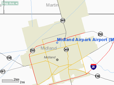
Location & QuickFacts
| FAA Information Effective: | 2008-09-25 |
| Airport Identifier: | MDD |
| Airport Status: | Operational |
| Longitude/Latitude: | 102-06-03.7000W/32-02-11.4880N
-102.101028/32.036524 (Estimated) |
| Elevation: | 2803 ft / 854.35 m (Surveyed) |
| Land: | 816 acres |
| From nearest city: | 3 nautical miles N of Midland, TX |
| Location: | Midland County, TX |
| Magnetic Variation: | 11E (1965) |
Owner & Manager
| Ownership: | Publicly owned |
| Owner: | City Of Midland |
| Address: | Po Box 60305 A.t.s.
Midland, TX 79711 |
| Phone number: | 432-560-2200 |
| Manager: | Marvin Esterly |
| Address: | Po Box 60305
Midland, TX 79711 |
| Phone number: | 432-560-2200 |
Airport Operations and Facilities
| Airport Use: | Open to public |
| Wind indicator: | Yes |
| Segmented Circle: | Yes |
| Control Tower: | No |
| Lighting Schedule: | DUSK-DAWN
MIRL RYS 07/25 & 16/34 PRESET LOW INTST; TO INCR INTST & ACTVT VASI RY 25; PAPI RYS 07, 16 & 34 - CTAF. |
| Beacon Color: | Clear-Green (lighted land airport) |
| Landing fee charge: | No |
| Sectional chart: | Albuquerque |
| Region: | ASW - Southwest |
| Boundary ARTCC: | ZFW - Fort Worth |
| Tie-in FSS: | SJT - San Angelo |
| FSS on Airport: | No |
| FSS Toll Free: | 1-800-WX-BRIEF |
| NOTAMs Facility: | MDD (NOTAM-d service avaliable) |
| Federal Agreements: | NGPY3 |
Airport Communications
| CTAF: | 122.700 |
| Unicom: | 122.700 |
Airport Services
| Fuel available: | 100LLA1+
FOR FUEL AFTER HOURS CALL 432-685-7000. |
| Airframe Repair: | MAJOR |
| Power Plant Repair: | MAJOR |
| Bottled Oxygen: | HIGH |
| Bulk Oxygen: | HIGH |
Runway Information
Runway 07/25
| Dimension: | 5022 x 75 ft / 1530.7 x 22.9 m |
| Surface: | ASPH, Good Condition |
| Surface Treatment: | Rubberized Friction Seal Coat |
| Weight Limit: | Single wheel: 18500 lbs. |
| Edge Lights: | Medium |
| |
Runway 07 |
Runway 25 |
| Longitude: | 102-06-31.9690W | 102-05-35.6380W |
| Latitude: | 32-02-14.4390N | 32-02-27.3290N |
| Elevation: | 2803.00 ft | 2790.00 ft |
| Alignment: | 75 | 127 |
| Traffic Pattern: | Left | Right |
| Markings: | Basic, Good Condition | Non-precision instrument, Good Condition |
| Crossing Height: | 40.00 ft | 47.00 ft |
| VASI: | 2-light PAPI on left side | 4-box on left side |
| Visual Glide Angle: | 3.00° | 3.00° |
| Obstruction: | 27 ft pole, 1100.0 ft from runway, 33 ft left of centerline, 8:1 slope to clear | , 50:1 slope to clear |
|
Runway 16/34
| Dimension: | 3977 x 75 ft / 1212.2 x 22.9 m |
| Surface: | ASPH, Good Condition |
| Weight Limit: | Single wheel: 18500 lbs. |
| Edge Lights: | Medium |
| |
Runway 16 |
Runway 34 |
| Longitude: | 102-06-09.5620W | 102-05-57.5500W |
| Latitude: | 32-02-18.7100N | 32-01-40.7120N |
| Elevation: | 2800.00 ft | 2796.00 ft |
| Alignment: | 127 | 127 |
| Traffic Pattern: | Left | Right |
| Markings: | Basic, Good Condition | Basic, Good Condition |
| Crossing Height: | 40.00 ft | 40.00 ft |
| VASI: | 2-light PAPI on left side | 2-light PAPI on left side |
| Visual Glide Angle: | 3.00° | 3.00° |
| Obstruction: | 7 ft fence, 421.0 ft from runway, 31:1 slope to clear | , 50:1 slope to clear |
|
Radio Navigation Aids
| ID |
Type |
Name |
Ch |
Freq |
Var |
Dist |
| MA | NDB | Farly | | 326.00 | 09E | 11.8 nm |
| ANR | NDB | Andrews | | 245.00 | 09E | 29.0 nm |
| LSA | NDB | Lamesa | | 338.00 | 09E | 44.4 nm |
| GNC | NDB | Gaines County | | 344.00 | 09E | 47.1 nm |
| OHE | NDB | Monahans | | 214.00 | 09E | 49.5 nm |
| MAF | VORTAC | Midland | 095X | 114.80 | 11E | 4.8 nm |
| BGS | VORTAC | Big Spring | 090X | 114.30 | 11E | 37.8 nm |
| MAF | VOT | Midland International | | 108.20 | | 8.0 nm |
Remarks
- BIRDS INVOF ARPT (SEASONAL).
- UNEVEN PAVEMENT NE 50 FT OF NORTH RAMP.
- ARPT CLSD TO ACFT OVER 25,000 LBS.
Images and information placed above are from
http://www.airport-data.com/airport/MDD/
We thank them for the data!
| General Info
|
| Country |
United States
|
| State |
TEXAS
|
| FAA ID |
MDD
|
| Latitude |
32-02-11.488N
|
| Longitude |
102-06-03.700W
|
| Elevation |
2803 feet
|
| Near City |
MIDLAND
|
We don't guarantee the information is fresh and accurate. The data may
be wrong or outdated.
For more up-to-date information please refer to other sources.
|
|


