 |
|
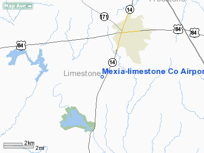
Mexia-limestone Co Airport |
Location & QuickFacts
| FAA Information Effective: | 2008-09-25 |
| Airport Identifier: | LXY |
| Airport Status: | Operational |
| Longitude/Latitude: | 096-30-53.0000W/31-38-23.4050N
-96.514722/31.639835 (Estimated) |
| Elevation: | 544 ft / 165.81 m (Surveyed) |
| Land: | 141 acres |
| From nearest city: | 3 nautical miles SW of Mexia, TX |
| Location: | Limestone County, TX |
| Magnetic Variation: | 07E (1965) |
Owner & Manager
| Ownership: | Publicly owned |
| Owner: | Limestone Co |
| Address: | Limestone Co Ct House
Groesbeck, TX 76642 |
| Phone number: | 254-729-3810 |
| Manager: | Buddy Miller |
| Address: | 4819 Highway 14 N
Mexia, TX 76667 |
| Phone number: | 254-562-2857 |
Airport Operations and Facilities
| Airport Use: | Open to public |
| Wind indicator: | Yes |
| Segmented Circle: | Yes |
| Control Tower: | No |
| Lighting Schedule: | DUSK-DAWN |
| Beacon Color: | Clear-Green (lighted land airport) |
| Landing fee charge: | No |
| Sectional chart: | Houston |
| Region: | ASW - Southwest |
| Boundary ARTCC: | ZFW - Fort Worth |
| Tie-in FSS: | FTW - Fort Worth |
| FSS on Airport: | No |
| FSS Phone: | 817-541-3474 |
| FSS Toll Free: | 1-800-WX-BRIEF |
| NOTAMs Facility: | FTW (NOTAM-d service avaliable) |
| Federal Agreements: | NGY |
Airport Communications
| CTAF: | 122.800 |
| Unicom: | 122.800 |
Airport Services
| Fuel available: | 100LLA
FOR FUEL AT NIGHT CALL 254-562-3174. |
| Airframe Repair: | MAJOR |
| Power Plant Repair: | MAJOR |
| Bottled Oxygen: | LOW |
Runway Information
Runway 18/36
| Dimension: | 4002 x 60 ft / 1219.8 x 18.3 m
NORTH 1000 FT CLSD INDEFLY. |
| Surface: | ASPH, Good Condition |
| Weight Limit: | Single wheel: 8000 lbs. |
| Edge Lights: | Medium |
| |
Runway 18 |
Runway 36 |
| Longitude: | 096-30-49.2560W | 096-30-56.7170W |
| Latitude: | 31-38-42.9060N | 31-38-03.8230N |
| Elevation: | 544.00 ft | 533.00 ft |
| Alignment: | 127 | 9 |
| Traffic Pattern: | Left | Left |
| Markings: | Non-precision instrument, Good Condition | Non-precision instrument, Good Condition |
| Crossing Height: | 23.00 ft | 24.00 ft |
| VASI: | 2-light PAPI on left side | 2-light PAPI on left side |
| Visual Glide Angle: | 3.00° | 3.00° |
| Obstruction: | , 50:1 slope to clear | 45 ft tree, 1710.0 ft from runway, 250 ft right of centerline, 50:1 slope to clear |
|
Radio Navigation Aids
| ID |
Type |
Name |
Ch |
Freq |
Var |
Dist |
| LXY | NDB | Mexia | | 329.00 | 07E | 0.1 nm |
| PYF | NDB | Pyramid | | 418.00 | 06E | 21.0 nm |
| CRS | NDB | Corsicana | | 396.00 | 06E | 24.1 nm |
| CGQ | NDB | Powell | | 344.00 | 06E | 25.9 nm |
| ROB | NDB | Robinson | | 400.00 | 07E | 29.6 nm |
| LIQ | NDB | Lochridge Ranch | | 335.00 | 09E | 36.3 nm |
| CSZ | NDB | Crossroads | | 215.00 | 08E | 38.2 nm |
| PSN | NDB | Palestine | | 375.00 | 04E | 42.5 nm |
| AHX | NDB | Athens | | 269.00 | 06E | 46.9 nm |
| GNL | VOR/DME | Groesbeck | 025X | 108.80 | 05E | 3.9 nm |
| CQY | VORTAC | Cedar Creek | 095X | 114.80 | 06E | 36.1 nm |
| ACT | VORTAC | Waco | 100X | 115.30 | 09E | 38.6 nm |
| LOA | VORTAC | Leona | 045X | 110.80 | 08E | 41.8 nm |
Images and information placed above are from
http://www.airport-data.com/airport/LXY/
We thank them for the data!
| General Info
|
| Country |
United States
|
| State |
TEXAS
|
| FAA ID |
LXY
|
| Latitude |
31-38-23.405N
|
| Longitude |
096-30-53.000W
|
| Elevation |
544 feet
|
| Near City |
MEXIA
|
We don't guarantee the information is fresh and accurate. The data may
be wrong or outdated.
For more up-to-date information please refer to other sources.
|
|


