|
|
| Mesquite Metro Airport |
| IATA: none – ICAO: KHQZ – FAA LID: HQZ |
| Summary |
| Airport type |
Public |
| Owner |
City of Mesquite |
| Serves |
Mesquite, Texas |
| Elevation AMSL |
447 ft / 136 m |
| Coordinates |
32°44′49″N 096°31′50″W / 32.74694°N 96.53056°W / 32.74694; -96.53056 |
| Website |
cityofmesquite.com/... |
| Runways |
| Direction |
Length |
Surface |
| ft |
m |
| 17/35 |
5,999 |
1,828 |
Concrete |
| Statistics (2004) |
| Aircraft operations |
100,000 |
| Based aircraft |
212 |
| Source: Federal Aviation Administration |
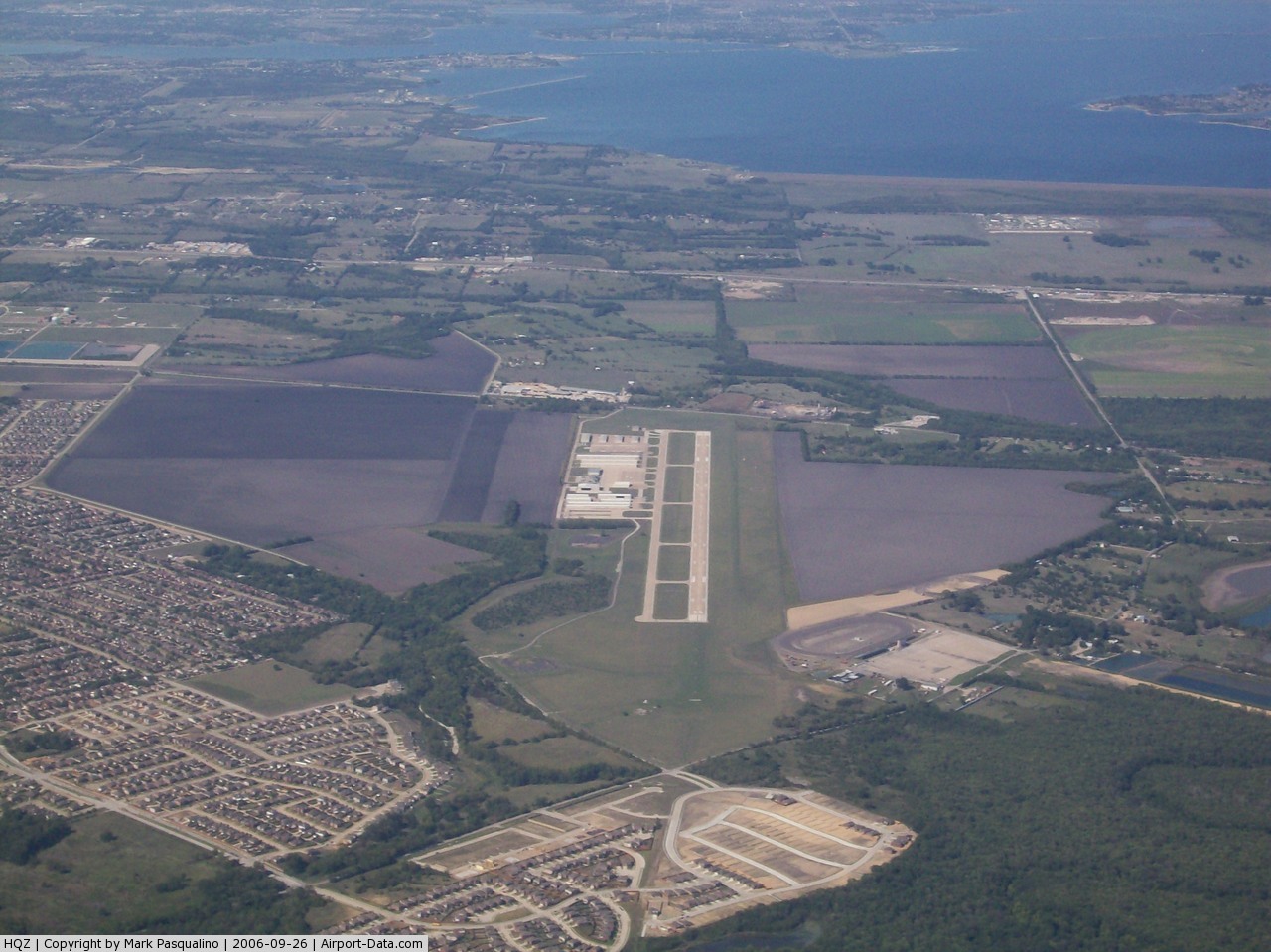
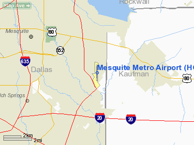
Mesquite Metro Airport (ICAO: KHQZ, FAA LID: HQZ) is a public use airport located in Dallas County, Texas, United States. It is three nautical miles (6 km) east of the central business district of the city of Mesquite. The airport is located west of the border of Dallas County and Kaufman County.
The airport was built with private funding in 1975. In 1983, the city of Mesquite purchased the airport using grant money from the FAA. In 1992, the runway underwent a refurbishment and was lengthened by 1,000 feet.
Although most U.S. airports use the same three-letter location identifier for the FAA and IATA, this airport is assigned HQZ by the FAA but has no designation from the IATA.
Facilities and aircraft
Mesquite Metro Airport covers an area of 399 acres (161 ha) at an elevation of 447 feet (136 m) above mean sea level. It has one runway designated 17/35 with a concrete surface measuring 5,999 by 100 feet (1,828 x 30 m).
For the 12-month period ending December 31, 2004, the airport had 100,000 general aviation aircraft operations, an average of 273 per day. At that time there were 212 aircraft based at this airport: 87% single-engine, 9% multi-engine, 2% helicopter and 1% jet.
The above content comes from Wikipedia and is published under free licenses – click here to read more.
 |
(Click on the photo to enlarge) |
Location & QuickFacts
| FAA Information Effective: | 2008-09-25 |
| Airport Identifier: | HQZ |
| Airport Status: | Operational |
| Longitude/Latitude: | 096-31-49.5020W/32-44-49.0660N
-96.530417/32.746963 (Estimated) |
| Elevation: | 447 ft / 136.25 m (Surveyed) |
| Land: | 399 acres |
| From nearest city: | 3 nautical miles E of Mesquite, TX |
| Location: | Dallas County, TX |
| Magnetic Variation: | 06E (1990) |
Owner & Manager
| Ownership: | Publicly owned |
| Owner: | City Of Mesquite |
| Address: | Po Box 850137
Mesquite, TX 75185-0137 |
| Phone number: | 972-288-7711 |
| Manager: | Cynthia Godfrey |
| Address: | 1340 Arpt Blvd.
Mesquite, TX 75181 |
| Phone number: | 972-216-4130 |
Airport Operations and Facilities
| Airport Use: | Open to public |
| Wind indicator: | Yes |
| Segmented Circle: | Yes |
| Control Tower: | No |
| Lighting Schedule: | DUSK-DAWN
MIRL RY 17/35 PRESET LOW INTST; TO INCR INTST & ACTVT REIL RY 17 - CTAF. |
| Beacon Color: | Clear-Green (lighted land airport) |
| Landing fee charge: | No |
| Sectional chart: | Dallas-ft Worth |
| Region: | ASW - Southwest |
| Boundary ARTCC: | ZFW - Fort Worth |
| Tie-in FSS: | FTW - Fort Worth |
| FSS on Airport: | No |
| FSS Phone: | 817-541-3474 |
| FSS Toll Free: | 1-800-WX-BRIEF |
| NOTAMs Facility: | HQZ (NOTAM-d service avaliable) |
| Federal Agreements: | NGY |
Airport Communications
| CTAF: | 123.050 |
| Unicom: | 123.050 |
Airport Services
| Fuel available: | 100LLA
SELF-SERVE FUEL AVBL 24 HRS WITH MAJOR CREDIT CARD. |
| Airframe Repair: | MAJOR |
| Power Plant Repair: | MAJOR |
| Bottled Oxygen: | NONE |
| Bulk Oxygen: | HIGH |
Runway Information
Runway 17/35
| Dimension: | 5999 x 100 ft / 1828.5 x 30.5 m |
| Surface: | CONC, Good Condition |
| Weight Limit: | Single wheel: 70000 lbs.
Dual wheel: 100000 lbs.
Dual tandem wheel: 100000 lbs. |
| Edge Lights: | Medium |
| |
Runway 17 |
Runway 35 |
| Longitude: | 096-31-48.9690W | 096-31-50.0520W |
| Latitude: | 32-45-18.7410N | 32-44-19.3890N |
| Elevation: | 446.00 ft | 442.00 ft |
| Alignment: | 127 | 1 |
| ILS Type: | ILS/DME
| |
| Traffic Pattern: | Left | Left |
| Markings: | Precision instrument, Good Condition | Non-precision instrument, Good Condition |
| Crossing Height: | 55.00 ft | 42.00 ft |
| VASI: | 4-light PAPI on left side | 4-light PAPI on left side |
| Visual Glide Angle: | 3.00° | 3.00° |
| Approach lights: | LDIN | LDIN |
| Runway End Identifier: | Yes | |
| Obstruction: | 15 ft brush, 201.0 ft from runway, 250 ft left of centerline
+15 FT TREES & BRUSH 0-200 FT FM THLD 250 FT LEFT OF CNTRLN. | 8 ft fence, 250.0 ft from runway, 500 ft right of centerline, 6:1 slope to clear |
|
Radio Navigation Aids
| ID |
Type |
Name |
Ch |
Freq |
Var |
Dist |
| PQF | NDB | Mesquite | | 248.00 | 06E | 3.8 nm |
| JUG | NDB | Jecca | | 388.00 | 06E | 4.7 nm |
| LNC | NDB | Lancaster | | 239.00 | 06E | 14.0 nm |
| AVZ | NDB | Travis | | 260.00 | 06E | 14.2 nm |
| RBD | NDB | Redbird | | 287.00 | 06E | 17.7 nm |
| MII | NDB | Caddo Mills | | 316.00 | 06E | 22.7 nm |
| XQH | NDB | Cedar Hill | | 353.00 | 08E | 24.4 nm |
| SYW | NDB | Cash | | 428.00 | 05E | 27.3 nm |
| CGQ | NDB | Powell | | 344.00 | 06E | 41.4 nm |
| CRS | NDB | Corsicana | | 396.00 | 06E | 43.8 nm |
| MJF | TACAN | Arvilla | 033X | | 05E | 30.5 nm |
| NFW | TACAN | Nas Jrb Fort Worth | 024X | | 07E | 46.0 nm |
| CVE | VOR/DME | Cowboy | 109X | 116.20 | 06E | 20.7 nm |
| TTT | VOR/DME | Maverick | 078X | 113.10 | 06E | 26.8 nm |
| FUZ | VORTAC | Ranger | 104X | 115.70 | 06E | 33.9 nm |
| CQY | VORTAC | Cedar Creek | 095X | 114.80 | 06E | 37.3 nm |
| BYP | VORTAC | Bonham | 093X | 114.60 | 06E | 49.8 nm |
| DAL | VOT | Dallas Love Field | | 113.30 | | 17.3 nm |
| FTW | VOT | Fort Worth Meacham | | 108.20 | | 42.1 nm |
Images and information placed above are from
http://www.airport-data.com/airport/HQZ/
We thank them for the data!
| General Info
|
| Country |
United States
|
| State |
TEXAS
|
| FAA ID |
HQZ
|
| Latitude |
32-44-49.066N
|
| Longitude |
096-31-49.502W
|
| Elevation |
447 feet
|
| Near City |
MESQUITE
|
We don't guarantee the information is fresh and accurate. The data may
be wrong or outdated.
For more up-to-date information please refer to other sources.
|
|