 |
|
Location & QuickFacts
| FAA Information Effective: | 2008-09-25 |
| Airport Identifier: | 58TE |
| Airport Status: | Operational |
| Longitude/Latitude: | 102-04-36.6140W/33-24-23.3170N
-102.076837/33.406477 (Estimated) |
| Elevation: | 3315 ft / 1010.41 m (Estimated) |
| Land: | 14 acres |
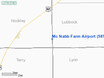
| From nearest city: | 4 nautical miles E of Ropesville, TX |
| Location: | Hockley County, TX |
| Magnetic Variation: | 09E (1985) |
Owner & Manager
| Ownership: | Privately owned |
| Owner: | F. E. Mc Nabb |
| Address: | Route 1, Box 19c
Ropesville, TX 79358 |
| Phone number: | 806-863-2220 |
| Manager: | Bobby Mc Nabb |
| Address: | Route 1, Box 19c
Ropesville, TX 79358 |
| Phone number: | 806-863-2572 |
Airport Operations and Facilities
| Airport Use: | Private |
| Wind indicator: | Yes |
| Segmented Circle: | No |
| Control Tower: | No |
| Landing fee charge: | No |
| Sectional chart: | Albuquerque |
| Region: | ASW - Southwest |
| Boundary ARTCC: | ZFW - Fort Worth |
| Tie-in FSS: | FTW - Fort Worth |
| FSS on Airport: | No |
| FSS Phone: | 817-541-3474 |
| FSS Toll Free: | 1-800-WX-BRIEF |
Airport Services
| Airframe Repair: | NONE |
| Power Plant Repair: | NONE |
Runway Information
Runway 01/19
| Dimension: | 1500 x 50 ft / 457.2 x 15.2 m |
| Surface: | TURF, Good Condition |
| |
Runway 01 |
Runway 19 |
| Traffic Pattern: | Left | Left |
| Obstruction: | 10 ft road | 20 ft trees, 40.0 ft from runway, 115 ft left of centerline, 2:1 slope to clear |
|
Runway 10/28
| Dimension: | 2750 x 150 ft / 838.2 x 45.7 m |
| Surface: | TURF, Good Condition |
| |
Runway 10 |
Runway 28 |
| Traffic Pattern: | Left | Left |
| Obstruction: | 4 ft fence | 4 ft fence, 0.0 ft from runway |
|
Radio Navigation Aids
| ID |
Type |
Name |
Ch |
Freq |
Var |
Dist |
| BFE | NDB | Brownfield | | 311.00 | 09E | 14.8 nm |
| LLN | NDB | Levelland | | 266.00 | 09E | 17.4 nm |
| LIU | NDB | Littlefield | | 212.00 | 10E | 34.5 nm |
| LSA | NDB | Lamesa | | 338.00 | 09E | 39.8 nm |
| CZX | NDB | Crosbyton | | 332.00 | 09E | 44.0 nm |
| PVW | VOR/DME | Plainview | 076X | 112.90 | 11E | 43.3 nm |
| LBB | VORTAC | Lubbock | 029X | 109.20 | 11E | 19.7 nm |
Remarks
- WATCH FOR CATTLE ON RWY 10/28.
- LGTD TWR 0.7 MI WNW.
- WATCH FOR IRRIGATION PIPE ON RWY.
Images and information placed above are from
http://www.airport-data.com/airport/58TE/
We thank them for the data!
| General Info
|
| Country |
United States
|
| State |
TEXAS
|
| FAA ID |
58TE
|
| Latitude |
33-24-23.317N
|
| Longitude |
102-04-36.614W
|
| Elevation |
3315 feet
|
| Near City |
ROPESVILLE
|
We don't guarantee the information is fresh and accurate. The data may
be wrong or outdated.
For more up-to-date information please refer to other sources.
|
|


