 |
|
Coordinates: 28°49′20″N 099°06′32″W / 28.82222°N 99.10889°W / 28.82222; -99.10889
| McKinley Field |
| IATA: none – ICAO: none – FAA LID: T30 |
| Summary |
| Airport type |
Public |
| Owner |
Don McKinley |
| Operator |
McKinley Aerial Service |
| Serves |
Pearsall, Texas |
| Elevation AMSL |
586 ft / 179 m |
| Runways |
| Direction |
Length |
Surface |
| ft |
m |
| 13/31 |
5,027 |
1,532 |
Asphalt |
| Statistics (2005) |
| Aircraft operations |
3,900 |
| Source: Federal Aviation Administration |
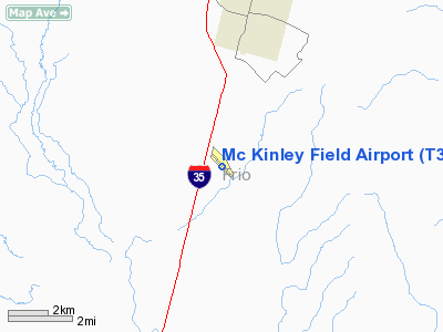
McKinley Field (FAA LID: T30) is a public-use airport located four miles (6 km) south of the central business district of Pearsall, in Frio County, Texas, United States. It is privately owned by Don McKinley.
Facilities and aircraft
McKinley Field covers an area of 141 acres (57 ha) which contains one asphalt paved runway (13/31) measuring 5,027 x 60 ft (1,532 x 18 m). For the 12-month period ending March 18, 2005, the airport had 3,900 aircraft operations, 100% of which were general aviation.
The above content comes from Wikipedia and is published under free licenses – click here to read more.
Location & QuickFacts
| FAA Information Effective: | 2008-09-25 |
| Airport Identifier: | T30 |
| Airport Status: | Operational |
| Longitude/Latitude: | 099-06-32.5000W/28-49-20.1000N
-99.109028/28.822250 (Estimated) |
| Elevation: | 586 ft / 178.61 m (Surveyed) |
| Land: | 141 acres |
| From nearest city: | 4 nautical miles S of Pearsall, TX |
| Location: | Frio County, TX |
| Magnetic Variation: | 07E (1980) |
Owner & Manager
| Ownership: | Privately owned |
| Owner: | Don Mc Kinley |
| Address: | Box 764
Pearsall, TX 78061 |
| Phone number: | 830-334-3721 |
| Manager: | Don Mc Kinley
FRIO COUNTY MAINTAIN ARPT. |
| Address: | Box 764
Pearsall, TX 78061 |
| Phone number: | 830-334-4565 |
Airport Operations and Facilities
| Airport Use: | Open to public |
| Wind indicator: | Yes |
| Segmented Circle: | Yes |
| Control Tower: | No |
| Lighting Schedule: | DUSK-DAWN
ACTVT LIRL RY 13/31 - CTAF OR CALL 830-334-3721. |
| Beacon Color: | Clear-Green (lighted land airport) |
| Landing fee charge: | No |
| Sectional chart: | San Antonio |
| Region: | ASW - Southwest |
| Boundary ARTCC: | ZHU - Houston |
| Tie-in FSS: | SJT - San Angelo |
| FSS on Airport: | No |
| FSS Toll Free: | 1-800-WX-BRIEF |
| NOTAMs Facility: | SJT (NOTAM-d service avaliable) |
Airport Communications
| CTAF: | 122.800 |
| Unicom: | 122.800 |
Airport Services
| Fuel available: | 100LLA |
| Bottled Oxygen: | NONE |
| Bulk Oxygen: | NONE |
Runway Information
Runway 13/31
| Dimension: | 5027 x 60 ft / 1532.2 x 18.3 m |
| Surface: | ASPH, Good Condition |
| Weight Limit: | Single wheel: 15000 lbs.
ESTIMATED. |
| Edge Lights: | Non-standard lighting system
NSTD LIRL; SPACING 20 FT FM EDGE & 300 FT BTN LGTS. ONLY CENTER 4702 FT LGTD. |
| |
Runway 13 |
Runway 31 |
| Longitude: | 099-06-51.7120W | 099-06-13.3060W |
| Latitude: | 28-49-38.3550N | 28-49-01.8500N |
| Elevation: | 586.00 ft | 554.00 ft |
| Alignment: | 127 | 127 |
| Traffic Pattern: | Left | Left |
| Markings: | Nonstandard, Good Condition
& 31 NRS NSTD; HALF SIZE. | Nonstandard, Good Condition |
| Displaced threshold: | 168.00 ft | 154.00 ft |
| Obstruction: | 15 ft road, 210.0 ft from runway, 120 ft right of centerline
APCH RATIO 25:1 TO DSPLCD THLD; +15 FT ROAD 378 FT FM DSPLCD THLD 120 FT RIGHT OF CNTRLN. | 66 ft pline, 2120.0 ft from runway, 28:1 slope to clear
APCH RATIO 34:1 TO DSPLCD THLD. |
|
Radio Navigation Aids
| ID |
Type |
Name |
Ch |
Freq |
Var |
Dist |
| HHH | NDB | Devine | | 359.00 | 07E | 21.0 nm |
| PEZ | NDB | Pleasanton | | 275.00 | 07E | 32.1 nm |
| HMA | NDB | Hondo | | 329.00 | 08E | 33.3 nm |
| CVB | NDB | Castroville | | 338.00 | 08E | 34.3 nm |
| UVA | NDB | Uvalde | | 281.00 | 07E | 38.8 nm |
| LKX | NDB | La Pryor | | 223.00 | 09E | 39.8 nm |
| DMD | NDB | Dimmit County | | 343.00 | 07E | 41.9 nm |
| CPZ | NDB | Chaparrosa Ranch | | 385.00 | 10E | 47.5 nm |
| KSY | TACAN | Kelly | 057X | | 07E | 44.0 nm |
| SSF | VOR | Stinson | | 108.40 | 09E | 43.7 nm |
| HDO | VOR/DME | Hondo | 31X | 109.40 | 08E | 31.9 nm |
| COT | VORTAC | Cotulla | 105X | 115.80 | 09E | 21.7 nm |
Images and information placed above are from
http://www.airport-data.com/airport/T30/
We thank them for the data!
| General Info
|
| Country |
United States
|
| State |
TEXAS
|
| FAA ID |
T30
|
| Latitude |
28-49-20.100N
|
| Longitude |
099-06-32.500W
|
| Elevation |
586 feet
|
| Near City |
PEARSALL
|
We don't guarantee the information is fresh and accurate. The data may
be wrong or outdated.
For more up-to-date information please refer to other sources.
|
|


