 |
|
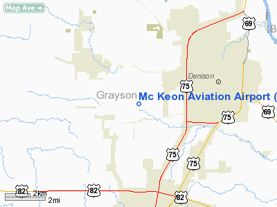
Location & QuickFacts
| FAA Information Effective: | 2008-09-25 |
| Airport Identifier: | 9XS4 |
| Airport Status: | Operational |
| Longitude/Latitude: | 096-37-35.9780W/33-44-03.3760N
-96.626661/33.734271 (Estimated) |
| Elevation: | 750 ft / 228.60 m (Estimated) |
| Land: | 0 acres |
| From nearest city: | 3 nautical miles SW of Denison, TX |
| Location: | Grayson County, TX |
| Magnetic Variation: | 06E (1985) |
Owner & Manager
| Ownership: | Privately owned |
| Owner: | Bill Mc Keon |
| Address: | 1173 Davy Lane
Denison, TX 75020-8819 |
| Phone number: | 903-465-9279 |
| Manager: | Bill Mc Keon |
| Address: | 1173 Davy Lane
Denison, TX 75020-8819 |
| Phone number: | 903-465-9279 |
Airport Operations and Facilities
| Airport Use: | Private |
| Wind indicator: | Yes |
| Segmented Circle: | No |
| Control Tower: | No |
| Landing fee charge: | Yes |
| Sectional chart: | Dallas-ft Worth |
| Region: | ASW - Southwest |
| Boundary ARTCC: | ZFW - Fort Worth |
| Tie-in FSS: | FTW - Fort Worth |
| FSS on Airport: | No |
| FSS Phone: | 817-541-3474 |
| FSS Toll Free: | 1-800-WX-BRIEF |
Airport Services
| Airframe Repair: | NONE |
| Power Plant Repair: | NONE |
Runway Information
Runway 18/36
| Dimension: | 1800 x 100 ft / 548.6 x 30.5 m |
| Surface: | TURF, Good Condition |
| |
Runway 18 |
Runway 36 |
| Traffic Pattern: | Left | Left |
| Obstruction: | 35 ft trees, 89 ft left of centerline | 12 ft trees, 0.0 ft from runway, 95 ft left of centerline |
|
Radio Navigation Aids
| ID |
Type |
Name |
Ch |
Freq |
Var |
Dist |
| DNI | NDB | Denison | | 341.00 | 06E | 5.8 nm |
| DUA | NDB | Durant | | 359.00 | 05E | 16.9 nm |
| HJM | NDB | Rayburn | | 415.00 | 06E | 23.7 nm |
| GLE | NDB | Gainesville | | 330.00 | 06E | 28.6 nm |
| AUV | NDB | Arbuckle | | 284.00 | 07E | 35.3 nm |
| MII | NDB | Caddo Mills | | 316.00 | 06E | 45.8 nm |
| MJF | TACAN | Arvilla | 033X | | 05E | 49.2 nm |
| URH | VOR/DME | Texoma | 090X | 114.30 | 05E | 17.2 nm |
| BYP | VORTAC | Bonham | 093X | 114.60 | 06E | 22.9 nm |
| ADM | VORTAC | Ardmore | 114X | 116.70 | 06E | 39.4 nm |
Images and information placed above are from
http://www.airport-data.com/airport/9XS4/
We thank them for the data!
| General Info
|
| Country |
United States
|
| State |
TEXAS
|
| FAA ID |
9XS4
|
| Latitude |
33-44-03.376N
|
| Longitude |
096-37-35.978W
|
| Elevation |
750 feet
|
| Near City |
DENISON
|
We don't guarantee the information is fresh and accurate. The data may
be wrong or outdated.
For more up-to-date information please refer to other sources.
|
|


